Home
States
Colorado
Connecticut
Maine
Massachusetts
New Hampshire
New York
Rhode Island
Utah
Vermont
View All
Lists
NE 4,000 Footers
NE 100 Highest
NH 4,000 Footers
NH 100 Highest
NH 52 With A View
NH Belknap Range
NH Ossipee 10
Links
Trail Conditions
Trip Log
Sunrises
Sunsets
About
|
Mt. Major
Alton, NH
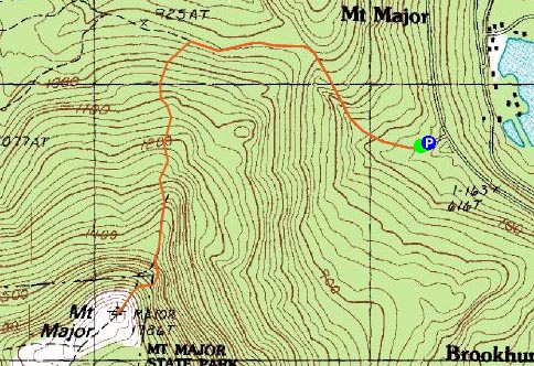
Trailheads, measurements, times, distances, and maps are all approximate and relative to the hike(s) as shown below.
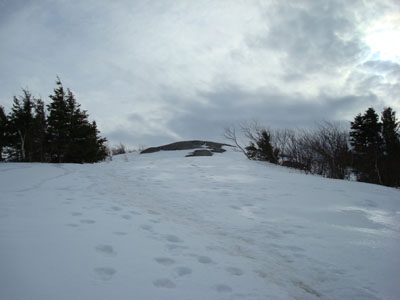
Looking up the Mt. Major Trail
Route: Mt. Major Trail, (Mt. Major), Mt. Major Trail
For this casual afternoon snowshoe, I put together three routes, the easiest of which would just be Major (the others would be Major plus an adajacent peak or two). A combination of factors, including the mostly cloudly skies, resulted in us doing the easy choice. To spice it up, I chose the Mt. Major Trail instead of the easier Brook Trail.
The trail was pretty well packed, however the snowshoes provided some needed traction to get up the ledge sections.
As we arrived at the summit, we were fortunate enough to get a brief glimpse of blue sky.
Much like the ascent, we did a leisurely descent down the same trail.
| Hike Ratings |
|
Getting To Trailhead: |
Easy |
| Destination: |
Mt. Major |
|
Length: |
Moderate |
|
Steepness: |
Difficult |
|
Navigation: |
Easy |
|
Views: |
Excellent |
|
Crowds: |
Minimal |
|
| Hike Stats |
|
Date Hiked: |
Thursday, March 27, 2008 |
| Hike Commenced: |
12:28 PM |
| Parking Elevation: |
585' |
| Destination: |
Mt. Major |
| Ascent Commenced: |
12:29 PM |
| Summit Reached: |
1:15 PM |
| Time Elapsed: |
00:46 |
| Trailhead Elevation: |
600' |
| Summit Elevation: |
1,786' |
| Distance: |
1.75 miles |
| Vertical Gain: |
1,211' |
|
|
| Hike Ended: |
4:17 PM |
| Hike Time Elapsed: |
03:48 |
| Hike Distance: |
3.5 miles |
| Hike Vertical Gain: |
1,276 |
|
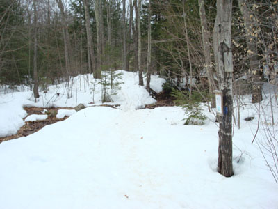
The Mt. Major Trail trailhead at the back of the Route 11 parking lot

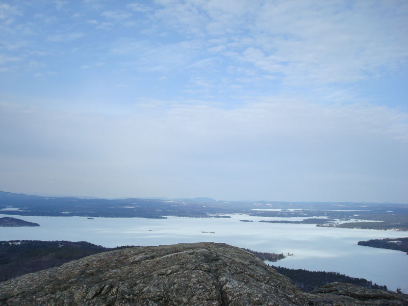
Looking over Lake Winnipesaukee at the Ossipee Mountains from the Mt. Major summit
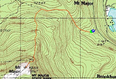

Directions to trailhead: Take Route 11 West (north in reality) from Alton Bay. Parking lot and trailhead are on the left after the blasted out section of Route 11.
Back to Mt. Major Profile
|