Home
States
Colorado
Connecticut
Maine
Massachusetts
New Hampshire
New York
Rhode Island
Utah
Vermont
View All
Lists
NE 4,000 Footers
NE 100 Highest
NH 4,000 Footers
NH 100 Highest
NH 52 With A View
NH Belknap Range
NH Ossipee 10
Links
Trail Conditions
Trip Log
Sunrises
Sunsets
About
|
Mt. Major, North Straightback Mountain, Straightback Mountain
Alton, NH
Trailheads, measurements, times, distances, and maps are all approximate and relative to the hike(s) as shown below.

Looking up the Beeline Trail
Route: Boulder Loop, Beeline Trail, Mt. Major Trail, (Mt. Major), Major-Straightback Link, Quarry Spur, Quarry Trail, (North Straightback Mountain), Quarry Trail, Blue Trail, (Straightback Mountain), Blue Trail, Quarry Trail, (North Straightback Mountain), Green Trail, Brook Trail, Mt. Major Trail
Trails were mostly dry and in good shape. Beeline Trail provided a good route for avoiding crowds on the ascent. Quarry Spur is orange blazed and generally easier to follow now than when it was being logged a few years ago. Green Trail from North Straightback to Brook Trail is also generally straightforward for descent (may be hard to find on ascent, as it starts on a section of the Brook Trail that has since been rerouted.
No blueberries to be seen on the main routes, however they were plentiful on Straightback and just south of North Straightback. Some of the berries are starting to get whizzled - someone or thing needs to get them soon!
| Hike Ratings |
|
Getting To Trailhead: |
Easy |
| Destination: |
Mt. Major |
|
Length: |
Moderate |
|
Steepness: |
Difficult |
|
Navigation: |
Easy |
|
Views: |
Excellent |
|
Crowds: |
Heavy |
| Destination: |
North Straightback Mountain |
|
Length: |
Moderate |
|
Steepness: |
Difficult |
|
Navigation: |
Easy |
|
Views: |
Excellent |
|
Crowds: |
Minimal |
| Destination: |
Straightback Mountain |
|
Length: |
Moderate |
|
Steepness: |
Moderate |
|
Navigation: |
Easy |
|
Views: |
Excellent |
|
Crowds: |
Minimal |
|
| Hike Stats |
|
Date Hiked: |
Wednesday, August 7, 2013 |
| Parking Elevation: |
585' |
| Destination: |
Mt. Major |
| Time Elapsed: |
00:24 |
| Trailhead Elevation: |
600' |
| Summit Elevation: |
1,786' |
| Vertical Gain: |
1,196' |
| Destination: |
North Straightback Mountain |
| Time Elapsed: |
00:21 |
| Trailhead Elevation: |
1,786' |
| Summit Elevation: |
1,910' |
| Vertical Gain: |
355' |
| Destination: |
Straightback Mountain |
| Time Elapsed: |
00:11 |
| Trailhead Elevation: |
1,910' |
| Summit Elevation: |
1,890' |
| Vertical Gain: |
90' |
|
|
| Hike Time Elapsed: |
02:11 |
| Hike Vertical Gain: |
1,791' |
|

The Boulder Loop Trail trailhead at the back of the Route 11 parking lot

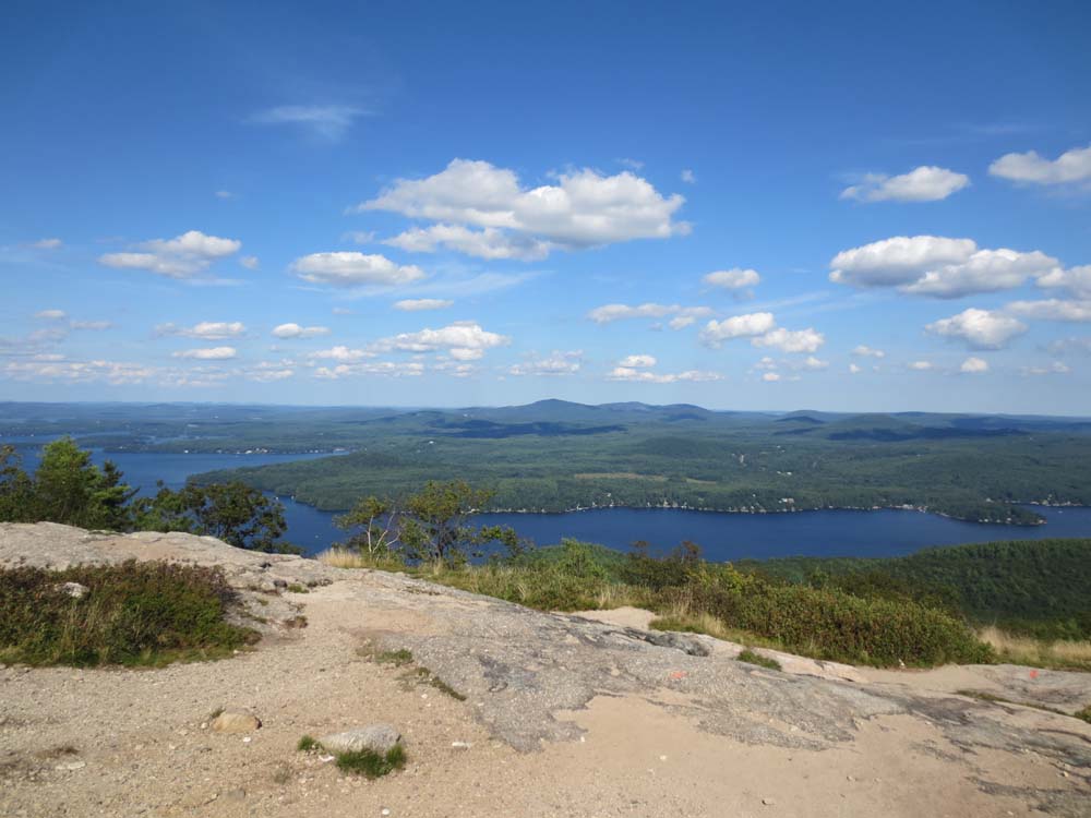
Looking at Alton Bay and Copple Crown from Mt. Major

The Quarry Spur to North Straightback Mountain

Fall already?

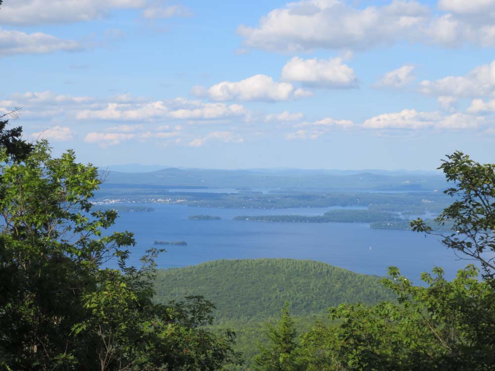
Lake Winnipesaukee as seen from near the top of North Straightback Mountain

Heading to Straightback Mountain

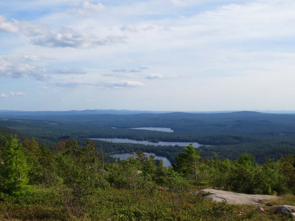
Hills Pond, Sunset Lake, Crystal Lake as seen from Straightback Mountain
Directions to trailhead: Take Route 11 West (north in reality) from Alton Bay. Parking lot and trailhead are on the left after the blasted out section of Route 11.
Back to Mt. Major Profile
Back to North Straightback Mountain Profile
Back to Straightback Mountain Profile
|