Home
States
Colorado
Connecticut
Maine
Massachusetts
New Hampshire
New York
Rhode Island
Utah
Vermont
View All
Lists
NE 4,000 Footers
NE 100 Highest
NH 4,000 Footers
NH 100 Highest
NH 52 With A View
NH Belknap Range
NH Ossipee 10
Links
Trail Conditions
Trip Log
Sunrises
Sunsets
About
|
Mt. Monroe
Chandler's Purchase, NH, Sargent's Purchase, NH
Trailheads, measurements, times, distances, and maps are all approximate and relative to the hike(s) as shown below.

Looking up the recently rebuilt Crawford Path
Route: Spur trail, Ammonoosuc Ravine Trail, Crawford Path, Mount Monroe Loop, (Mt. Monroe), Mount Monroe Loop, Crawford Path, Ammonoosuc Ravine Trail, spur trail
Ammo was a mixture of dry trail, minor mud, damp ledge, and areas of running water. Not nearly as bad as it can get in the wet season, but slippery in a few places nevertheless.
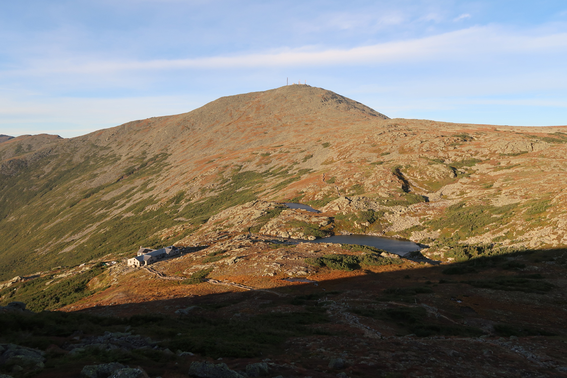
The hut is still open.
The short stretch of the Crawford Path for this route is greatly improved with step stones and some drainage. Hopefully this makes it a lot better (this section is often like walking up a brook).
Monroe Loop was mostly dry.
A little windy and chilly above treeline early this evening, but still relatively mild down low. Upper elevation birch is going gold. Lower elevations are still mostly green, but getting the tint.
| Hike Ratings |
|
Getting To Trailhead: |
Easy |
| Destination: |
Mt. Monroe |
|
Length: |
Moderate |
|
Steepness: |
Difficult |
|
Navigation: |
Easy |
|
Views: |
Excellent |
|
Crowds: |
Heavy |
|
| Hike Stats |
|
Date Hiked: |
Friday, September 13, 2019 |
| Parking Elevation: |
2,700' |
| Destination: |
Mt. Monroe |
| Time Elapsed: |
01:20 |
| Trailhead Elevation: |
2,740' |
| Summit Elevation: |
5,372' |
| Vertical Gain: |
2,732' |
|
|
| Hike Time Elapsed: |
02:57 |
| Hike Vertical Gain: |
2,862' |
|

The trailhead near the Marshfield Base Station

Looking at Mt. Washington from near the summit of Mt. Monroe

The sunset from the Ammonoosuc Ravine Trail
Directions to trailhead: To get to the Cog Base Station, take 302 West from Crawford Notch, then take a right onto Base Station Road. In summer 2019, there was hiker parking available at the Cog Base Station's bottom lot for $10 per person (iron ranger). Looking up the mountain from the parking lot, the spur trail to the Ammonoosuc Ravine Trail begins up the hill to the right, a bit below two cabins.
Back to Mt. Monroe Profile
|