Home
States
Colorado
Connecticut
Maine
Massachusetts
New Hampshire
New York
Rhode Island
Utah
Vermont
View All
Lists
NE 4,000 Footers
NE 100 Highest
NH 4,000 Footers
NH 100 Highest
NH 52 With A View
NH Belknap Range
NH Ossipee 10
Links
Trail Conditions
Trip Log
Sunrises
Sunsets
About
|
Mt. Moriah, Shelburne Moriah Mountain
Bean's Purchase, NH, Shelburne, NH
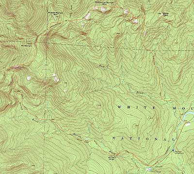
Trailheads, measurements, times, distances, and maps are all approximate and relative to the hike(s) as shown below.
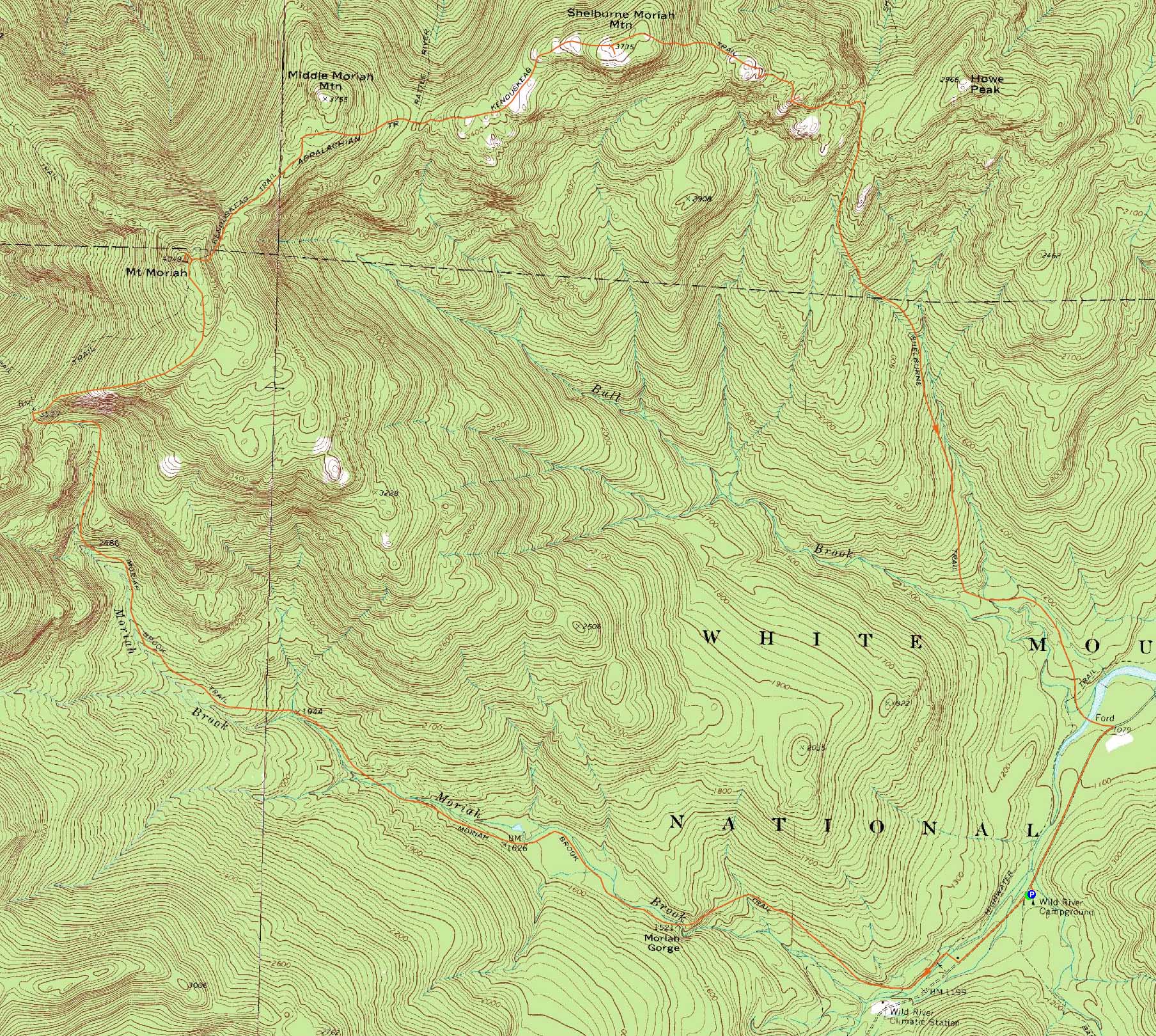
The Moriah Brook Trail
Route: Wild River Trail, Moriah Brook Trail, Carter-Moriah Trail, (Mt. Moriah), Carter-Moriah Trail, Kenduskeag Trail, (Shelburne Moriah Mountain), Kenduskeag Trail, Shelburne Trail, Wild River Road
Having never visited Shelburne Moriah, it was time to try a new approach to Moriah (after having done Stony Brook and Carter-Moriah so many times).
Starting at Wild River Campground, we followed the dirt road for a bit (the Wild River Trail proper in that area was closed for maintenance), then hopped onto Moriah Brook Trail to cross the Wild River on the suspension bridge.
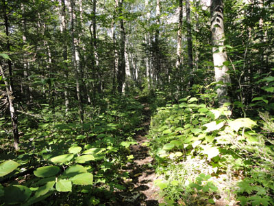
The Moriah Brook Trail started off very gradually on an old railgrade, offering pretty good footing. We took a bit of a break at the top of Moriah Gorge, however there didn't seem to be enough time to explore downstream, so we kept on going. The trail was quite nice, weaving its way through hardwood forest while passing many cascades and pools. Though in pretty good shape with recent dry weather, it would certainly be a bit challenging in wet or icy conditions with numerous brook crossings.
After passing though a muddy area with views of the cliffs on the back side of Moriah, the trail climbed steeply up out of the wilderness and to the Carter Moriah Trail.
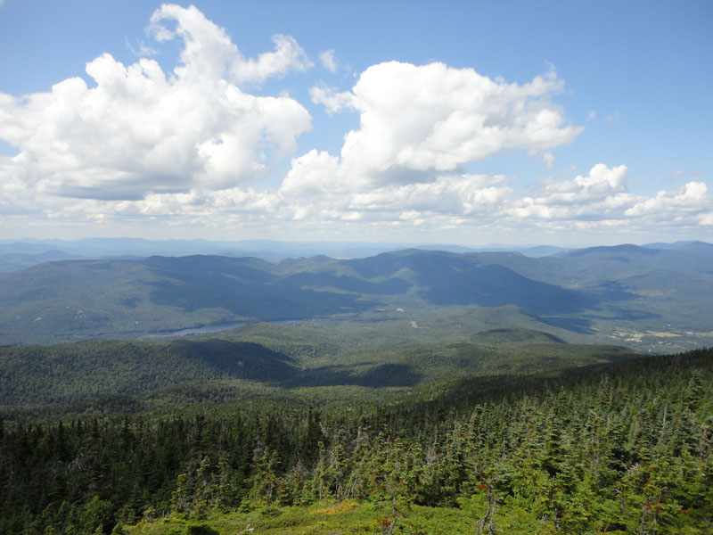
From there, it was a very scenic walk with numerous ledges as we worked our way to Mt. Moriah, taking numerous breaks along the way. From Moriah, we had excellent views in most directions.
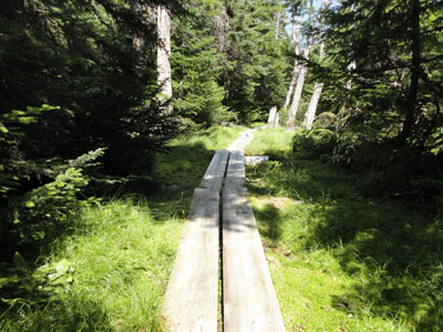
Our next stop was Shelburne Moriah. The Kenduskeag Trail dropped soon after passing over a small crag, then worked its way to the side of Middle Moriah and eventually the Rattle River Trail junction. While the trail had been dominated by bogwalks up to this point, subsequent muddy areas were left exposed.
Shelburne Moriah appeared to stay in the distance for quite some time as we worked our way uphill through various scrubby and ledgy areas with tremendous views. While I was a bit let down by the summit (due to it being somewhat wooded), it was nonetheless extremely scenic in multiple directions.
After another break, we continued onward, passing through a nice alpine meadow, then dropping steeply to some small subpeaks.
From one of these subpeaks, we could see a rocky crag jutting up in the distance. The trail eventually worked its way to it, dropping steeply over a small ladder at one point. It was pretty obvious we were at the crag when a herdpath and ledge climbed up to our right - we followed this about 20 feet from the trail and were soon treated with superb views of the Wild River Valley. Curious, I recrossed the trail and bushwhacked to some higher ledges, which offered similar views from a slightly different perspective.
After this stop, it was a steep drop down to the Shelburne Trail junction. We took a right and continued somewhat steeply downhill at first on the grown in trail, eventually reaching much better footing after a brook crossing.
The trail then reached a railgrade, soon coming to a confusing non-junction. A double blaze on a tree led us to believe we needed to turn right - however, this soon dead ended at perhaps a campsite. Back at the double blazed trail, we continued straight over a brook crossing on the railgrade, soon seeing the footbed that was a bit obscured by grass.
The railgrade eventually led us to the Highwater Trail junction. While we had originally planned to take this back to the suspension bridge, the Wild River had seemed low enough to cross. Indeed it was, though some of the steeping stones were rather slippery. From there, we continued on the grade to Wild River Road, then walked about 10 minutes back to the parking lot.
A long, but very nice approach to Mt. Moriah.
| Hike Ratings |
|
Getting To Trailhead: |
Easy |
| Destination: |
Mt. Moriah |
|
Length: |
Difficult |
|
Steepness: |
Difficult |
|
Navigation: |
Easy |
|
Views: |
Excellent |
|
Crowds: |
Minimal |
| Destination: |
Shelburne Moriah Mountain |
|
Length: |
Difficult |
|
Steepness: |
Difficult |
|
Navigation: |
Easy |
|
Views: |
Excellent |
|
Crowds: |
Heavy |
|
| Hike Stats |
|
Date Hiked: |
Sunday, August 1, 2010 |
| Hike Commenced: |
7:48 AM |
| Parking Elevation: |
1,150' |
| Destination: |
Mt. Moriah |
| Ascent Commenced: |
7:48 AM |
| Summit Reached: |
12:49 PM |
| Time Elapsed: |
05:01 |
| Trailhead Elevation: |
1,150' |
| Summit Elevation: |
4,049' |
| Distance: |
7.3 miles |
| Vertical Gain: |
3,009' |
| Destination: |
Shelburne Moriah Mountain |
| Ascent Commenced: |
1:11 PM |
| Summit Reached: |
2:48 PM |
| Time Elapsed: |
01:37 |
| Trailhead Elevation: |
4,049' |
| Summit Elevation: |
3,735' |
| Vertical Gain: |
695' |
|
|
| Hike Ended: |
6:12 PM |
| Hike Time Elapsed: |
10:24 |
| Hike Vertical Gain: |
4,035' |
|
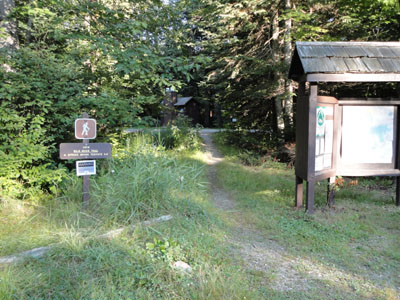
The Wild River Trail trailhead
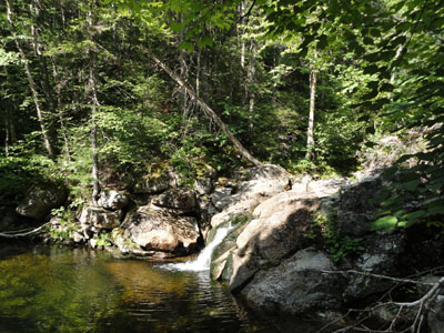
One of the many cascades along the Moriah Brook Trail
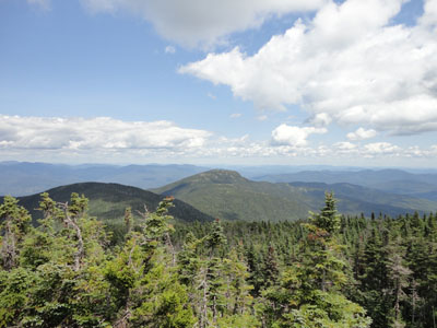
Looking at Shelburne Moriah from Moriah
The Kenduskeag Trail on the way to Shelburne Moriah
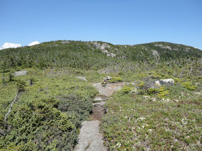
The Kenduskeag Trail on the way to Shelburne Moriah

Looking at the Mahoosucs from Shelburne Moriah
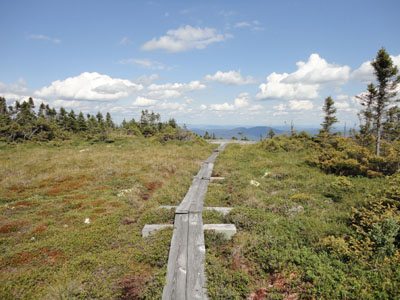
The Kenduskeag Trail beyond Shelburne Moriah

Directions to trailhead: From US 2, take Route 113 south, then take a right onto Wild River Road. The Wild River Trail WMNF fee parking area and trailhead are located on the left just before entering the campground.
Back to Mt. Moriah Profile
Back to Shelburne Moriah Mountain Profile
|