Home
States
Colorado
Connecticut
Maine
Massachusetts
New Hampshire
New York
Rhode Island
Utah
Vermont
View All
Lists
NE 4,000 Footers
NE 100 Highest
NH 4,000 Footers
NH 100 Highest
NH 52 With A View
NH Belknap Range
NH Ossipee 10
Links
Trail Conditions
Trip Log
Sunrises
Sunsets
About
|
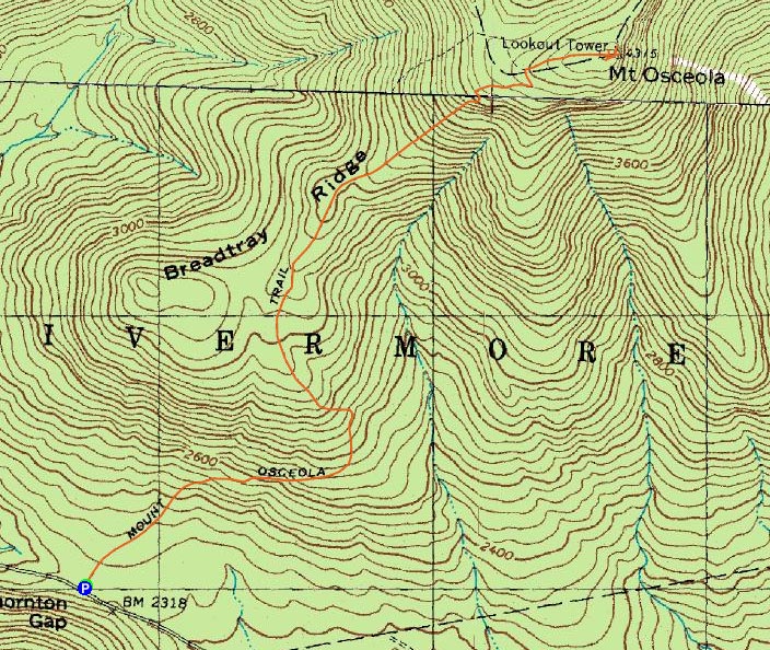
Mt. Osceola
Livermore, NH, Lincoln, NH
Trailheads, measurements, times, distances, and maps are all approximate and relative to the hike(s) as shown below.
Mt. Osceola Trail to Mt. Osceola
Route: Mt. Osceola Trail
A recurring theme this summer - scrambling to get out and get a quick hike in before an extended period of bad weather. The longest stretch of decent weather this summer so far I think was something like four days - what a joke.
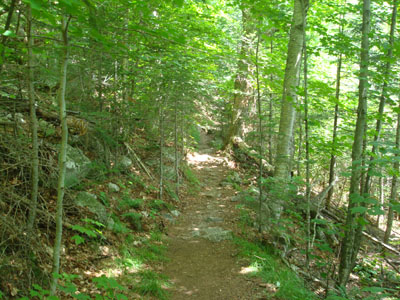
Leaving work a bit early, I was quickly on my way upon reaching the Mt. Osceola Trail trailhead off Tripoli Road. While the trail is very gradual, it's hard to get a good pace going due to the rocky nature of the first mile or so.
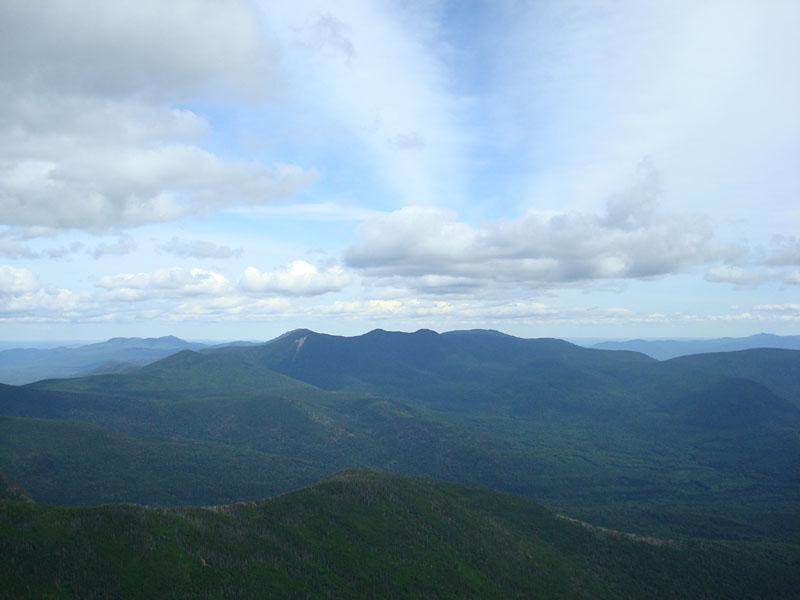
While it had been a really nice morning, clouds were quickly moving in, progressively blocking out more sunlight. Nonetheless, when I reached the empty summit, there was still decent visibility. It's a great viewpoint - had it been a bit more sunny and had I had a bit more time (and had I had a few more hads in my sentence), I would have stayed longer than 10 or 15 minutes.
The descent wasn't noteworthy, though once again I was wishing the bottom half of the trail wasn't so rocky.
| Hike Ratings |
|
Getting To Trailhead: |
Easy |
| Destination: |
Mt. Osceola |
|
Length: |
Moderate |
|
Steepness: |
Moderate |
|
Navigation: |
Easy |
|
Views: |
Excellent |
|
Crowds: |
Moderate |
|
| Hike Stats |
|
Date Hiked: |
Wednesday, July 30, 2008 |
| Hike Commenced: |
1:42 PM |
| Parking Elevation: |
2,340' |
| Destination: |
Mt. Osceola |
| Ascent Commenced: |
1:42 PM |
| Summit Reached: |
3:02 PM |
| Time Elapsed: |
01:20 |
| Trailhead Elevation: |
2,340' |
| Summit Elevation: |
4,340' |
| Distance: |
3.2 miles |
| Vertical Gain: |
2,080' |
|
|
| Hike Ended: |
4:37 PM |
| Hike Time Elapsed: |
02:55 |
| Hike Distance: |
6.4 miles |
| Hike Vertical Gain: |
2,160' |
|
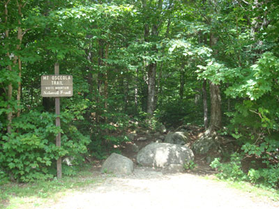
Mt. Osceola Trail trailhead at the Tripoli Road parking lot

A colorful mushroom next to the Mt. Osceola Trail

Looking at Mt. Tripyramid from the Mt. Osceola ledges


Directions to trailhead: From Waterville Valley, take Tripoli Road (bear right at the entrance to the ski area) to the top of the gap. Just after the road turns from pavement from dirt, the Mt. Osceola WMNF fee parking lot appears on the right. The trailhead is located at the back of the parking lot.
Back to Mt. Osceola Profile
|