Home
States
Colorado
Connecticut
Maine
Massachusetts
New Hampshire
New York
Rhode Island
Utah
Vermont
View All
Lists
NE 4,000 Footers
NE 100 Highest
NH 4,000 Footers
NH 100 Highest
NH 52 With A View
NH Belknap Range
NH Ossipee 10
Links
Trail Conditions
Trip Log
Sunrises
Sunsets
About
|
Mt. Osceola, Mt. Osceola (East Peak)
Livermore, NH, Lincoln, NH
Trailheads, measurements, times, distances, and maps are all approximate and relative to the hike(s) as shown below.
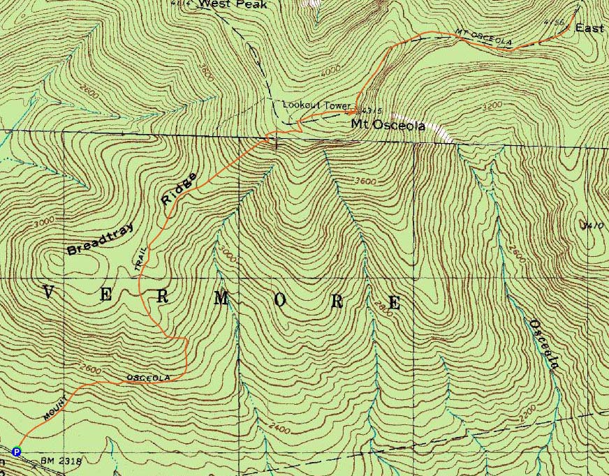
Mt. Osceola Trail to Mt. Osceola
Route: Mt. Osceola Trail
With word that the Osceolas were close to snow free, I had my next knee-rehab hike chosen. Arriving at the Tripoli Road trailhead, I did some stretching and was soon on my way up the rocky portion of the Mt. Osceola Trail. While there were some black flies biting near the beginning of the trail, the rest of the way was biting-fly-free. In addition, other than two small patches just short of the summit, the trail was snow free.
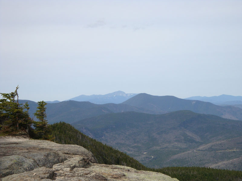
Though the sky was clouding over, the views from the ledge vista on Mt. Osceola were spectacular. After some more stretching, I was on my way to East Osceola.
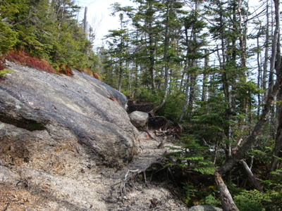
The Mt. Osceola Trail between the peaks was mostly bare, with a few small patches of snow and ice thrown in for good measure. Arriving at the summit of East Osceola, I dropped my pack and continued north to the quasi-vista for a look at the Tripyramids.
On my way back to the main peak, I removed some blowdowns that had annoyed me in my winter and early spring trips. Seeing that the chimney was clear, I scrambled up it as I climbed my way out of the col.
About half way down the trail from the main peak, my bad knee was getting a bit impatient with the hiking. Fortunately, after some more stretching and resting, it allowed me to finish the descent without any agony. Old age is terrible.
| Hike Ratings |
|
Getting To Trailhead: |
Easy |
| Destination: |
Mt. Osceola |
|
Length: |
Moderate |
|
Steepness: |
Moderate |
|
Navigation: |
Easy |
|
Views: |
Excellent |
|
Crowds: |
Moderate |
| Destination: |
Mt. Osceola (East Peak) |
|
Length: |
Moderate |
|
Steepness: |
Very Difficult |
|
Navigation: |
Easy |
|
Views: |
Moderate |
|
Crowds: |
Minimal |
|
| Hike Stats |
|
Date Hiked: |
Friday, May 15, 2009 |
| Hike Commenced: |
2:51 PM |
| Parking Elevation: |
2,340' |
| Destination: |
Mt. Osceola |
| Ascent Commenced: |
2:51 PM |
| Summit Reached: |
4:16 PM |
| Time Elapsed: |
01:25 |
| Trailhead Elevation: |
2,340' |
| Summit Elevation: |
4,340' |
| Vertical Gain: |
2,090' |
| Destination: |
Mt. Osceola (East Peak) |
| Ascent Commenced: |
4:21 PM |
| Summit Reached: |
4:54 PM |
| Time Elapsed: |
00:33 |
| Trailhead Elevation: |
4,340' |
| Summit Elevation: |
4,156' |
| Vertical Gain: |
386' |
|
|
| Hike Ended: |
7:21 PM |
| Hike Time Elapsed: |
04:30 |
| Hike Vertical Gain: |
3,171' |
|
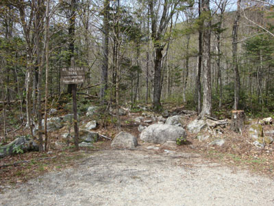
Mt. Osceola Trail trailhead at the Tripoli Road parking lot
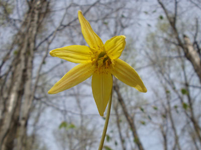
Trout lily on the lower portion of the Mt. Osceola Trail
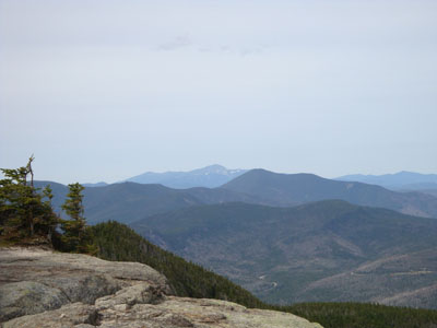
Looking at Mt. Washington and Mt. Carrigain from Mt. Osceola
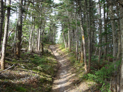
The Mt. Osceola Trail between Mt. Osceola and the East Peak
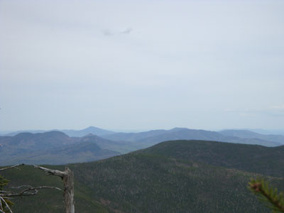
Looking at Kearsarge North Mountain and the Moats from near the summit of the East Peak of Mt. Osceola
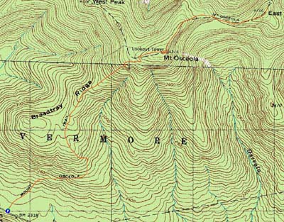 ' '

Directions to trailhead: From Waterville Valley, take Tripoli Road (bear right at the entrance to the ski area) to the top of the gap. Just after the road turns from pavement from dirt, the Mt. Osceola WMNF fee parking lot appears on the right. The trailhead is located at the back of the parking lot.
Back to Mt. Osceola Profile
Back to Mt. East Osceola Profile
|