Home
States
Colorado
Connecticut
Maine
Massachusetts
New Hampshire
New York
Rhode Island
Utah
Vermont
View All
Lists
NE 4,000 Footers
NE 100 Highest
NH 4,000 Footers
NH 100 Highest
NH 52 With A View
NH Belknap Range
NH Ossipee 10
Links
Trail Conditions
Trip Log
Sunrises
Sunsets
About
|
Mt. Pemigewasset
Lincoln, NH
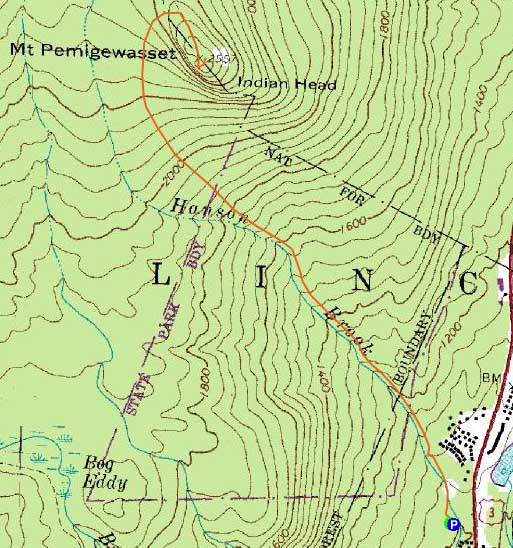
Trailheads, measurements, times, distances, and maps are all approximate and relative to the hike(s) as shown below.
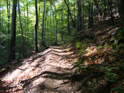
Looking up the Indian Head Trail
Route: Indian Head Trail, Mt. Pemigewasset Trail, (Mt. Pemigewasset), Mt. Pemigewasset Trail, Indian Head Trail
Waiting out a passing storm, I headed up to Lincoln. In the course of only a few minutes, the clouds and rain showers parted, revealing blue skies.
The Indian Head Trail started off in the woods, prior to heading through a field, then back into the woods, then under two interstate bridges, then back into the woods. While the highway traffic was a bit loud, it was soon drowned out by the adjacent brook.
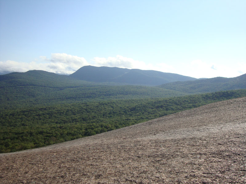
The footing was generally decent with the exception of a few rocky areas, as well as plenty of light mud. Climbing away from the brook, the trail looped around and approached Mt. Pemigewasset steeply for a bit, eventually reaching the Mt. Pemigewasset Trail. It then shortly reached the dramatic southern ledges, where there were decent views despite the southern clouds. I continued on, wrapping around to the eastern ledges, where there were some views of the Franconia Ridge.
The descent went smoothly enough - it was interesting to see all of the variations of herd paths around the eroded areas of the trailbed. Despite the good weather and heavy crowds in the area, I didn't see a single person the entire hike.
| Hike Ratings |
|
Getting To Trailhead: |
Easy |
| Destination: |
Mt. Pemigewasset |
|
Length: |
Moderate |
|
Steepness: |
Difficult |
|
Navigation: |
Moderate |
|
Views: |
Excellent |
|
Crowds: |
Minimal |
|
| Hike Stats |
|
Date Hiked: |
Thursday, June 17, 2010 |
| Hike Commenced: |
5:09 PM |
| Parking Elevation: |
1,000' |
| Destination: |
Mt. Pemigewasset |
| Ascent Commenced: |
5:09 PM |
| Summit Reached: |
5:57 PM |
| Time Elapsed: |
00:48 |
| Trailhead Elevation: |
1,000' |
| Summit Elevation: |
2,557' |
| Distance: |
1.9 miles |
| Vertical Gain: |
1,577' |
|
|
| Hike Ended: |
6:45 PM |
| Hike Time Elapsed: |
01:36 |
| Hike Distance: |
3.8 miles |
| Hike Vertical Gain: |
1,597' |
|
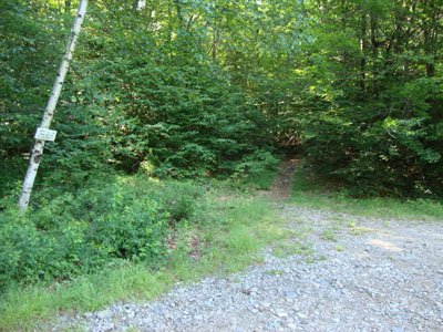
The Indian Trail trailhead off US 3

Birdsfoot Trefoil along the lower Indian Head Trail
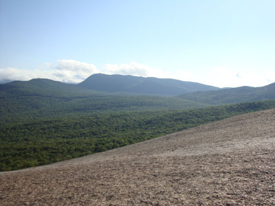
Looking at Mt. Wolf from the Mt. Pemigewasset ledges
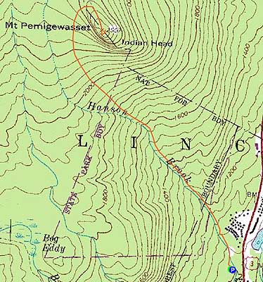

Directions to trailhead: Take I-93 north from Lincoln, to exit 33. Take US 3 north. Shortly after passing the water park, the dirt road leading to the Indian Head Trail parking lot will be on the left (sign on the right for trailhead parking). The Indian Head Trail starts at the back right of the parking lot.
Back to Mt. Pemigewasset Profile
|