Home
States
Colorado
Connecticut
Maine
Massachusetts
New Hampshire
New York
Rhode Island
Utah
Vermont
View All
Lists
NE 4,000 Footers
NE 100 Highest
NH 4,000 Footers
NH 100 Highest
NH 52 With A View
NH Belknap Range
NH Ossipee 10
Links
Trail Conditions
Trip Log
Sunrises
Sunsets
About
|
Mt. Pierce
Carroll, NH, Crawford's Purchase, NH, Bean's Grant, NH
Trailheads, measurements, times, distances, and maps are all approximate and relative to the hike(s) as shown below.
Looking up the Crawford Path
Route: Crawford Connector, Crawford Path, Webster Cliff Trail
Mt. Pierce is my go-to for an easy Presidential Range hike. The trail is gradual and the summit has some tree growth, making it a fairly safe bet even in slightly rough weather.
As I suited up, I talked to a few hikers who had just finished a loop hike - the good news was that the trail was mostly barebootable! The snowshoes went on my backpack.
The trail was mostly spring snow - somewhat of a wet granular. The blue sky and 50 degree temperature (at least at the trailhead) made for a very pleasant hike.
At one point, I heard some movement in the woods. Sure enough, there was a moose! I made a note of where this was and continued to the summit.
I was able to bareboot all the way up the Crawford Path, however the Webster Cliff Trail had extended patches of blue ice. On with the MSRs.
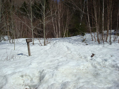
I was surprised how strong the views from the summit were - the snowpack allowed me to see over all of the small trees and thus have views in all directions. After taking a few photos, I decided to look for the moose!
As I reached the spot where I had seen the moose, I slowed down and tried to be quiet. Sure enough, I heard some rustling in the trees. Bushwacking a bit, I came within a few dozen yards of the moose - s/he knew I was there, but didn't seem concerned - in fact, s/he started to approach me. Not knowing much about moose, I took that as my cue to leave. Time to go learn about moose behavior!
I ended up barebooting the bottom half of the trail, allowing for some boot sliding. All things considered, a nice hike.
| Hike Ratings |
|
Getting To Trailhead: |
Easy |
| Destination: |
Mt. Pierce |
|
Length: |
Moderate |
|
Steepness: |
Moderate |
|
Navigation: |
Easy |
|
Views: |
Excellent |
|
Crowds: |
Minimal |
|
| Hike Stats |
|
Date Hiked: |
Tuesday, March 8, 2008 |
| Hike Commenced: |
2:57 PM |
| Parking Elevation: |
1,920' |
| Destination: |
Mt. Pierce |
| Ascent Commenced: |
2:58 PM |
| Summit Reached: |
4:50 PM |
| Time Elapsed: |
01:52 |
| Trailhead Elevation: |
1,920' |
| Summit Elevation: |
4,310' |
| Distance: |
3.2 miles |
| Vertical Gain: |
2,430' |
|
|
| Hike Ended: |
6:14 PM |
| Hike Time Elapsed: |
03:17 |
| Hike Distance: |
6.4 miles |
| Hike Vertical Gain: |
2,470' |
|
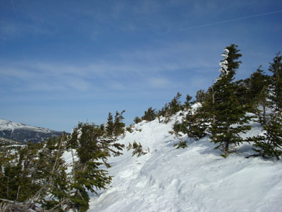
Crawford Connector trailhead
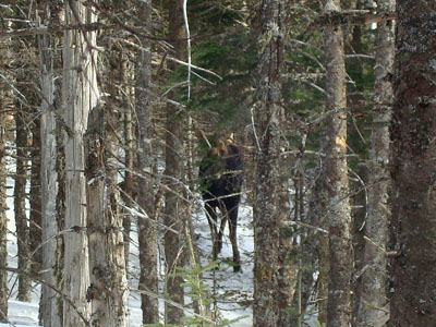
A moose!
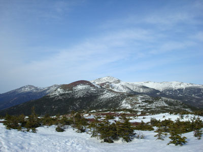
Looking northeast at Mt. Eisenhower and Mt. Washington from near the Mt. Pierce summit
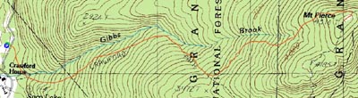

Directions to trailhead: Take Route 302 West from Bartlett into Carroll. Just after Saco Lake, take a right onto Mt. Clinton Road. Shortly thereafter, take a left into the WMNF fee parking area driveway and Crawford Connector trailhead.
Back to Mt. Pierce Profile
|