Home
States
Colorado
Connecticut
Maine
Massachusetts
New Hampshire
New York
Rhode Island
Utah
Vermont
View All
Lists
NE 4,000 Footers
NE 100 Highest
NH 4,000 Footers
NH 100 Highest
NH 52 With A View
NH Belknap Range
NH Ossipee 10
Links
Trail Conditions
Trip Log
Sunrises
Sunsets
About
|
Mt. Prospect
Holderness, NH
Trailheads, measurements, times, distances, and maps are all approximate and relative to the hike(s) as shown below.

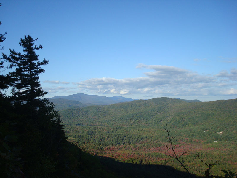
Some fall colors on the trail to Mt. Prospect
Route: Unknown trail
After two consecutive longer hikes, I decided to take it easy after work and do a smaller hike. I'd been meaning to check out Mt. Prospect for a year or so - and with the days getting shorter and winter approaching, I decided to check it out in good weather, so I could perhaps try it on snowshoes later on.
It took me a moment to find the trailhead, as there were two possibilities, but after getting out of my vehicle I was able to determine it was the first one (blocked by two granite blocks). After dipping down and crossing a brook, the trail climbed steadily briefly, before becoming rather tame for awhile. The trail itself was more along the lines of an old road for the first half or so of the distance. Of note were the numerous trails crossing the main trail throughout the ascent - apparently bike trails. The main trail is seldom marked, but, other than the two junctions, is pretty easy to follow.
After reaching a col (and seeing evidence of and hearing a moose run away), there were soon two junctions. The first one I went straight on, following a wooden arrow. At the second junction, a right turn led to a nice outlook, while a left led up toward the summit.
About a minute or two prior to reaching the summit, the trail reached a great vista that looked at the lakes. The summit itself was wooded - an old benchmark and triangle were visible on the trail, while the actual highpoint was a bit to the west along a herd path.
After checking out the herd path to the highpoint (apparently the herd path links back up with the trail at one of the previously mentioned junctions), I followed a somewhat marked trail to the north, first reaching a narrow outlook (looking at Franconia Notch amongst other places), then descending further to another nice open lakes viewpoint. I considered following this trail further, however I wasn't looking to turn this into a big hike.
The descent was pleasant and rather gentle, thanks to the tame grades and good footing.
| Hike Ratings |
|
Getting To Trailhead: |
Easy |
| Destination: |
Mt. Prospect |
|
Length: |
Moderate |
|
Steepness: |
Moderate |
|
Navigation: |
Moderate |
|
Views: |
Excellent |
|
Crowds: |
Minimal |
|
| Hike Stats |
|
Date Hiked: |
Monday, September 22, 2008 |
| Parking Elevation: |
1,080' |
| Destination: |
Mt. Prospect |
| Time Elapsed: |
00:42 |
| Trailhead Elevation: |
1,080' |
| Summit Elevation: |
2,064' |
| Distance: |
1.6 miles |
| Vertical Gain: |
1,019' |
|
|
| Hike Time Elapsed: |
01:38 |
| Hike Vertical Gain: |
1,159' |
|

The trailhead on Mt. Prospect Road

Looking northeast toward the Sandwich Dome from one of the Mt. Prospect viewpoints


Directions to trailhead: From Meredeth, take Route 25 west, then take a right onto Route 175 north. Just prior to the 175A junction, take a right onto Mt. Prospect Road. After passing Prospect Ridge Road on the right and dipping down a bit, the road climbs and soon turns to the left. The trailhead is on the right (two granite columns laying on their side). There is some room to park on the side of the road next to the trailhead.
Back to Mt. Prospect Profile
|