Home
States
Colorado
Connecticut
Maine
Massachusetts
New Hampshire
New York
Rhode Island
Utah
Vermont
View All
Lists
NE 4,000 Footers
NE 100 Highest
NH 4,000 Footers
NH 100 Highest
NH 52 With A View
NH Belknap Range
NH Ossipee 10
Links
Trail Conditions
Trip Log
Sunrises
Sunsets
About
|
Mt. Prospect
Holderness, NH
Trailheads, measurements, times, distances, and maps are all approximate and relative to the hike(s) as shown below.

Looking up the trail to Mt. Prospect
Route: Unknown trail
With a significant hike planned for the following day, I decided to take it easy. Seeing blue sky over the Squam Lake region on an otherwise cloudy (yet forecasted sunny) afternoon, I headed over to Holderness.
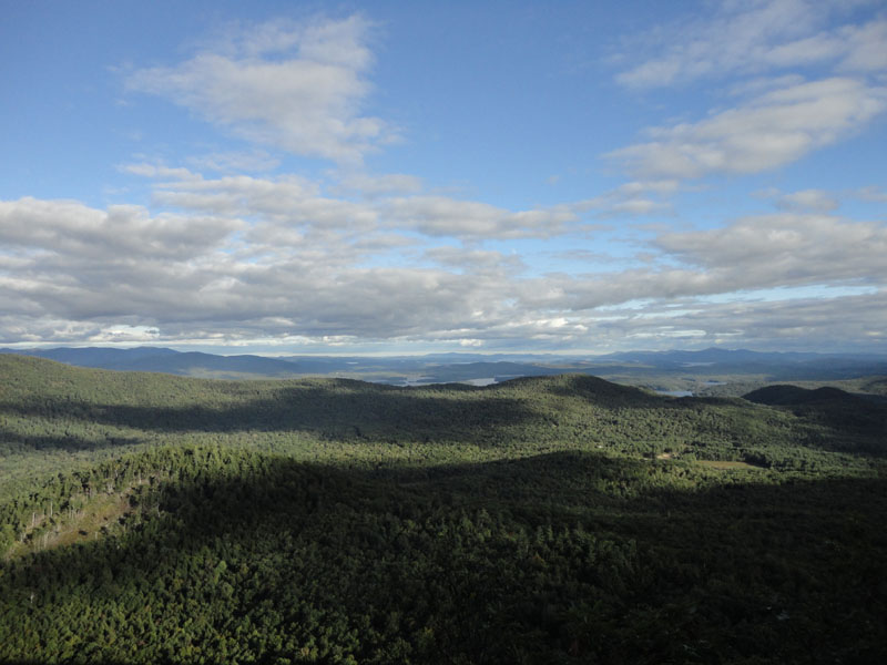
With the nice footing of the unnamed trail to Mt. Prospect, I took advantage of the cool temperature and jogged to the summit. After signing in on the summit register, I headed down to the northeastern viewpoint. Previously I had stopped at the first slight ledge - this time I continued just beyond it and came to a much nicer view point with 180 degree views.
Again taking advantage of the nice footing, I jogged back to the trailhead.
| Hike Ratings |
|
Getting To Trailhead: |
Easy |
| Destination: |
Mt. Prospect |
|
Length: |
Moderate |
|
Steepness: |
Moderate |
|
Navigation: |
Moderate |
|
Views: |
Excellent |
|
Crowds: |
Minimal |
|
| Hike Stats |
|
Date Hiked: |
Friday, September 17, 2010 |
| Parking Elevation: |
1,080' |
| Destination: |
Mt. Prospect |
| Time Elapsed: |
00:25 |
| Trailhead Elevation: |
1,080' |
| Summit Elevation: |
2,064' |
| Distance: |
1.6 miles |
| Vertical Gain: |
1,019' |
|
|
| Hike Time Elapsed: |
01:17 |
| Hike Vertical Gain: |
1,159' |
|

The trailhead on Mt. Prospect Road

Looking over the Squam Range toward the lakes from the northeastern Mt. Prospect viewpoint


Directions to trailhead: From Meredeth, take Route 25 west, then take a right onto Route 175 north. Just prior to the 175A junction, take a right onto Mt. Prospect Road. After passing Prospect Ridge Road on the right and dipping down a bit, the road climbs and soon turns to the left. The trailhead is on the right (two granite columns laying on their side). There is some room to park on the side of the road next to the trailhead.
Back to Mt. Prospect Profile
|