Home
States
Colorado
Connecticut
Maine
Massachusetts
New Hampshire
New York
Rhode Island
Utah
Vermont
View All
Lists
NE 4,000 Footers
NE 100 Highest
NH 4,000 Footers
NH 100 Highest
NH 52 With A View
NH Belknap Range
NH Ossipee 10
Links
Trail Conditions
Trip Log
Sunrises
Sunsets
About
|
Mt. Prospect
Holderness, NH
Trailheads, measurements, times, distances, and maps are all approximate and relative to the hike(s) as shown below.

Looking down the icy trail to Mt. Prospect
Route: Unknown trail
Trail was dry and in good shape. Normal mudpit about halfway up was dry. Decent foliage. No rain yet as of late afternoon.
| Hike Ratings |
|
Getting To Trailhead: |
Easy |
| Destination: |
Mt. Prospect |
|
Length: |
Moderate |
|
Steepness: |
Moderate |
|
Navigation: |
Moderate |
|
Views: |
Excellent |
|
Crowds: |
Minimal |
|
| Hike Stats |
|
Date Hiked: |
Wednesday, October 16, 2013 |
| Parking Elevation: |
1,150' |
| Destination: |
Mt. Prospect |
| Time Elapsed: |
00:26 |
| Trailhead Elevation: |
1,150' |
| Summit Elevation: |
2,064' |
| Vertical Gain: |
974' |
|
|
| Hike Time Elapsed: |
00:54 |
| Hike Vertical Gain: |
1,034' |
|

The trailhead at the end of Prospect Ridge Road

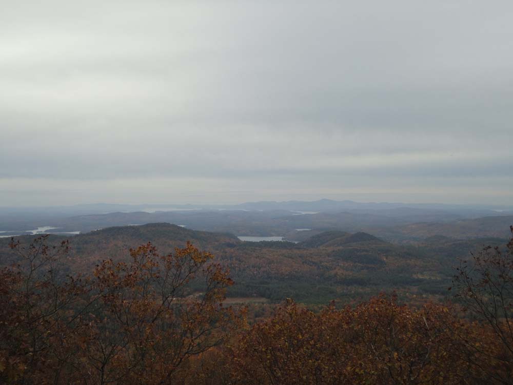
Looking toward the lakes and Belknaps from the southeastern Mt. Prospect viewpoint


Directions to trailhead: From Meredeth, take Route 25 west, then take a right onto Route 175 north. Just prior to the 175A junction, take a right onto Mt. Prospect Road. A few minutes later, take a right onto Prospect Ridge Road. There is a small paved turnaround at the top of this road, with a path starting at a concrete cap.
Back to Mt. Prospect Profile
|