Home
States
Colorado
Connecticut
Maine
Massachusetts
New Hampshire
New York
Rhode Island
Utah
Vermont
View All
Lists
NE 4,000 Footers
NE 100 Highest
NH 4,000 Footers
NH 100 Highest
NH 52 With A View
NH Belknap Range
NH Ossipee 10
Links
Trail Conditions
Trip Log
Sunrises
Sunsets
About
|
Mt. Prospect
Holderness, NH
Trailheads, measurements, times, distances, and maps are all approximate and relative to the hike(s) as shown below.

The trail to Mt. Prospect
Route: Unknown trail, herd path, bushwhack
Trail was generally dry with just a few damp places from this morning's showers. Mudpit is still dry. Foliage is starting to pop.
From the summit, I continued about 0.15 mile northeast to the good viewpoint, then followed a faint herd path (cross over a stonewall, then look for mossy old cairns) another 0.15 mile north. At this point, I was at a cairn on a ledge, and to the right was an opening to a slanted view ledge (looking at The Button and beyond); this is just prior to the first bump shown on the USGS.
I descended the view ledge a dozen or two feet on some larger rocks, then took an immediate left. Just to my left, almost under the slanted view ledge, was a cavern, probably 15-20 feet deep. I didn't look around too much, as I didn't want to fall in, but I believe this is the Miser's Cave, as described in old guidebooks. I suspect one would need a rope to get in/out of it.
I returned to the cairn and went north to the northernmost bump, occasionally finding old cairns, a tin blaze, a neat opening in a stonewall, and an old firepit.
This was my first time consciously looking for the cave...was neat to (most likely) find it, after reading about it years ago.
| Hike Ratings |
|
Getting To Trailhead: |
Easy |
| Destination: |
Mt. Prospect |
|
Length: |
Moderate |
|
Steepness: |
Moderate |
|
Navigation: |
Moderate |
|
Views: |
Excellent |
|
Crowds: |
Minimal |
|
| Hike Stats |
|
Date Hiked: |
Friday, October 6, 2017 |
| Parking Elevation: |
1,080' |
| Destination: |
Mt. Prospect |
| Time Elapsed: |
00:28 |
| Trailhead Elevation: |
1,080' |
| Summit Elevation: |
2,064' |
| Distance: |
1.6 miles |
| Vertical Gain: |
1,019' |
|
|
| Hike Time Elapsed: |
01:43 |
| Hike Vertical Gain: |
1,254' |
|

(Probably) Miser's Cave

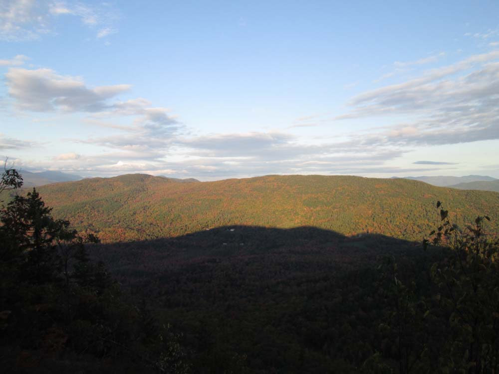
The Squam Range as seen from the northeastern Mt. Prospect viewpoint
Directions to trailhead: From Meredeth, take Route 25 west, then take a right onto Route 175 north. Just prior to the 175A junction, take a right onto Mt. Prospect Road. After passing Prospect Ridge Road on the right and dipping down a bit, the road climbs and soon turns to the left. The trailhead is on the right (two granite columns laying on their side). There is some room to park on the side of the road next to the trailhead.
Back to Mt. Prospect Profile
|