Home
States
Colorado
Connecticut
Maine
Massachusetts
New Hampshire
New York
Rhode Island
Utah
Vermont
View All
Lists
NE 4,000 Footers
NE 100 Highest
NH 4,000 Footers
NH 100 Highest
NH 52 With A View
NH Belknap Range
NH Ossipee 10
Links
Trail Conditions
Trip Log
Sunrises
Sunsets
About
|
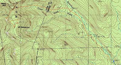
Mt. Resolution
Bartlett, NH, Jackson, NH, Sargents Purchase, NH
Trailheads, measurements, times, distances, and maps are all approximate and relative to the hike(s) as shown below.
Looking down the Stairs Col Trail
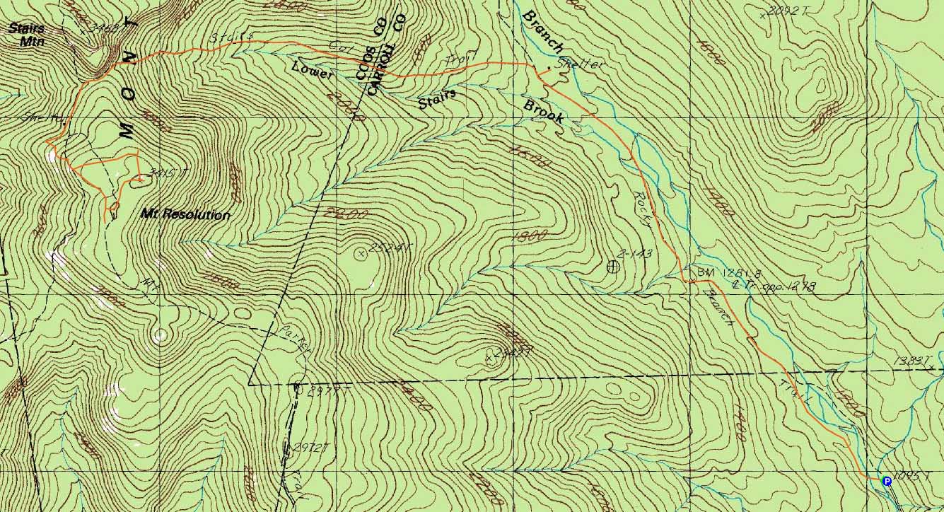
Route: Rocky Branch Trail, Stairs Col Trail, Davis Path, Mt. Parker Trail, bushwhack, (Mt. Resolution), bushwhack, Mt. Parker Trail, Davis Path, Stairs Col Trail, Rocky Branch Trail
After a long day, and with a forecast of afternoon thunderstorms, I decided to do just a half day hike.
Starting at the end of Jericho Road, the Rocky Branch Trail was initially (after crossing the river on a bridge) a grassy logging road. At a sharp turn, the Rocky Branch Trail continued straight with continued excellent footing. With the exception of one brief reroute (still good footing), it was essentially a railgrade walk (without the mud and rotten railroad ties of many other old WMNF railbeds). The two water crossings were easily rock hopped.
Taking a left onto the Stairs Col Trail, things were gradual to moderate for awhile, with halfway decent footing. Nearing the col, the trail steepened up with some rock stairways.
After passing through the col (a few views through the leaves of the Giant Stairs), the trail dropped down to the Davis Path. Heading southbound, I eventually took a left onto the Mt. Parker Trail.
The trail climbed somewhat steeply, crossing over some ledges (which wouldn't be fun in wet or icy conditions) and eventually reaching what I found to be the highpoint of the trail. The USGS map was very inaccurate, and the AMC map lacked the necessary detail (100 foot contours) - as a result, I continued southbound for awhile until I was convinced I had passed the highpoint.
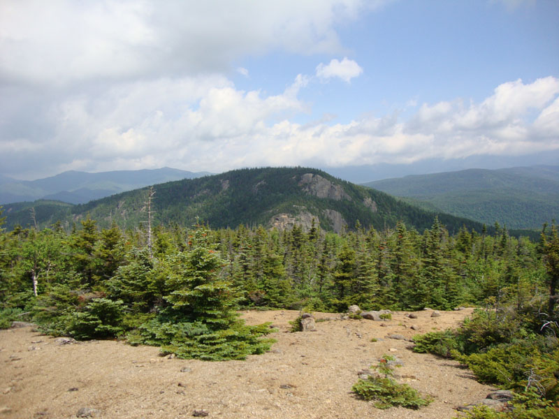
Back at the on-trail highpoint, I followed some herd paths along the ledges uphill to the east, where I was able to obtain a visual of higher trees to the northeast. I bushwhacked toward them, via a shallow col, going a bit too far north at first. Pushing through somewhat thick spruce, I eventually reached what I found to be the highpoint - a cairn stacked in some shrubs/small trees. Immediately next to it was a nice open area with some ledges and dirt and good views of Stairs Mountain, as well as points to the west and east.
I spotted another set of ledges a bit to my north, which I verified with the satellite imagery I had brought with me. It was another short, but thick, bushwhack to these, from where I had slightly better views of Stairs. After a brief break, I bushwhacked from these ledges back toward the Mt. Parker Trail, reaching it near the northern on-trail ledges.
While I was tempted to visit Stairs Mountain, I opted to call it a day, reaching the parking lot just before thunderstorm clouds rolled in.
| Hike Ratings |
|
Getting To Trailhead: |
Easy |
| Destination: |
Mt. Resolution |
|
Length: |
Moderate |
|
Steepness: |
Difficult |
|
Navigation: |
Difficult |
|
Views: |
Excellent |
|
Crowds: |
Minimal |
|
| Hike Stats |
|
Date Hiked: |
Sunday, June 20, 2010 |
| Hike Commenced: |
7:49 AM |
| Parking Elevation: |
1,095' |
| Destination: |
Mt. Resolution |
| Ascent Commenced: |
7:49 AM |
| Summit Reached: |
10:21 AM |
| Time Elapsed: |
02:32 |
| Trailhead Elevation: |
1,095' |
| Summit Elevation: |
3,415' |
| Vertical Gain: |
2,600' |
|
|
| Hike Ended: |
12:52 PM |
| Hike Time Elapsed: |
05:03 |
| Hike Vertical Gain: |
2,900' |
|
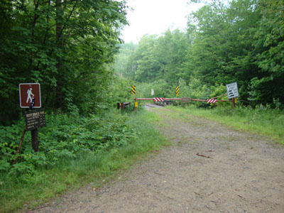
The Rocky Branch Trail trailhead
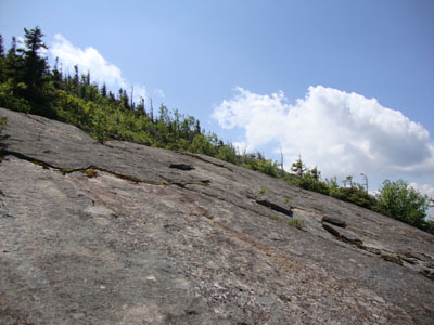
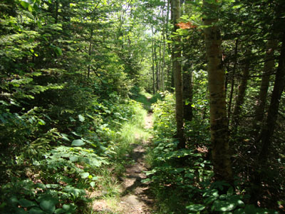
Looking up the Mt. Parker Trail on the way to Mt. Resolution
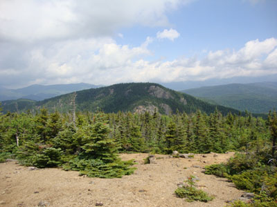
Looking at Stairs Mountain from near the summit of Mt. Resolution

Directions to trailhead: Take Route 302 west from North Conway. Shortly after passing through Glen (Route 302-16 junction), Jericho Road will be on the right. The road will eventually become dirt, passing through a gate. There is room to park at the end of the road. The Rocky Branch Trail will start on the left at a closed gate, immediately crossing over two wooden bridges.
Back to Mt. Resolution Profile
|