Home
States
Colorado
Connecticut
Maine
Massachusetts
New Hampshire
New York
Rhode Island
Utah
Vermont
View All
Lists
NE 4,000 Footers
NE 100 Highest
NH 4,000 Footers
NH 100 Highest
NH 52 With A View
NH Belknap Range
NH Ossipee 10
Links
Trail Conditions
Trip Log
Sunrises
Sunsets
About
|
Owl's Cliff, Mt. Tremont
Albany, NH
Trailheads, measurements, times, distances, and maps are all approximate and relative to the hike(s) as shown below.

The Sawyer Pond Trail
Route: Sawyer Pond Trail, Brunel Trail, Owl's Cliff Spur, herd path, (Owl's Cliff), herd path, Owl's Cliff Spur, Brunel Trail, (Mt. Tremont), Brunel Trail, Sawyer Pond Trail
Had to wade Swift River crossing (very close to the trailhead, so at least you find out early on if it's doable)...went about 100 feet downstream and found a place that was knee deep. Otherwise, crossings were minor.
Route was generally dry. A bit gravelly on the steeps on Owls Cliff and Tremont, making for a tricky descent. Some slippery rocks as well. Followed a herd path from the Owls Cliff view spur to the summit, but didn't see anything marking the highpoint.
| Hike Ratings |
|
Getting To Trailhead: |
Easy |
| Destination: |
Owl's Cliff |
|
Length: |
Moderate |
|
Steepness: |
Difficult |
|
Navigation: |
Moderate |
|
Views: |
Excellent |
|
Crowds: |
Minimal |
| Destination: |
Mt. Tremont |
|
Length: |
Moderate |
|
Steepness: |
Difficult |
|
Navigation: |
Easy |
|
Views: |
Excellent |
|
Crowds: |
Minimal |
|
| Hike Stats |
|
Date Hiked: |
Wednesday, July 4, 2012 |
| Parking Elevation: |
1,225' |
| Destination: |
Owl's Cliff |
| Time Elapsed: |
01:33 |
| Trailhead Elevation: |
1,225' |
| Summit Elevation: |
2,940' |
| Vertical Gain: |
1,875' |
| Destination: |
Mt. Tremont |
| Time Elapsed: |
00:29 |
| Trailhead Elevation: |
2,940' |
| Summit Elevation: |
3,371' |
| Vertical Gain: |
671' |
|
|
| Hike Time Elapsed: |
03:53 |
| Hike Vertical Gain: |
2,916' |
|

The Sawyer Pond Trail trailhead

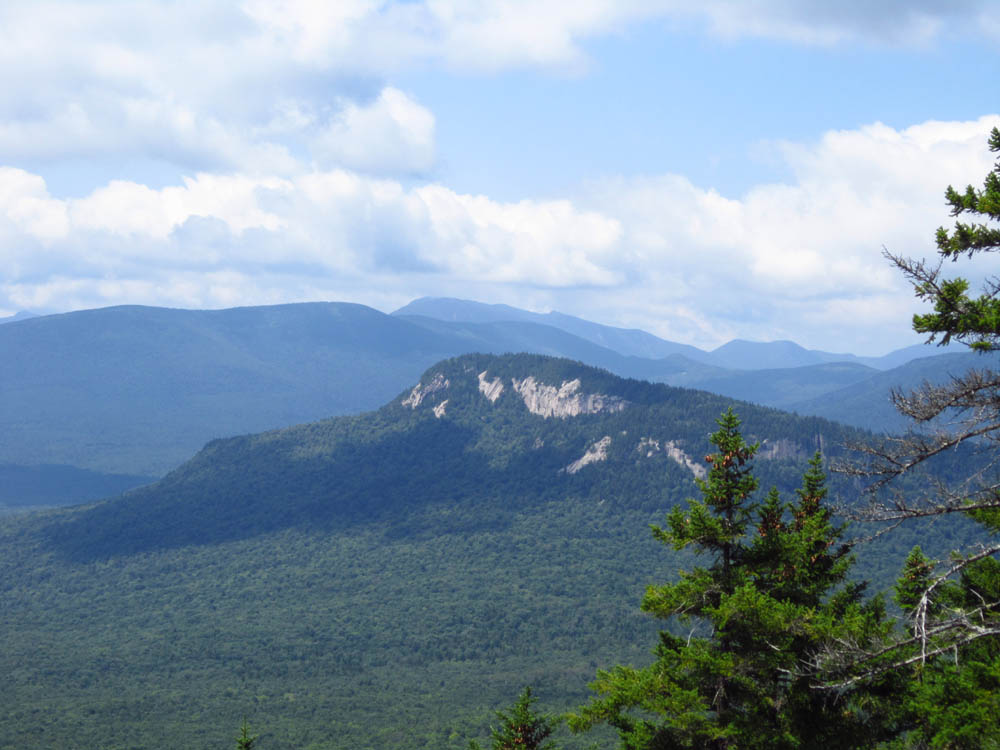
Greens Cliff as seen from the Owl's Cliff vista

The Brunel Trail near the summit of Mt. Tremont

The Sandwich Range as seen from Mt. Tremont
Directions to trailhead: Take Route 112 West from Bear Notch Road. The access road to the Sawyer Pond Trail trailhead will eventually be on the right.
Back to Owls Cliff Profile
Back to Mt. Tremont Profile
|