Home
States
Colorado
Connecticut
Maine
Massachusetts
New Hampshire
New York
Rhode Island
Utah
Vermont
View All
Lists
NE 4,000 Footers
NE 100 Highest
NH 4,000 Footers
NH 100 Highest
NH 52 With A View
NH Belknap Range
NH Ossipee 10
Links
Trail Conditions
Trip Log
Sunrises
Sunsets
About
|
Pine Mountain
Gorham, NH
Trailheads, measurements, times, distances, and maps are all approximate and relative to the hike(s) as shown below.
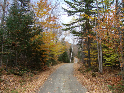
Looking up Pine Mountain Road
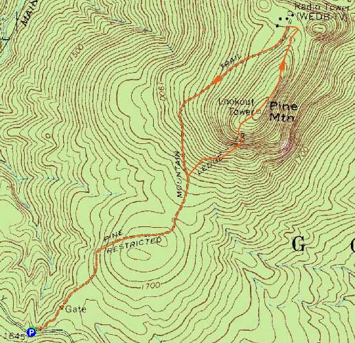
Route: Pine Mountain Road, Ledge Trail, (Pine Mountain), Pine Mountain Trail, Pine Mountain Road
Almost a week after the bad fall, my knee was still quite problematic. Since Dolly Copp Road wouldn't be open much longer (assuming winter comes soon), I figured it was as good a time as any to check out Pine Mountain.
The road walk to the Ledge Trail junction was pretty tame - a few trees still had some decent colors. Reaching the Ledges Trail, things picked up in pitch a bit, though never more than moderately, save for a few very short sections (a few slabby areas could be tough in wet or icy conditions). The trail soon wrapped around the bottom of some dramatic ledges and cliffs with viewpoints of the Carters, Wildcats, and Northern Presidentials.
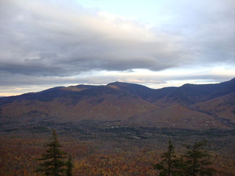
Eventually reaching the top of these ledges, there was a very nice viewpoint. Continuing up the trail, it soon reached the highpoint, adjacent to the former fire tower site. While there were no views here, there were additional viewpoints just beyond it, both looking toward Mt. Moriah and adjacent peaks.
Reaching the next trail junction, I took a left and descended to the Horton Center, taking Pine Mountain Road back to the trailhead.
| Hike Ratings |
|
Getting To Trailhead: |
Easy |
| Destination: |
Pine Mountain |
|
Length: |
Moderate |
|
Steepness: |
Difficult |
|
Navigation: |
Easy |
|
Views: |
Excellent |
|
Crowds: |
Minimal |
|
| Hike Stats |
|
Date Hiked: |
Wednesday, October 21, 2009 |
| Hike Commenced: |
4:36 PM |
| Parking Elevation: |
1,645' |
| Destination: |
Pine Mountain |
| Ascent Commenced: |
4:36 PM |
| Summit Reached: |
5:14 PM |
| Time Elapsed: |
00:38 |
| Trailhead Elevation: |
1,645' |
| Summit Elevation: |
2,405' |
| Distance: |
1.5 miles |
| Vertical Gain: |
850' |
|
|
| Hike Ended: |
6:00 PM |
| Hike Time Elapsed: |
01:24 |
| Hike Distance: |
3.5 miles |
| Hike Vertical Gain: |
980' |
|
The beginning of Pine Mountain Road off Dolly Copp Road
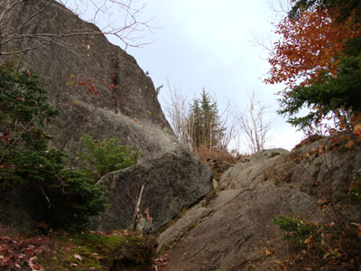
Looking up the Ledge Trail

Looking at Mt. Moriah from near the summit of Pine Mountain
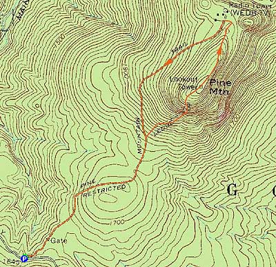

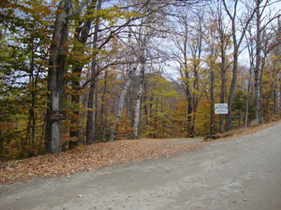
Directions to trailhead: Take Route 16 north from Pinkham Notch. After passing the entrance to Camp Dodge (on the right), Dolly Copp (Pinkham B) Road will eventually be on the left. Take Dolly Copp Road past the Barnes Field entrance to the Pink Link Trail parking area (left). The beginning of Pine Mountain Road (gated around the corner) is on the right.
Back to Pine Mountain Profile
|