Home
States
Colorado
Connecticut
Maine
Massachusetts
New Hampshire
New York
Rhode Island
Utah
Vermont
View All
Lists
NE 4,000 Footers
NE 100 Highest
NH 4,000 Footers
NH 100 Highest
NH 52 With A View
NH Belknap Range
NH Ossipee 10
Links
Trail Conditions
Trip Log
Sunrises
Sunsets
About
|
Rattlesnake Mountain
Rumney, NH
Trailheads, measurements, times, distances, and maps are all approximate and relative to the hike(s) as shown below.
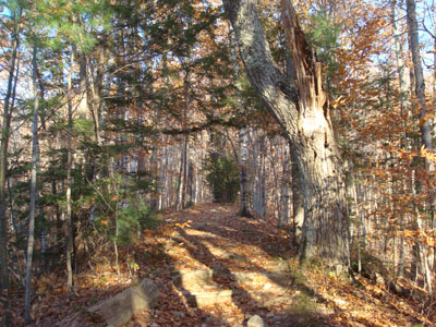
Looking up the Rattlesnake Mountain Trail
Route: Rattlesnake Mountain Trail, (Rattlesnake Mountain), Rattlesnake Mountain Trail
After hiking Carr Mountain, I decided to hustle down to Rattlesnake Mountain for a sunset hike.
Arriving at the trailhead, I had to park on the side of the road, as the tiny parking lot was full. The trail started gradually, before steepening for a constant ascent to the loop junction. From there, I took the eastern loop, which became quite scenic as it meandered to the summit.
The views from the summit ledges were tremendous, ranging from Stinson Mountain to points to the northwest. While a fire had burned the mountain pretty heavily over the summer, only a small portion near the summit showed signs of that.
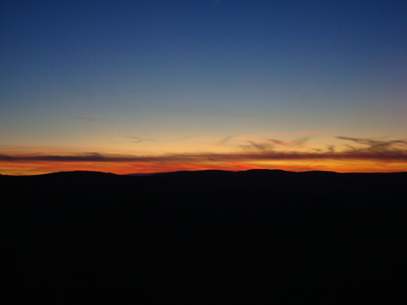
Finding a ledge with a decent western view, I settled in and waited in the cold wind for the sunset, which proved to be decent.
The descent went fine, until I approached Buffalo Road - where was my truck? As I reached the road, I began to wonder if it had been towed. Fortunately, I realized that somewhere I had turned off the trail and followed a logging road down to the road - a short road walk brought me back to my vehicle with a feeling of relief.
| Hike Ratings |
|
Getting To Trailhead: |
Easy |
| Destination: |
Rattlesnake Mountain |
|
Length: |
Moderate |
|
Steepness: |
Difficult |
|
Navigation: |
Easy |
|
Views: |
Excellent |
|
Crowds: |
Minimal |
|
| Hike Stats |
|
Date Hiked: |
Sunday, November 2, 2008 |
| Hike Commenced: |
3:14 PM |
| Parking Elevation: |
630' |
| Destination: |
Rattlesnake Mountain |
| Ascent Commenced: |
3:14 PM |
| Summit Reached: |
3:48 PM |
| Time Elapsed: |
00:34 |
| Trailhead Elevation: |
630' |
| Summit Elevation: |
1,594' |
| Distance: |
1.3 miles |
| Vertical Gain: |
1,294' |
|
|
| Hike Ended: |
5:34 PM |
| Hike Time Elapsed: |
02:20 |
| Hike Distance: |
2.5 miles |
| Hike Vertical Gain: |
1,329' |
|
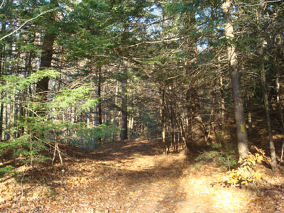
The Rattlesnake Mountain Trail trailhead on off Buffalo Road
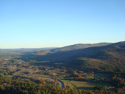
Looking east from the Rattlesnake Mountain summit
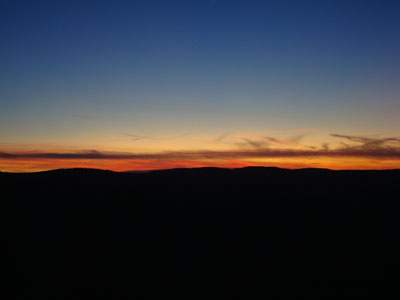
The sunset as seen from Rattlesnake Mountain
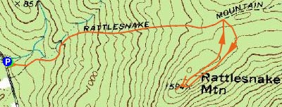

Directions to trailhead: Take Route 25 west from Plymouth, then take a right onto Main Street in Rumney. Take a left onto Buffalo Road. The Rattlesnake Mountain Trail and small parking lot will eventually be on the right, after passing two rock climbing parking areas.
Back to Rattlesnake Mountain Profile
|