Home
States
Colorado
Connecticut
Maine
Massachusetts
New Hampshire
New York
Rhode Island
Utah
Vermont
View All
Lists
NE 4,000 Footers
NE 100 Highest
NH 4,000 Footers
NH 100 Highest
NH 52 With A View
NH Belknap Range
NH Ossipee 10
Links
Trail Conditions
Trip Log
Sunrises
Sunsets
About
|
Rattlesnake Mountain
Rumney, NH
Trailheads, measurements, times, distances, and maps are all approximate and relative to the hike(s) as shown below.

The Rattlesnake Mountain Trail near the summit
Route: Rattlesnake Mountain Trail, (Rattlesnake Mountain), Rattlesnake Mountain Trail
With a cold, but nice afternoon, I decided to stay local and head over to Rattlesnake Mountain.
Starting at the tiny parking lot (plowed, but not much room for parking), I kept a somewhat brisk pace due to the single digit temperatures. Reaching the summit, there were excellent views in nearly all directions. While it was tempting to wait for the sunset, I didn't want to sit on the exposed peak for half an hour in below zero windchill temperatures (including the light winds). Thusly, I was able to make it back to the parking lot in daylight.
| Hike Ratings |
|
Getting To Trailhead: |
Easy |
| Destination: |
Rattlesnake Mountain |
|
Length: |
Moderate |
|
Steepness: |
Difficult |
|
Navigation: |
Easy |
|
Views: |
Excellent |
|
Crowds: |
Minimal |
|
| Hike Stats |
|
Date Hiked: |
Monday, January 24, 2011 |
| Hike Commenced: |
3:40 PM |
| Parking Elevation: |
630' |
| Destination: |
Rattlesnake Mountain |
| Ascent Commenced: |
3:40 PM |
| Summit Reached: |
4:12 PM |
| Time Elapsed: |
00:32 |
| Trailhead Elevation: |
630' |
| Summit Elevation: |
1,594' |
| Distance: |
1.2 miles |
| Vertical Gain: |
999' |
|
|
| Hike Ended: |
4:40 PM |
| Hike Time Elapsed: |
01:00 |
| Hike Distance: |
2.4 miles |
| Hike Vertical Gain: |
1,034' |
|

The Rattlesnake Mountain Trail trailhead on off Buffalo Road

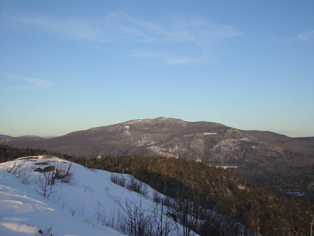
Looking at Stinson Mountain from Rattlesnake Mountain

Late day sun on the Rattlesnake Mountain Trail


Directions to trailhead: Take Route 25 west from Plymouth, then take a right onto Main Street in Rumney. Take a left onto Buffalo Road. The Rattlesnake Mountain Trail and small parking lot will eventually be on the right, after passing two rock climbing parking areas.
Back to Rattlesnake Mountain Profile
|