Home
States
Colorado
Connecticut
Maine
Massachusetts
New Hampshire
New York
Rhode Island
Utah
Vermont
View All
Lists
NE 4,000 Footers
NE 100 Highest
NH 4,000 Footers
NH 100 Highest
NH 52 With A View
NH Belknap Range
NH Ossipee 10
Links
Trail Conditions
Trip Log
Sunrises
Sunsets
About
|
Red Hill
Moultonborough, NH
Trailheads, measurements, times, distances, and maps are all approximate and relative to the hike(s) as shown below.
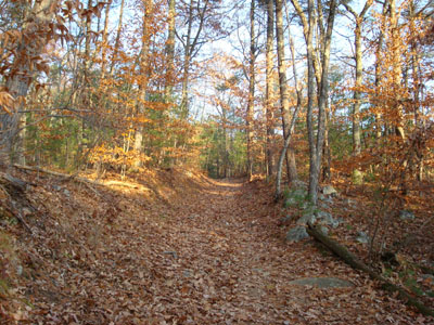
Looking up the Red Hill Trail
Route: Red Hill Trail
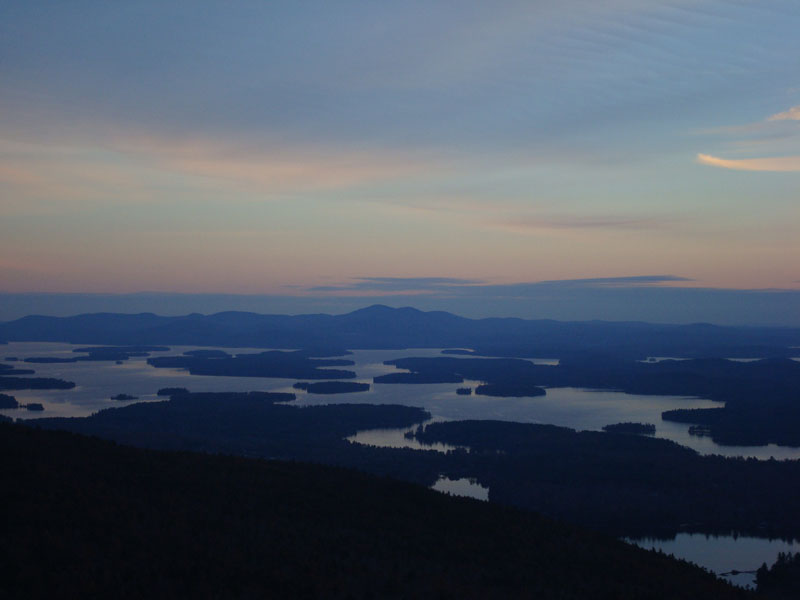
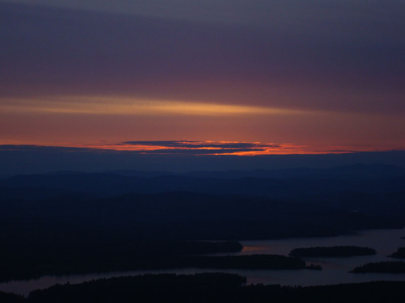
Today's sunset hike was Red Hill. As I ascended up the Red Hill Trail, I could see a thick cloud bank was overtaking the setting sun.
As I arrived on the summit, I could see that the sunset wouldn't be that great. Nonetheless, it was still a nice display from the firetower - the rays illuminated the edges of the clouds. The wind whipping up high on the fire tower made things rather cold! Nonetheless, there was no snow or ice on the summit.
| Hike Ratings |
|
Getting To Trailhead: |
Easy |
| Destination: |
Red Hill |
|
Length: |
Moderate |
|
Steepness: |
Moderate |
|
Navigation: |
Easy |
|
Views: |
Excellent |
|
Crowds: |
Minimal |
|
| Hike Stats |
|
Date Hiked: |
Monday, November 12, 2007 |
| Hike Commenced: |
3:31 PM |
| Parking Elevation: |
635' |
| Destination: |
Red Hill |
| Ascent Commenced: |
3:31 PM |
| Summit Reached: |
4:07 PM |
| Time Elapsed: |
00:36 |
| Trailhead Elevation: |
640' |
| Summit Elevation: |
2,033' |
| Distance: |
1.7 miles |
| Vertical Gain: |
1,398' |
|
|
| Hike Ended: |
5:12 PM |
| Hike Time Elapsed: |
01:41 |
| Hike Distance: |
3.4 miles |
| Hike Vertical Gain: |
1,408' |
|
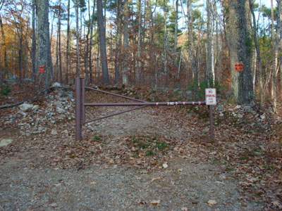
Red Hill Trail trailhead
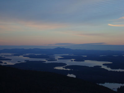
Looking southeast at Mt. Rowe and Belknap Mountain
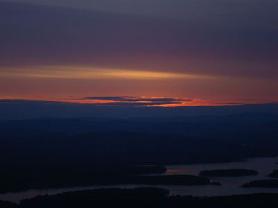
The sunset as seen from the Red Hill fire tower
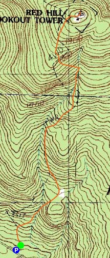

Directions to trailhead: Take Red Hill Road (also signed as Sawmill Road in some places) north from Route 25 near Center Harbor. Parking area and trailhead are on the right shortly after passing Sibley Road on the left.
Back to Red Hill Profile
|