Home
States
Colorado
Connecticut
Maine
Massachusetts
New Hampshire
New York
Rhode Island
Utah
Vermont
View All
Lists
NE 4,000 Footers
NE 100 Highest
NH 4,000 Footers
NH 100 Highest
NH 52 With A View
NH Belknap Range
NH Ossipee 10
Links
Trail Conditions
Trip Log
Sunrises
Sunsets
About
|
Smarts Mountain
Lyme, NH
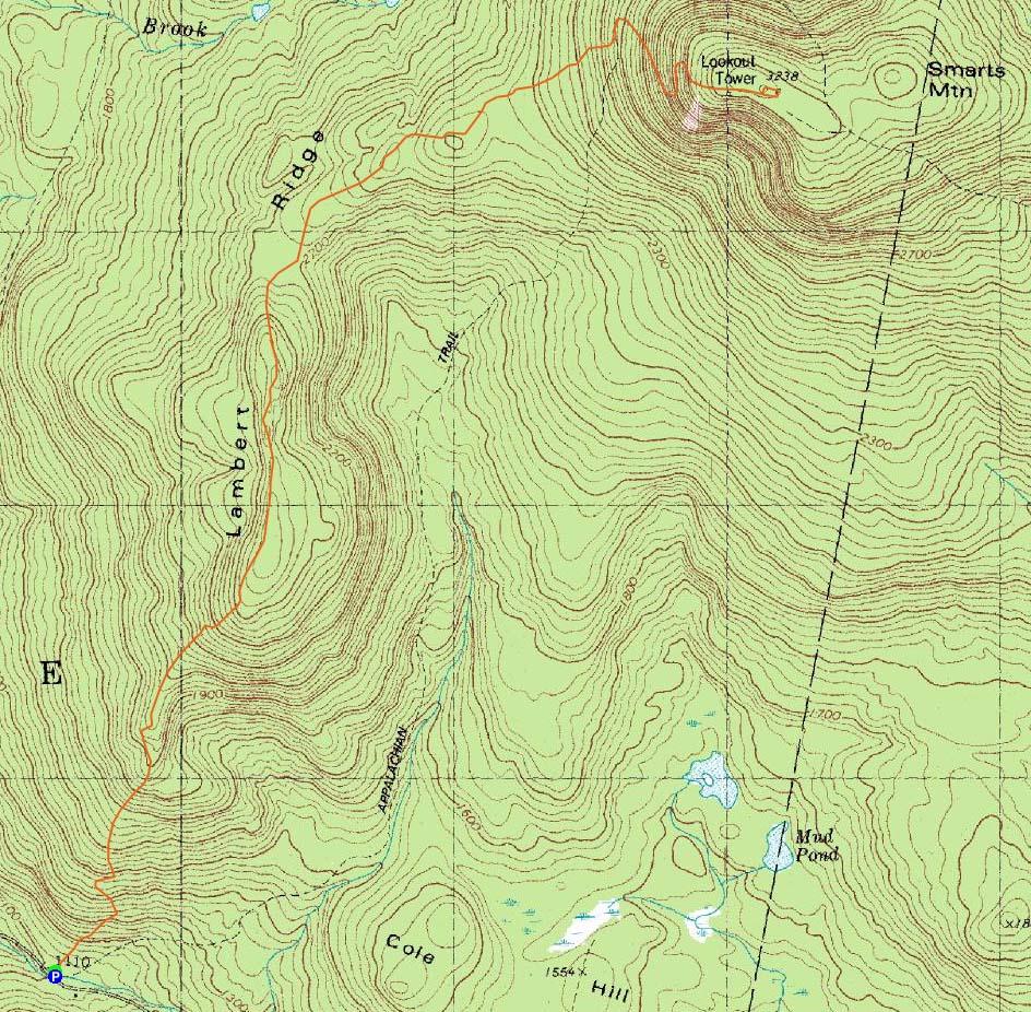
Trailheads, measurements, times, distances, and maps are all approximate and relative to the hike(s) as shown below.

Looking up the Lambert Ridge Trail
Route: Lambert Ridge Trail
After three consecutive rough four thousand footer hikes, I decided to take a lighter hike at a lower elevation. Since Smarts Mountain is a bit too long of a drive to do after work, it seemed like a decent pick for a lazy Sunday.
Arriving at a somewhat full (small) parking lot, I parking on the side of the road and was soon on my way up the Lambert Ridge Trail. While the trail was bland at first, it soon reached some very nice ledges. Though the summit was in the clouds as I ascended, I had a feeling my luck would change.
Other than some sort, steep ledgy spots, the trail was fairly gradual until it reached a wet col. Above that, it ascended at a steady pace to the Ranger Trail junction. Beyond this, I hit the first ice and snow of the day - a bit tricky in places as it was thick and on top of wet ledge.
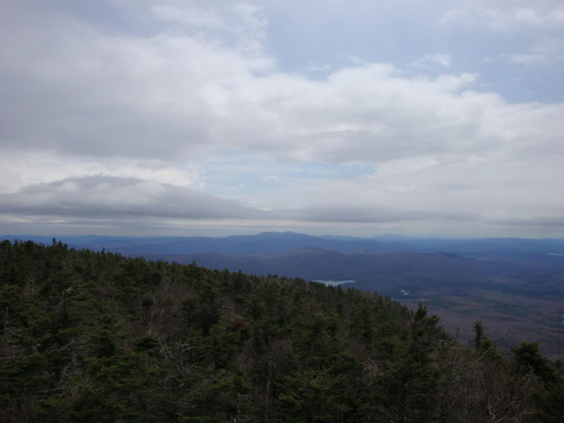
Reaching the summit fire tower, I had decent (albeit cloudy) views in all directions. Though there were low level clouds to the west, I could see fairly far in all other directions.
After spending some time chatting at the summit, as well as checking out the viewpoint near the tent site, it was time to call it a day. Though I wish I had had blue skies, it was nonetheless nice to get out without terrible trail conditions and rain.
| Hike Ratings |
|
Getting To Trailhead: |
Easy |
| Destination: |
Smarts Mountain |
|
Length: |
Moderate |
|
Steepness: |
Difficult |
|
Navigation: |
Easy |
|
Views: |
Excellent |
|
Crowds: |
Minimal |
|
| Hike Stats |
|
Date Hiked: |
Sunday, April 26, 2009 |
| Hike Commenced: |
10:09 AM |
| Parking Elevation: |
1,110' |
| Destination: |
Smarts Mountain |
| Ascent Commenced: |
10:10 AM |
| Summit Reached: |
12:06 PM |
| Time Elapsed: |
01:56 |
| Trailhead Elevation: |
1,110' |
| Summit Elevation: |
3,238' |
| Vertical Gain: |
2,498' |
|
|
| Hike Ended: |
3:28 PM |
| Hike Time Elapsed: |
05:19 |
| Hike Vertical Gain: |
2,868' |
|

The Lambert Ridge Trail trailhead

Wood sorrel along the Lambert Ridge Trail

Looking at Mt. Cardigan from the Smarts Mountain fire tower.

Directions to trailhead: From Route 25A, take Route 10 South toward Lyme. Take a left onto Dorchester Road (may also be signed as Lyme Center Road). Bear left onto a dirt road (still Dorchester Road) when the Dartmouth Skiway is visible to the right. The Lambert Ridge Trail parking area and trailhead will be a few minutes up the dirt road on the left, just before crossing a brook.
Back to Smarts Mountain Profile
|