Home
States
Colorado
Connecticut
Maine
Massachusetts
New Hampshire
New York
Rhode Island
Utah
Vermont
View All
Lists
NE 4,000 Footers
NE 100 Highest
NH 4,000 Footers
NH 100 Highest
NH 52 With A View
NH Belknap Range
NH Ossipee 10
Links
Trail Conditions
Trip Log
Sunrises
Sunsets
About
|
South Baldface, North Baldface
Chatham, NH, Bean's Purchase, NH
Trailheads, measurements, times, distances, and maps are all approximate and relative to the hike(s) as shown below.
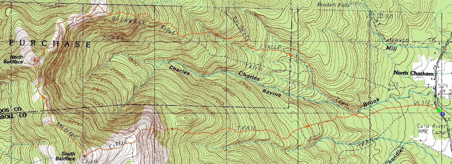
The Baldface Circle Trail to South Baldface
Route: Baldface Circle Trail, (South Baldface), Baldface Circle Trail, (North Baldface), Baldface Circle Trail, Bicknell Ridge Trail, Eagle Cascade Link, Baldface Circle Trail, Emerald Pool spur trail, (Emerald Pool), Emerald Pool spur trail, Baldface Circle Trail
A warm, but nice weather pattern moved in just in time for a Baldfaces hike.
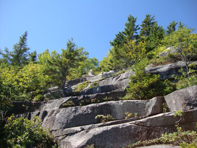
Starting at the trailhead on Route 113, we headed up the Baldface Circle Trail, taking a left onto the clockwise loop. After a break at the shelter, we headed up the hot, but dry, scramble ledges.
Reaching the Baldface Knob Trail junction, we were greeted with a nice, steady wind - very much welcome, as it was getting quite hot outside!
After taking an extended break on the summit of South Baldface, we continued over to the col and up the scramble ledges to North Baldface, where we once again had great views.
For the descent, we took the scenic Bicknell Ridge Trail, taking a left onto the Eagle Cascade Link. The cascade looked to be quite impressive in times of good runoff, however at this point it was running at just a trickle.
Once rejoining the Baldface Circle Trail, we worked out way down to the Emerald Pool, we were took an extended break in the refreshingly cold water.
| Hike Ratings |
|
Getting To Trailhead: |
Easy |
| Destination: |
South Baldface |
|
Length: |
Moderate |
|
Steepness: |
Very Difficult |
|
Navigation: |
Moderate |
|
Views: |
Excellent |
|
Crowds: |
Moderate |
| Destination: |
North Baldface |
|
Length: |
Moderate |
|
Steepness: |
Very Difficult |
|
Navigation: |
Easy |
|
Views: |
Excellent |
|
Crowds: |
Moderate |
|
| Hike Stats |
|
Date Hiked: |
Sunday, August 29, 2010 |
| Hike Commenced: |
8:57 AM |
| Parking Elevation: |
505' |
| Destination: |
South Baldface |
| Ascent Commenced: |
8:59 AM |
| Summit Reached: |
12:20 PM |
| Time Elapsed: |
03:21 |
| Trailhead Elevation: |
500' |
| Summit Elevation: |
3,570' |
| Distance: |
3.7 miles |
| Vertical Gain: |
3,130' |
| Destination: |
North Baldface |
| Ascent Commenced: |
12:45 PM |
| Summit Reached: |
1:25 PM |
| Time Elapsed: |
00:40 |
| Trailhead Elevation: |
3,570' |
| Summit Elevation: |
3,610' |
| Distance: |
1.2 miles |
| Vertical Gain: |
470' |
|
|
| Hike Ended: |
5:13 PM |
| Hike Time Elapsed: |
08:16 |
| Hike Vertical Gain: |
3,705' |
|
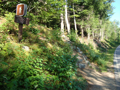
The Baldface Circle Trail trailhead on Route 113

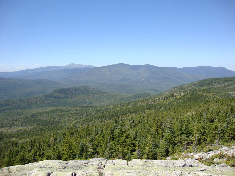
Looking at Mt. Washington and the Carters from South Baldface
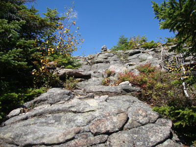
The Baldface Circle Trail to North Baldface

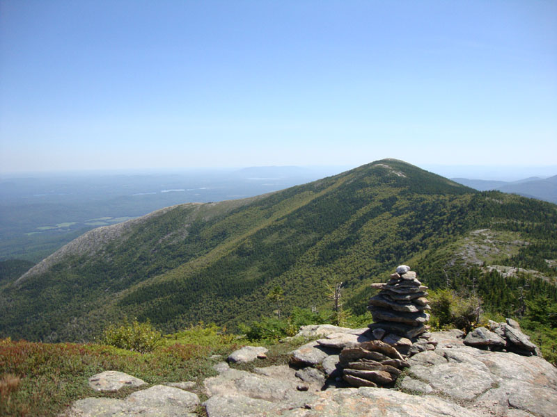
Looking at South Baldface from North Baldface
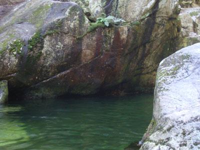
The Emerald Pool


Directions to trailhead: From US 302 in Maine, take 113 North towards Evans Notch. The Baldface parking lot is on the right side of the road. The trailhead is just north of the parking lot on 113.
Back to South Baldface Profile
Back to North Baldface Profile
|