Home
States
Colorado
Connecticut
Maine
Massachusetts
New Hampshire
New York
Rhode Island
Utah
Vermont
View All
Lists
NE 4,000 Footers
NE 100 Highest
NH 4,000 Footers
NH 100 Highest
NH 52 With A View
NH Belknap Range
NH Ossipee 10
Links
Trail Conditions
Trip Log
Sunrises
Sunsets
About
|
South Baldface, North Baldface, Eagle Crag
Chatham, NH, Bean's Purchase, NH
Trailheads, measurements, times, distances, and maps are all approximate and relative to the hike(s) as shown below.

The Baldface Circle Trail to South Baldface
Route: Baldface Circle Trail, (South Baldface), Baldface Circle Trail, (North Baldface), Baldface Circle Trail, Meader Ridge Trail, (Eagle Crag), Meader Ridge Trail, Baldface Circle Trail, Bicknell Ridge Trail, Baldface Circle Trail
We originally planned to ascend via Slippery Brook Trail, but with the conditions and no recent traffic on it (bottom appeared to be last used maybe last weekend), we opted to have some fun on technical terrain.
Trail was well packed to the shelter, but above there a mix of drifts, frozen granular, blue ice, open ledge, etc. For the initial scrambling, we opted to swing south and thread a needle up to the shoulder. Doable with Flex Alps, but a bit iffy on MSRs. No fall zones as well. Others were using crampons to get up the trail proper, but were having to take their time due to the blue ice and deep drifts (up to the blazes).
Once on the shoulder, it was hardpack and blue ice up to the junction with the trail from Baldface Knob. While we hadn't seen any traffic on the Slippery Brook Trail at its junction with Baldface Circle, there were folks who emerged from the south onto Baldface Knob whilst we were on the knoll, suggesting they took a route up from Cold River Camp or else up from the Jackson side.
Decent snowshoeing from the knoll up to the summit.
Lots of drifting and pockets of deep snow (ie spruce tree tops in a few places) between the peaks, as well as a lot of trailfinding. Steep scrambles up North Baldface were filled in, but took time to break out and ascend with care.
Initial descent off North Baldface was icy with no fall zones. Once in the scrub, the trail was hard to follow in places due to drifting and blowdowns.
Not wanting to leave treeline early on such a nice day, we continued to Eagle Crag (no sign of traffic from the north via Meader, but folks had been up the north Baldface Circle section today). We then backtracked to Bicknell Ridge and followed tracks down that (trail meanders in a few places, but otherwise was generally on target). We chose this over the Baldface Circle descent due to it not being as steep, as well as being more scenic. From there, it was a smooth snowshoe out. Some snow was getting a little moist in the sun, while other areas had slight crusts and yet other areas were still powder.
Decent weather (a few cloudy times, but no pop up snowshowers, and blue sky moved back in for the descent) with temperatures warm enough that I didn't need to wear my jacket - much appreciated after some bitterly cold bushwhacks this winter.
| Hike Ratings |
|
Getting To Trailhead: |
Easy |
| Destination: |
South Baldface |
|
Length: |
Moderate |
|
Steepness: |
Very Difficult |
|
Navigation: |
Moderate |
|
Views: |
Excellent |
|
Crowds: |
Minimal |
| Destination: |
North Baldface |
|
Length: |
Moderate |
|
Steepness: |
Very Difficult |
|
Navigation: |
Difficult |
|
Views: |
Excellent |
|
Crowds: |
Minimal |
| Destination: |
Eagle Crag |
|
Length: |
Moderate |
|
Steepness: |
Very Difficult |
|
Navigation: |
Difficult |
|
Views: |
Excellent |
|
Crowds: |
Minimal |
|
| Hike Stats |
|
Date Hiked: |
Saturday, March 7, 2015 |
| Parking Elevation: |
505' |
| Destination: |
South Baldface |
| Time Elapsed: |
02:27 |
| Trailhead Elevation: |
500' |
| Summit Elevation: |
3,570' |
| Distance: |
3.7 miles |
| Vertical Gain: |
3,130' |
| Destination: |
North Baldface |
| Time Elapsed: |
00:54 |
| Trailhead Elevation: |
3,570' |
| Summit Elevation: |
3,610' |
| Distance: |
1.2 miles |
| Vertical Gain: |
470' |
| Destination: |
Eagle Crag |
| Time Elapsed: |
01:13 |
| Trailhead Elevation: |
3,610' |
| Summit Elevation: |
3,020' |
| Distance: |
1.2 miles |
| Vertical Gain: |
260' |
|
|
| Hike Time Elapsed: |
06:54 |
| Hike Vertical Gain: |
3,965' |
|

The Baldface Circle Trail trailhead on Route 113

The Baldface Circle Trail to South Baldface

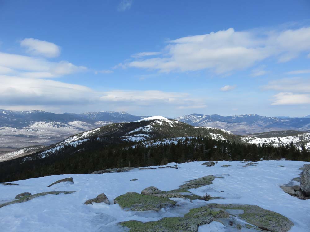
Looking at North Baldface from South Baldface

The Baldface Circle Trail to North Baldface

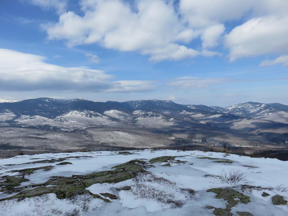
Looking at the Carter-Moriah Range from the North Baldface summit

Looking down the snowfields on the way to Eagle Crag

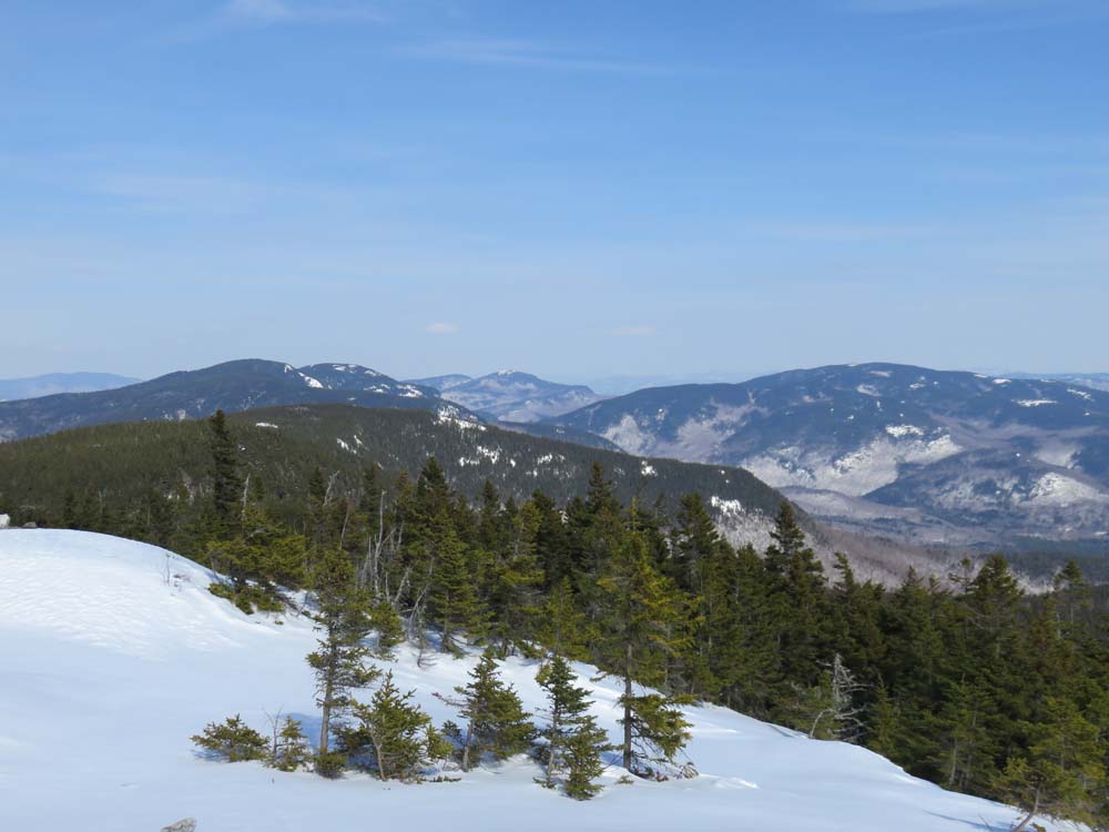
Looking at Royces, Caribou, and Speckled from Eagle Crag
Directions to trailhead: From US 302 in Maine, take 113 North towards Evans Notch. The Baldface parking lot is on the right side of the road. The trailhead is just north of the parking lot on 113.
Back to South Baldface Profile
Back to North Baldface Profile
Back to Eagle Crag Profile
|