Home
States
Colorado
Connecticut
Maine
Massachusetts
New Hampshire
New York
Rhode Island
Utah
Vermont
View All
Lists
NE 4,000 Footers
NE 100 Highest
NH 4,000 Footers
NH 100 Highest
NH 52 With A View
NH Belknap Range
NH Ossipee 10
Links
Trail Conditions
Trip Log
Sunrises
Sunsets
About
|
South Doublehead, North Doublehead
Jackson, NH
Trailheads, measurements, times, distances, and maps are all approximate and relative to the hike(s) as shown below.
Looking down the Old Path on the way to South Doublehead
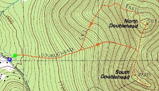
Route: Doublehead Ski Trail, Old Path, New Path, (South Doublehead), New Path, (North Doublehead), Doublehead Ski Trail
I originally planned to do something more significant on this day, however I made it back home really late from a Red Sox victory (great success!) and didn't have the energy to move around, nevermind hike, for most of the morning. Once I finally had my act together, I decided I'd try the Doubleheads in Jackson.
There was barely room to fit into the tiny parking lot, however I was able to squeeze in. The trail started off rather mildly - a bit grown in with weeds, but not hard at all to follow - before the junction of the Old Path. Wanting a direct hike, I took the Old Path up to the col. The path certainly has an 'old' feeling to it at the beginning - eroded, blowdowns, etc. It gets rather steep in places too - nothing dangerous, but certainly enough to work up a sweat.
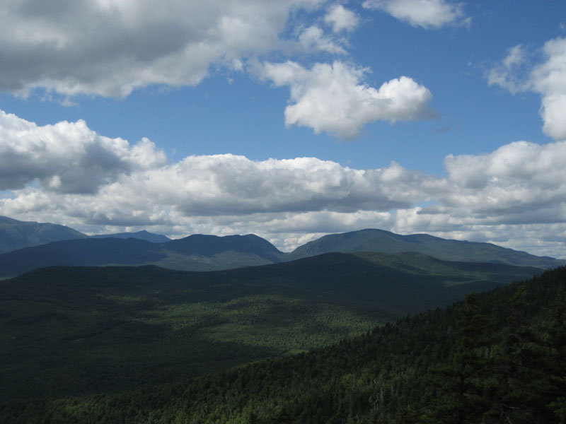
At the col, I took a right and headed to South Doublehead. The first view ledge is great - looking at the Presidentials, Jackson, and Black Mountain ski area. I suspect the high ground above this ledge is the high point - it's labelled as such on the maps.
Continuing past this area and past the New Path junction, a second peak is reached - this one marked with a tall cairn. Though this does seem close in elevation to the first one, looking out toward it from the first makes me think its a few feet lower.
Just a bit past this is another peak, marked with multiple cairns. I feel this is the lowest of the three peaks - by a good 10 feet at least. The views here, though, are great - looking into Maine, up toward Evans Notch, and west (though not as intense as the west viewpoint earlier).
It was now time to head to North Doublehead - the taller of the two main peaks. The descent into the col isn't too steep, however the ascent to North Doublehead gets rather steep in places - not scrambling material, but still a work out.
The summit of North Doublehead is not as scenic as South Doublehead in my opinion. Though the cabin has a view of Mt. Washington (likely better when the leaves are down), it and the other view (into Maine) aren't quite as open and stretching as South Doublehead.
I descended down the ski trail which doesn't seem overly steep - if it were wider (and groomed obviously), it'd be an intermediate trail. It looks like a lot of fun - probably skiable with as little as a foot of snow and a pair of rock skis.
| Hike Ratings |
|
Getting To Trailhead: |
Easy |
| Destination: |
South Doublehead |
|
Length: |
Moderate |
|
Steepness: |
Difficult |
|
Navigation: |
Easy |
|
Views: |
Excellent |
|
Crowds: |
Minimal |
| Destination: |
North Doublehead |
|
Length: |
Moderate |
|
Steepness: |
Difficult |
|
Navigation: |
Easy |
|
Views: |
Excellent |
|
Crowds: |
Minimal |
|
| Hike Stats |
|
Date Hiked: |
Sunday, August 19, 2007 |
| Hike Commenced: |
2:54 PM |
| Parking Elevation: |
1,480' |
| Destination: |
South Doublehead |
| Ascent Commenced: |
2:55 PM |
| Summit Reached: |
3:39 PM |
| Time Elapsed: |
00:44 |
| Trailhead Elevation: |
1,480' |
| Summit Elevation: |
2,939' |
| Vertical Gain: |
1,459' |
| Destination: |
North Doublehead |
| Ascent Commenced: |
3:54 PM |
| Summit Reached: |
4:12 PM |
| Time Elapsed: |
00:18 |
| Trailhead Elevation: |
2,939' |
| Summit Elevation: |
3,053' |
| Vertical Gain: |
353' |
|
|
| Hike Ended: |
5:08 PM |
| Hike Time Elapsed: |
02:13 |
| Hike Vertical Gain: |
1,917' |
|
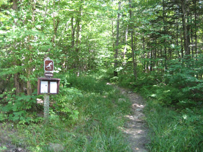
The Doublehead Ski Trail trailhead
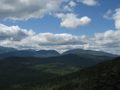
Looking north toward the Wildcats and Carters from the ledge near the South Doublehead summit
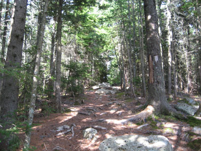
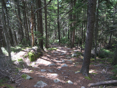
The New Path to North Doublehead
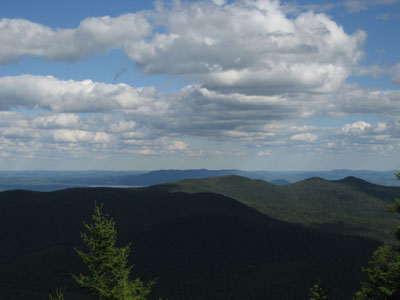
Looking southeast at Pleasant Mountain from the ledge near the North Doublehead summit
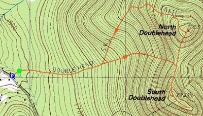

Directions to trailhead: Take Route 16 North to Jackson, then take 16A past Black Mountain Ski Area. Just after the ski area, take a right onto Dundee Road. A small parking lot and the trailhead are both located on the left side of the road, on a private drive (the trailhead is a few hundred feet down the private drive on the right).
Back to South Doublehead Profile
Back to North Doublehead Profile
|