Home
States
Colorado
Connecticut
Maine
Massachusetts
New Hampshire
New York
Rhode Island
Utah
Vermont
View All
Lists
NE 4,000 Footers
NE 100 Highest
NH 4,000 Footers
NH 100 Highest
NH 52 With A View
NH Belknap Range
NH Ossipee 10
Links
Trail Conditions
Trip Log
Sunrises
Sunsets
About
|
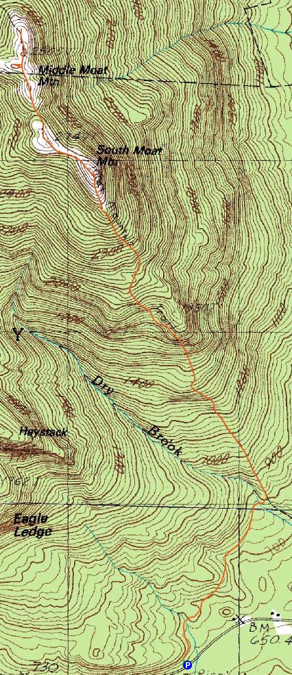
South Moat Mountain, Middle Moat Mountain
Albany, NH, Hale's Location, NH, Barlett, NH
Trailheads, measurements, times, distances, and maps are all approximate and relative to the hike(s) as shown below.
Moat Mountain Trail near South Moat Mountain
It was finally time for some Moats!
My intent was to just do South Moat Mountain. I arrived at the trailhead just before 4 - it seemed a bit further down the road than I had anticipated (come to find out, it has indeed been relocated, with this new area apparently being about half a mile further down the road).
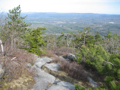
The beginning of the trail is a series of up and downs, as it traverses back toward the original path. Once there, things steepen up, as exposed rock becomes more and more common.
The trail markings weren't great - the new part of the trail was easily enough to follow due to the obvious excavation, however thereafter, the blazes are rather faded.
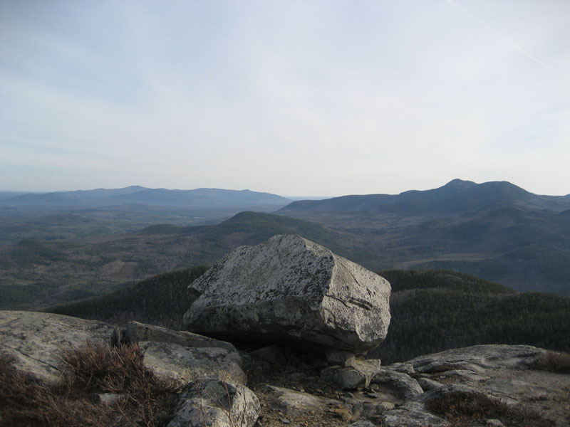
Upon arriving at the summit, I was greeted with views in all directions - Mt. Chocorua, Pleasant Mountain, Mt. Kearsarge North, and Mt. Washington were all easily identified.
After taking in the sites at the bare summit, I decided to continue down the ridge toward Middle Moat Mountain.
The walk started off above treeline, however it quickly dipped into a gully filled with blowdowns. I considered turning around, but in the end decided to make my own trail and pushed through to the other side and back above treeline.
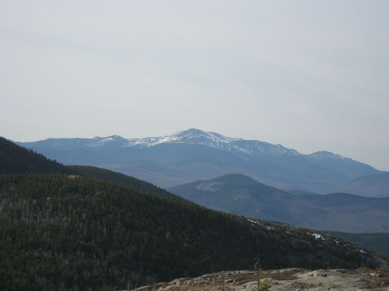
There are a few random peaks, however the actual Middle Moat Mountain peak is just above a flat shelf. The views from here were also rather neat - similar views as Moat Mountain, but with a slightly different angle.
On my way back, I paused just north of South Moat Mountain to look at the view. Big mistake. I almost instantly felt discomfort in the knee I hurt popping out of a boot slide on Mt. Moosilauke two days earlier. This made for a rather slow descent.
There's discomfort whenever it's straightened out or whenever there's weight put on it. Due to my previous dealings, I've decided to take it easy for awhile and hopefully let this heal. We shall see!
| Hike Ratings |
|
Getting To Trailhead: |
Easy |
| Destination: |
South Moat Mountain |
|
Length: |
Moderate |
|
Steepness: |
Difficult |
|
Navigation: |
Moderate |
|
Views: |
Excellent |
|
Crowds: |
Minimal |
| Destination: |
Middle Moat Mountain |
|
Length: |
Moderate |
|
Steepness: |
Moderate |
|
Navigation: |
Difficult |
|
Views: |
Excellent |
|
Crowds: |
Minimal |
|
| Hike Stats |
|
Date Hiked: |
Monday, May 7, 2007 |
| Hike Commenced: |
3:54 PM |
| Parking Elevation: |
650' |
| Destination: |
South Moat Mountain |
| Ascent Commenced: |
3:54 PM |
| Summit Reached: |
5:06 PM |
| Time Elapsed: |
01:12 |
| Trailhead Elevation: |
650' |
| Summit Elevation: |
2,770' |
| Distance: |
2.7 miles |
| Vertical Gain: |
2,235' |
| Destination: |
Middle Moat Mountain |
| Ascent Commenced: |
5:10 PM |
| Summit Reached: |
5:29 PM |
| Time Elapsed: |
00:19 |
| Trailhead Elevation: |
2,770' |
| Summit Elevation: |
2,805' |
| Vertical Gain: |
205' |
|
|
| Hike Ended: |
7:30 PM |
| Hike Time Elapsed: |
03:36 |
| Hike Vertical Gain: |
2,775' |
|
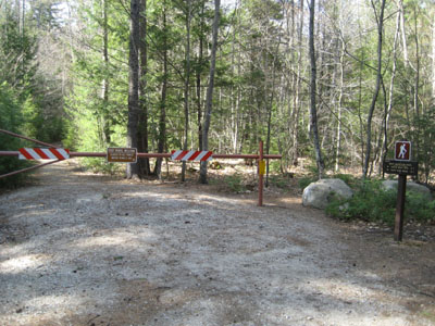
Moat Mountain Trail trailhead
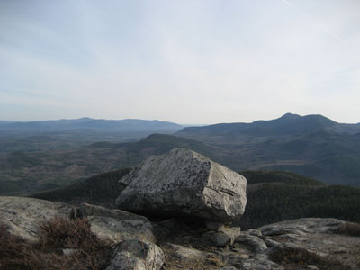
Looking south from South Moat Mountain at Mount Chocorua
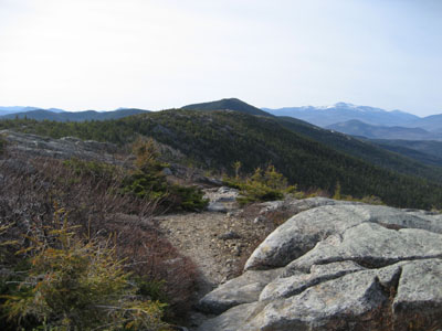
Moat Mountain Trail to Middle Moat Mountain
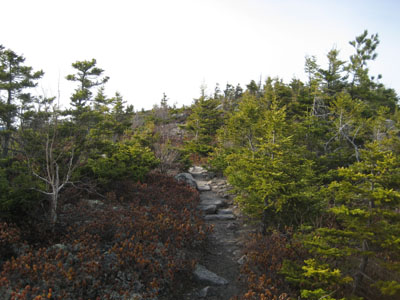
Moat Mountain Trail to Middle Moat Mountain
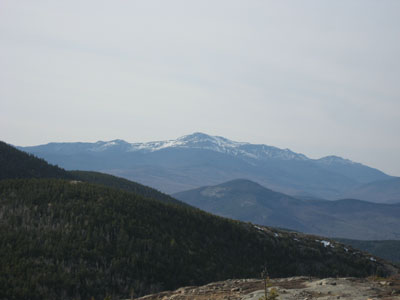
Looking north at Mt. Washington from Middle Moat Mountain
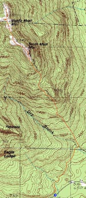

Directions to trailhead: Take Route 16 North into Conway. Take a left at the first set of downtown lights onto West Side Road. Soon after, take a left onto Passaconaway Road. A few minutes down the road, the Moat Mountain Trail trailhead and WMNF fee parking area will be on the right. If you pass the picnic area on your left, you've gone just a little bit too far.
Back to South Moat Mountain Profile
Back to Middle Moat Mountain Profile
|