Home
States
Colorado
Connecticut
Maine
Massachusetts
New Hampshire
New York
Rhode Island
Utah
Vermont
View All
Lists
NE 4,000 Footers
NE 100 Highest
NH 4,000 Footers
NH 100 Highest
NH 52 With A View
NH Belknap Range
NH Ossipee 10
Links
Trail Conditions
Trip Log
Sunrises
Sunsets
About
|
South Moat Mountain
Albany, NH
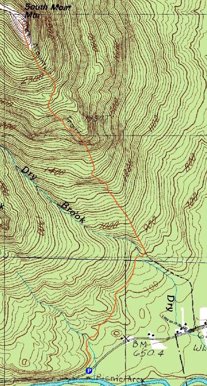
Trailheads, measurements, times, distances, and maps are all approximate and relative to the hike(s) as shown below.
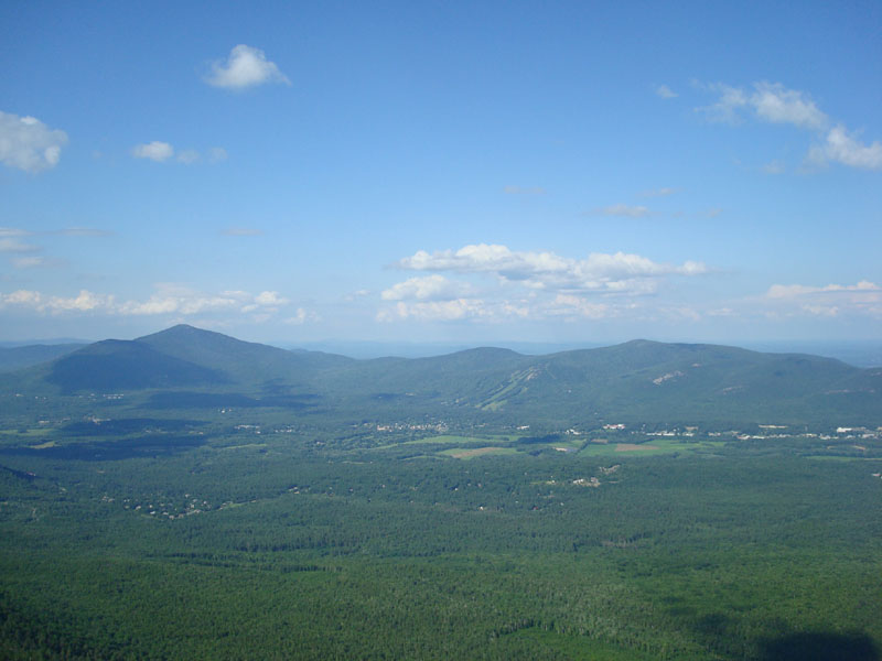
Looking down the Moat Mountain Trail
Route: Moat Mountain Trail
Though the weather forecast didn't look optimistic, I still decided to take my chances above treeline on South Moat on a hot, humid day.
I was surprised how different the first part of the trail looked - every other time I had been up this portion in the past had been in winter/spring months. All things considered, this reroute is a bit nicer with leaves on the trees.
I found the lower ledges to be a bit tricky, as the recent rain and the humidity resulted in wet rocks. Up higher, things were fortunately dry.
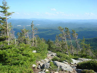
Though hazy and a little bit cloudy, the views from the top were nonetheless decent. While Mt. Washington was in the clouds, points to the east were still quite scenic.
The descent wasn't particularly notable, although I did have to proceed with caution down the wet lower ledges. While they weren't out when I started, there were a few skeeters biting toward the end of the trail (there were also a few black flies at the summit, but I was able to get by without putting on DEET).
| Hike Ratings |
|
Getting To Trailhead: |
Easy |
| Destination: |
South Moat Mountain |
|
Length: |
Moderate |
|
Steepness: |
Difficult |
|
Navigation: |
Moderate |
|
Views: |
Excellent |
|
Crowds: |
Minimal |
|
| Hike Stats |
|
Date Hiked: |
Monday, June 30, 2008 |
| Hike Commenced: |
3:36 PM |
| Parking Elevation: |
650' |
| Destination: |
South Moat Mountain |
| Ascent Commenced: |
3:36 PM |
| Summit Reached: |
4:54 PM |
| Time Elapsed: |
01:18 |
| Trailhead Elevation: |
650' |
| Summit Elevation: |
2,770' |
| Distance: |
2.7 miles |
| Vertical Gain: |
2,235' |
|
|
| Hike Ended: |
6:29 PM |
| Hike Time Elapsed: |
02:53 |
| Hike Distance: |
5.4 miles |
| Hike Vertical Gain: |
2,350' |
|

Moat Mountain Trail trailhead

Bog laurel on the Moat Mountain Trail near the South Moat Mountain summit

Looking east northeast toward Cranmore Mountain and Kearsarge North Mountain


Directions to trailhead: Take Route 16 North into Conway. Take a left at the first set of downtown lights onto West Side Road. Soon after, take a left onto Passaconaway Road. A few minutes down the road, the Moat Mountain Trail trailhead and WMNF fee parking area will be on the right. If you pass the picnic area on your left, you've gone just a little bit too far.
Back to South Moat Mountain Profile
|