Home
States
Colorado
Connecticut
Maine
Massachusetts
New Hampshire
New York
Rhode Island
Utah
Vermont
View All
Lists
NE 4,000 Footers
NE 100 Highest
NH 4,000 Footers
NH 100 Highest
NH 52 With A View
NH Belknap Range
NH Ossipee 10
Links
Trail Conditions
Trip Log
Sunrises
Sunsets
About
|
Vose Spur
Livermore, NH
Trailheads, measurements, times, distances, and maps are all approximate and relative to the hike(s) as shown below.

Ascending the scree field on Vose Spur
Route: Sawyer River Road, Signal Ridge Trail, Carrigain Notch Trail, bushwhack, (Vose Spur), bushwhack, Carrigain Notch Trail, Signal Ridge Trail, Sawyer River Road
Quick snowshoeing on Sawyer River Road and lower Signal Ridge Trail.
Bushwhack up scree field on Vose Spur was slow going, especially above it with the steep scrambles and set up surface.
Deeming a descent via that route to be too risky, we instead descended into the col headed toward Carrigain (on the side of which there is a spectacular scree field with excellent views). Relatively smooth sailing from Vose to the col. Occasional pockets of rubbish woods below it with some open areas. Short stretch of good going on a brookbed, then we climbed up into the open woods below Vose and dropped back to the Carrigain Notch Trail.
| Hike Ratings |
|
Getting To Trailhead: |
Difficult |
| Destination: |
Vose Spur |
|
Length: |
Moderate |
|
Steepness: |
Very Difficult |
|
Navigation: |
Difficult |
|
Views: |
Excellent |
|
Crowds: |
Minimal |
|
| Hike Stats |
|
Date Hiked: |
Saturday, January 24, 2015 |
| Parking Elevation: |
900' |
| Time To Trailhead: |
00:40 |
| Destination: |
Vose Spur |
| Time Elapsed: |
02:58 |
| Trailhead Elevation: |
1,370' |
| Summit Elevation: |
3,862' |
| Vertical Gain: |
2,657' |
|
|
| Hike Time Elapsed: |
08:14 |
| Hike Vertical Gain: |
3,312' |
|

Signal Ridge Trail trailhead on Sawyer River Road

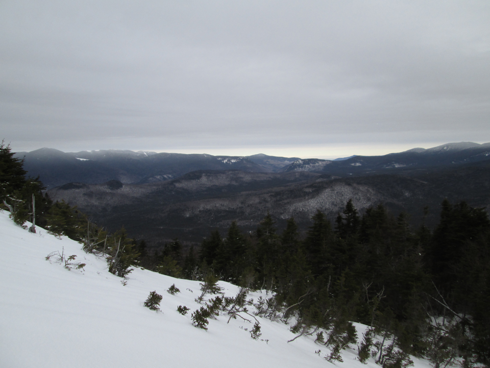
Looking at the Bonds and Willey Range from the scree field in the col adjacent to Vose Spur

Descending the brook below Signal Ridge
Directions to trailhead: Take Route 302 West from Bartlett to Sawyer River Road. In winter, there is a WMNF fee parking lot located to the left of the closed Sawyer River Road. The Signal Ridge Trail is 2 miles up Sawyer River Road, on the right.
Back to Vose Spur Profile
|