Home
States
Colorado
Connecticut
Maine
Massachusetts
New Hampshire
New York
Rhode Island
Utah
Vermont
View All
Lists
NE 4,000 Footers
NE 100 Highest
NH 4,000 Footers
NH 100 Highest
NH 52 With A View
NH Belknap Range
NH Ossipee 10
Links
Trail Conditions
Trip Log
Sunrises
Sunsets
About
|
Wantastiquet Mountain, East Hill, Daniels Mountain
Chesterfield, NH, Hinsdale, NH
Trailheads, measurements, times, distances, and maps are all approximate and relative to the hike(s) as shown below.

Looking up the Wantastiquet Mountain Trail
Route: Unnamed trail, Ann Stokes Loop, Wantastiquet Mountain Trail, (Wantastiquet Mountain), Wantastiquet Mountain Trail, Ann Stokes Loop, (East Hill), Ann Stokes Loop, Daniels Mountain Loop, (Daniels Mountain), Daniels Mountain Loop, Ann Stokes Loop
Trails were mostly dry and in good shape. Didn't research this one much prior to going, so I got hosed up a little bit at the beginning, thinking I was on trail when I passed by the mansion remains. Indeed there were some unmarked trails, however they all faded out. I ended up bushwhacking down to the Ann Stokes Loop and was able to stay on trail thereafter without issue.
Good views from Wantastiquet Mountain (the Mine Loop Trail is now known as the Wantastiquet Mountain Trail; the Mine Loop spur wasn't marked, but can be found where there are brown arrow signs on the main trail).
Some very nice woods and views. This would be an excellent day hike when fall colors arrive.
| Hike Ratings |
|
Getting To Trailhead: |
Easy |
| Destination: |
Wantastiquet Mountain |
|
Length: |
Moderate |
|
Steepness: |
Difficult |
|
Navigation: |
Moderate |
|
Views: |
Excellent |
|
Crowds: |
Moderate |
| Destination: |
East Hill |
|
Length: |
Moderate |
|
Steepness: |
Difficult |
|
Navigation: |
Easy |
|
Views: |
Excellent |
|
Crowds: |
Minimal |
| Destination: |
Daniels Mountain |
|
Length: |
Moderate |
|
Steepness: |
Difficult |
|
Navigation: |
Easy |
|
Views: |
Minimal |
|
Crowds: |
Minimal |
|
| Hike Stats |
|
Date Hiked: |
Saturday, September 8, 2013 |
| Parking Elevation: |
640' |
| Destination: |
Wantastiquet Mountain |
| Time Elapsed: |
01:05 |
| Trailhead Elevation: |
640' |
| Summit Elevation: |
1,351' |
| Vertical Gain: |
861' |
| Destination: |
East Hill |
| Time Elapsed: |
00:46 |
| Trailhead Elevation: |
1,351' |
| Summit Elevation: |
1,098' |
| Vertical Gain: |
318' |
| Destination: |
Daniels Mountain |
| Time Elapsed: |
00:51 |
| Trailhead Elevation: |
1,098' |
| Summit Elevation: |
1,230' |
| Vertical Gain: |
430' |
|
|
| Hike Time Elapsed: |
03:19 |
| Hike Vertical Gain: |
1,629' |
|

The trailhead off Gulf Road

Remains of the Madame Sherri Castle near the Ann Stokes Loop Trail

Indian Pond

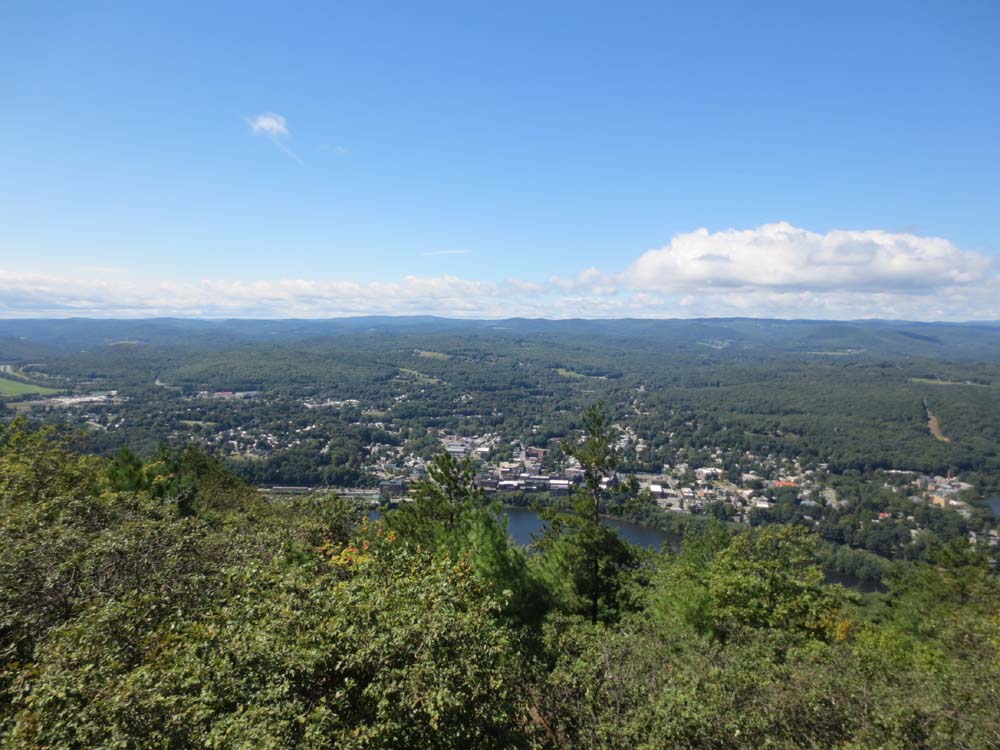
Looking toward Brattleboro from near the summit of Wantastiquet Mountain

The Ann Stokes Loop near the summit of East Hill

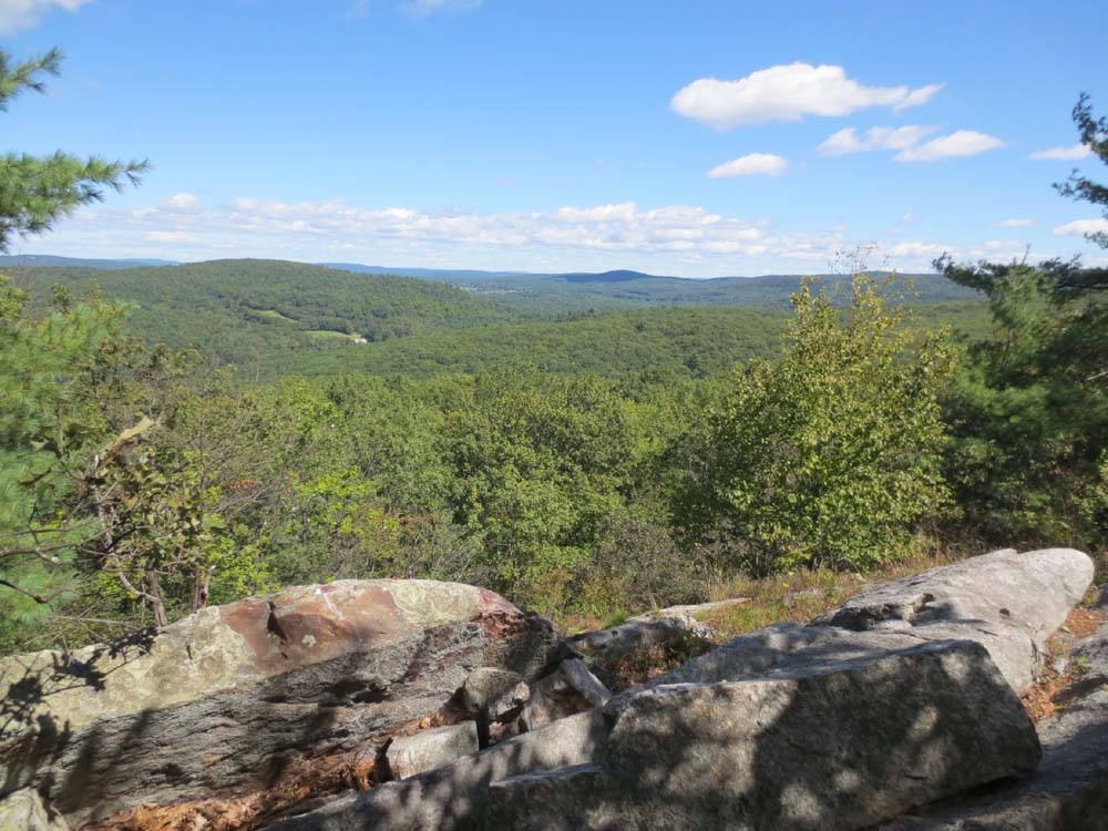
Looking northeast from East Hill

The Daniels Mountain Loop Trail

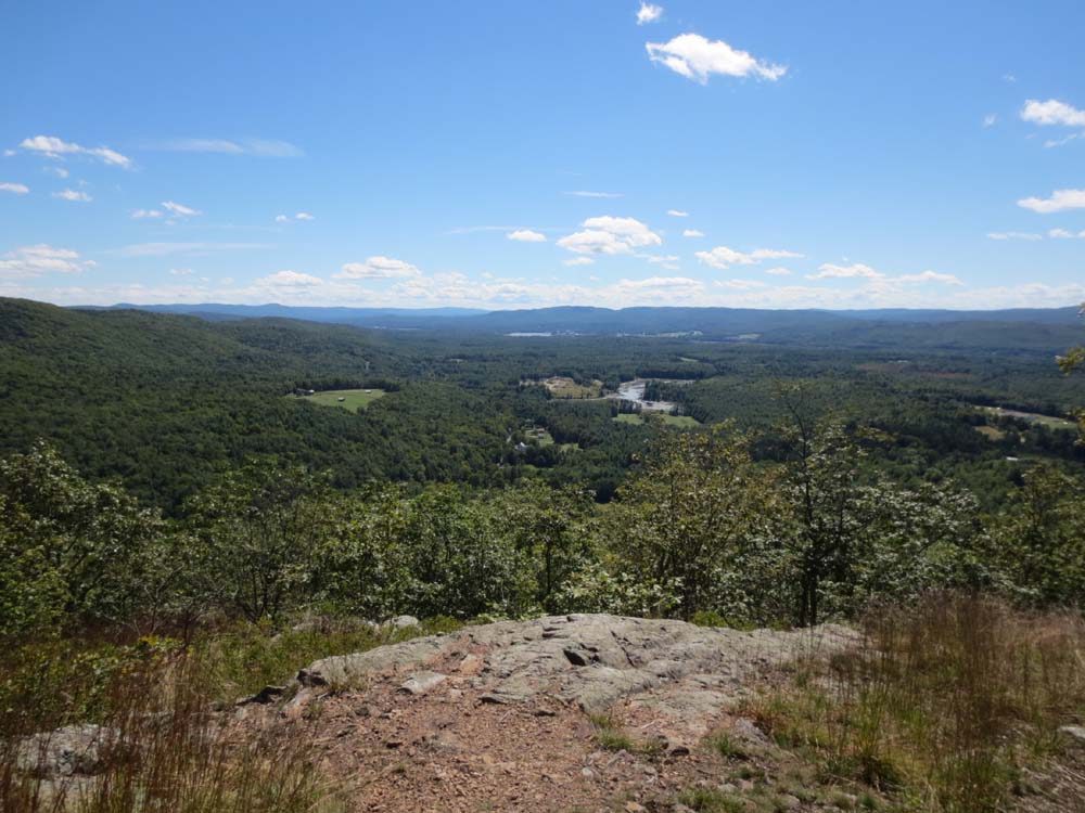
The southern ledges on Daniels Mountain


Directions to trailhead: From Brattleboro, take Route 9 East over the Connecticut River, then take a right onto Gulf Road. Shortly thereafter, take a left to stay on Gulf Road. The Madame Sherri parking area will eventually be on the right.
Back to Wantastiquet Mountain Profile
Back to East Hill Profile
Back to Daniels Mountain Profile
|