Home
States
Colorado
Connecticut
Maine
Massachusetts
New Hampshire
New York
Rhode Island
Utah
Vermont
View All
Lists
NE 4,000 Footers
NE 100 Highest
NH 4,000 Footers
NH 100 Highest
NH 52 With A View
NH Belknap Range
NH Ossipee 10
Links
Trail Conditions
Trip Log
Sunrises
Sunsets
About
|
Welch Mountain
Thornton, NH, Waterville Valley, NH
Trailheads, measurements, times, distances, and maps are all approximate and relative to the hike(s) as shown below.

Heading up the snow covered ledges below Welch Mountain
Route: Welch-Dickey Loop Trail, (Welch Mountain), Welch-Dickey Loop Trail
After hurting my hip/lower back two days earlier, I decided to try to do something a bit relaxed in nature on a nice afternoon. Though the trail was solidly packed, I opted for snowshoes for traction purposes.
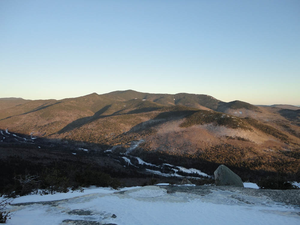
Reaching the summit of Welch, I had excellent views in all directions. I was almost half an hour early, however, so I had to wait for the sunset.
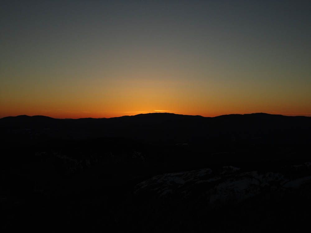
The sunset was decent, though a lack of clouds resulted in not much of a glow on the snow in the foreground of the display.
Even without much moonlight, I was able to make my way back to the parking lot without needing my headlamp.
| Hike Ratings |
|
Getting To Trailhead: |
Easy |
| Destination: |
Welch Mountain |
|
Length: |
Moderate |
|
Steepness: |
Difficult |
|
Navigation: |
Easy |
|
Views: |
Excellent |
|
Crowds: |
Minimal |
|
| Hike Stats |
|
Date Hiked: |
Wednesday, February 23, 2011 |
| Hike Commenced: |
4:19 PM |
| Parking Elevation: |
1,080' |
| Destination: |
Welch Mountain |
| Ascent Commenced: |
3:58 PM |
| Summit Reached: |
4:53 PM |
| Time Elapsed: |
00:55 |
| Trailhead Elevation: |
1,090' |
| Summit Elevation: |
2,605' |
| Distance: |
2 miles |
| Vertical Gain: |
1,545' |
|
|
| Hike Ended: |
6:23 PM |
| Hike Time Elapsed: |
02:04 |
| Hike Distance: |
4 miles |
| Hike Vertical Gain: |
1,575' |
|

The Welch-Dickey Loop Trail trailhead

Looking at Sandwich Mountain from near the Welch Mountain summit

The sunset as seen from Welch Mountain


Directions to trailhead: Take Route 49 to Six Mile Bridge - take a left there and go up the hill. Take a right onto Orris Road. National Forest pay parking lot will be on the right after a short drive.
Back to Welch Mountain Profile
|