Home
States
Colorado
Connecticut
Maine
Massachusetts
New Hampshire
New York
Rhode Island
Utah
Vermont
View All
Lists
NE 4,000 Footers
NE 100 Highest
NH 4,000 Footers
NH 100 Highest
NH 52 With A View
NH Belknap Range
NH Ossipee 10
Links
Trail Conditions
Trip Log
Sunrises
Sunsets
About
|
West Rattlesnake, East Rattlesnake
Holderness, NH, Sandwich, NH
Trailheads, measurements, times, distances, and maps are all approximate and relative to the hike(s) as shown below.
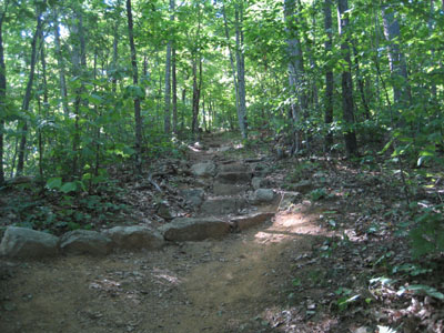
The Pasture Trail to West Rattlesnake
Route: Pasture Trail, (West Rattlesnake), Ridge Trail, (East Rattlesnake), Ridge Trail, East Rattlesnake Trail
Knowing the next few days would be rainy, I decided to go for a quick hike away from all of the Sunday traffic. As a result, I found myself heading west to the Rattlesnakes.
In keeping the hike as short as possible, I chose the most direct path two both summits as possible - taking the Pasture, Ridge, and East Rattlesnake Trails.
The Pasture Trail offers a consistently steep ascent (other than a few short switchbacks) to West Rattlesnake - not deadly, but nonetheless steep enough to work up a sweat at a decent pace.
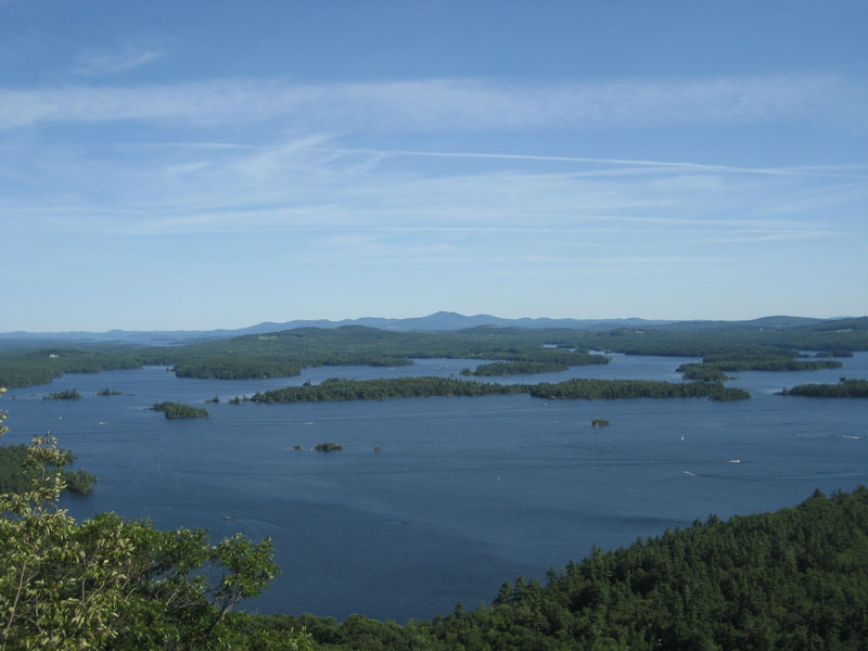
The summit ledges (the actual summit is a bit behind these) of West Rattlesnake was crowded and one can see why - the views are amazing! Ranging from the Sqaum Range to Red Hill, the deep blue of the lakes makes for awesome scenery.
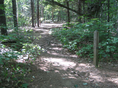
From here, I headed over to East Rattlesnake via the Ridge Trail. Moderate at best, this is a pretty easy walk. The view point is passed on the way to the wooded summit - the views, while not as wide as West Rattlesnake, are still rather nice and don't draw the crowds of its neighbor.
I descended via the somewhat steep East Rattlesnake Trail in peace - a nice way to end a Sunday afternoon.
| Hike Ratings |
|
Getting To Trailhead: |
Easy |
| Destination: |
West Rattlesnake |
|
Length: |
Easy |
|
Steepness: |
Moderate |
|
Navigation: |
Easy |
|
Views: |
Excellent |
|
Crowds: |
Heavy |
| Destination: |
East Rattlesnake |
|
Length: |
Moderate |
|
Steepness: |
Moderate |
|
Navigation: |
Easy |
|
Views: |
Excellent |
|
Crowds: |
Minimal |
|
| Hike Stats |
|
Date Hiked: |
Sunday, August 5, 2007 |
| Hike Commenced: |
3:51 PM |
| Parking Elevation: |
623' |
| Destination: |
West Rattlesnake |
| Ascent Commenced: |
3:56 PM |
| Summit Reached: |
4:09 PM |
| Time Elapsed: |
00:13 |
| Trailhead Elevation: |
720' |
| Summit Elevation: |
1,240' |
| Vertical Gain: |
530' |
| Destination: |
East Rattlesnake |
| Ascent Commenced: |
4:13 PM |
| Summit Reached: |
4:37 PM |
| Time Elapsed: |
00:24 |
| Trailhead Elevation: |
1,220' |
| Summit Elevation: |
1,289' |
| Distance: |
.8 mile |
| Vertical Gain: |
374' |
|
|
| Hike Ended: |
5:10 PM |
| Hike Time Elapsed: |
01:19 |
| Hike Vertical Gain: |
1,016' |
|
The Pasture Trail trailhead
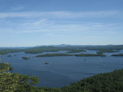
Looking southeast across Squam Lake toward the Belknap Range from West Rattlesnake
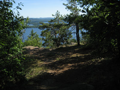
The Ridge Trail to East Rattlesnake
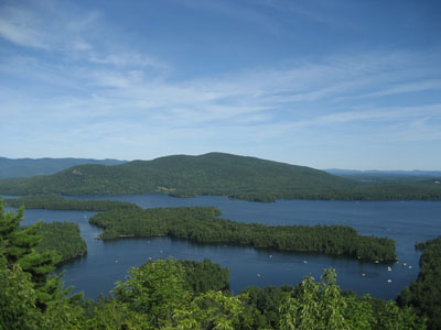
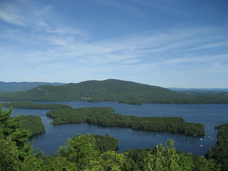
The viewpoint near the East Rattlesnake summit
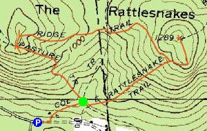

Directions to trailhead: Take Route 113 West from Center Sandwich. Shortly after the Mt. Morgan parking lot, take a left onto Pinehurst Road. Park outside the private property entranceway (don't block the road!), then follow the road up shortly, taking a left, then a right between two cabins. The Pasture Trail departs shortly thereafter on the left.
Back to West Rattlesnake Profile
Back to East Rattlesnake Profile
|