Home
States
Colorado
Connecticut
Maine
Massachusetts
New Hampshire
New York
Rhode Island
Utah
Vermont
View All
Lists
NE 4,000 Footers
NE 100 Highest
NH 4,000 Footers
NH 100 Highest
NH 52 With A View
NH Belknap Range
NH Ossipee 10
Links
Trail Conditions
Trip Log
Sunrises
Sunsets
About
|
West Rattlesnake
Holderness, NH
Trailheads, measurements, times, distances, and maps are all approximate and relative to the hike(s) as shown below.
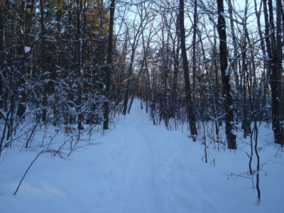
Looking up the Old Bridle Path
Route: Old Bridle Path
Though the forecasts were calling for a mostly cloudy day, I had seen nothing but blue sky out the window. As a result, I decided I would go for a sunset hike. West Rattlesnake fit the time constraint perfectly.
Arriving at the plowed Mt. Morgan parking area, I was somewhat surprised to see other vehicles there. Once at the Old Bridle Path trailhead, I could see the fresh snow from the night before had already been very well packed. While the trail was certainly barebootable, I decided to wear my snowshoes anyway, for traction and for the additional exercise. With temperatures hovering around freezing, I wore only a short sleeved shirt on the ascent and added a long sleeved shirt once I stood around on the summit ledges.
Since the Old Bridle Path is quite gradual, it's an easy snowshoe. After going to the summit, I went down to the view ledges to catch the beginning of the sunset. While not a bad sunset, it wasn't anything special, as just about the only cloud in the sky happened to be where the sun was setting. As a result of this thick, low hanging cloud, the colors weren't overly vivid. Nonetheless, it was still very nice to watch it set from such a nice, wide vista with two frozen over lakes in plain sight.
| Hike Ratings |
|
Getting To Trailhead: |
Easy |
| Destination: |
West Rattlesnake |
|
Length: |
Easy |
|
Steepness: |
Easy |
|
Navigation: |
Easy |
|
Views: |
Excellent |
|
Crowds: |
Moderate |
|
| Hike Stats |
|
Date Hiked: |
Tuesday, January 15, 2008 |
| Hike Commenced: |
3:48 PM |
| Parking Elevation: |
815' |
| Destination: |
West Rattlesnake |
| Ascent Commenced: |
3:51 PM |
| Summit Reached: |
4:11 PM |
| Time Elapsed: |
00:20 |
| Trailhead Elevation: |
800' |
| Summit Elevation: |
1,240' |
| Distance: |
.9 miles |
| Vertical Gain: |
455' |
|
|
| Hike Ended: |
5:01 PM |
| Hike Time Elapsed: |
01:13 |
| Hike Distance: |
1.8 miles |
| Hike Vertical Gain: |
485' |
|
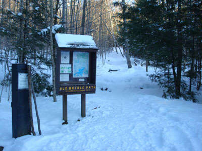
The Old Bridle Path trailhead on Route 113
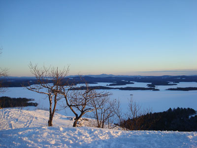
Looking southeast across Squam Lake toward the Belknap Range from West Rattlesnake
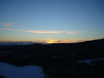
The sunset as seen from the West Rattlesnake ledges
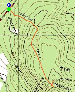

Directions to trailhead: Take Route 113 West from Center Sandwich. Shortly after the Mt. Morgan parking lot, the trailhead is on the left. Parking available in the Mt. Morgan parking lot and on the side of the road (not on pavement).
Back to West Rattlesnake Profile
|


