Home
States
Colorado
Connecticut
Maine
Massachusetts
New Hampshire
New York
Rhode Island
Utah
Vermont
View All
Lists
NE 4,000 Footers
NE 100 Highest
NH 4,000 Footers
NH 100 Highest
NH 52 With A View
NH Belknap Range
NH Ossipee 10
Links
Trail Conditions
Trip Log
Sunrises
Sunsets
About
|
West Rattlesnake
Holderness, NH
Trailheads, measurements, times, distances, and maps are all approximate and relative to the hike(s) as shown below.

Looking up the Ramsey Trail
Route: Ramsey Trail
After being ambushed by mosquitoes on my aborted attempt at hiking Mt. Paugus, I decided I wanted to still get out an enjoy the sunny morning. Not wanting to deal with mosquitoes or a long hike, I decided to try a new approach up West Rattlesnake.
Since there is no parking lot available on Pinehurst Road, I parked on the side of the road near the Ramsey Trail trailhead. I'm not sure if this is kosher, but cars could get by and I wasn't encroaching upon anyone's property.
The Ramsey Trail starts off with easy to moderate grades, before turning uphill and starting some steep ascents up some rocky ledges.
Once I reached a height of land, I was a bit confused, as there were yellow blazes going in two directions. To the left, the blazes led to a nice outlook, which I knew was a bit below the Bridle Path. Back at the junction, I took a right and quickly arrived at the upper ledges after a short, steep ascent.
After going to the high point behind the ledges, I went back and enjoyed the sights. I was lucky in that I had the ledges to myself the entire time - nearly 40 minutes! While the temperature was rising and the humidity was high, the bug free conditions and great lake views made it a way to spend a morning.
| Hike Ratings |
|
Getting To Trailhead: |
Easy |
| Destination: |
West Rattlesnake |
|
Length: |
Easy |
|
Steepness: |
Difficult |
|
Navigation: |
Moderate |
|
Views: |
Excellent |
|
Crowds: |
Minimal |
|
| Hike Stats |
|
Date Hiked: |
Sunday, June 8, 2008 |
| Hike Commenced: |
8:46 AM |
| Parking Elevation: |
640' |
| Destination: |
West Rattlesnake |
| Ascent Commenced: |
8:46 AM |
| Summit Reached: |
9:07 AM |
| Time Elapsed: |
00:21 |
| Trailhead Elevation: |
640' |
| Summit Elevation: |
1,240' |
| Distance: |
.5 mile |
| Vertical Gain: |
630' |
|
|
| Hike Ended: |
10:07 AM |
| Hike Time Elapsed: |
01:21 |
| Hike Distance: |
1 mile |
| Hike Vertical Gain: |
640' |
|

The Old Bridle Path trailhead on Route 113

A wild columbine flower at the top of West Rattlesnake

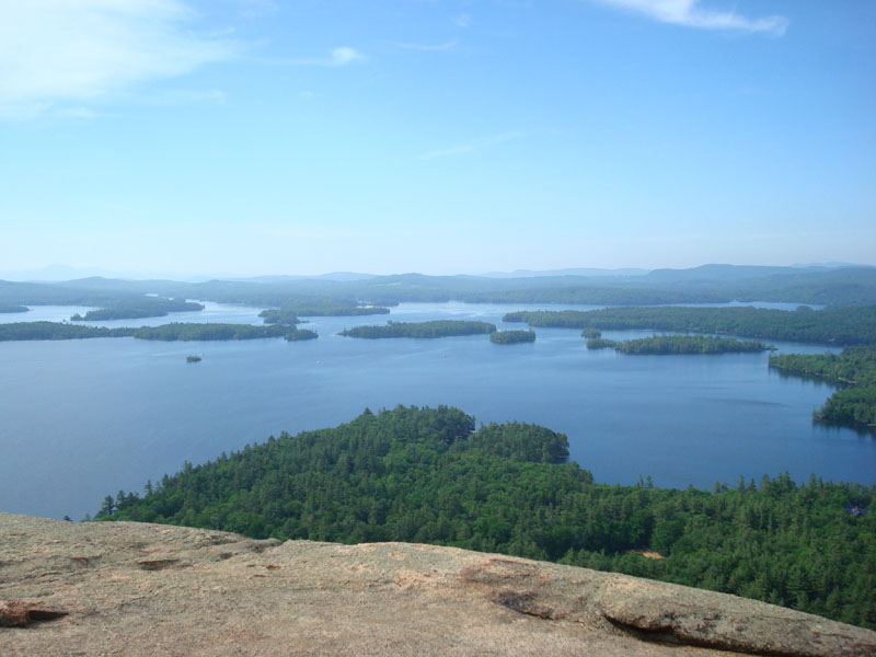
Looking at Squam Lake from West Rattlesnake


Directions to trailhead: Take Route 113 West from Center Sandwich. Shortly after the Mt. Morgan parking lot, take a left onto Pinehurst Road. The Ramsey Trail trailhead will eventually be on the left side of the road. There is no parking lot. Please respect any no parking signs.
Back to West Rattlesnake Profile
|