Home
States
Colorado
Connecticut
Maine
Massachusetts
New Hampshire
New York
Rhode Island
Utah
Vermont
View All
Lists
NE 4,000 Footers
NE 100 Highest
NH 4,000 Footers
NH 100 Highest
NH 52 With A View
NH Belknap Range
NH Ossipee 10
Links
Trail Conditions
Trip Log
Sunrises
Sunsets
About
|
West Rattlesnake
Holderness, NH, Sandwich, NH
Trailheads, measurements, times, distances, and maps are all approximate and relative to the hike(s) as shown below.
Looking up the Old Bridle Path
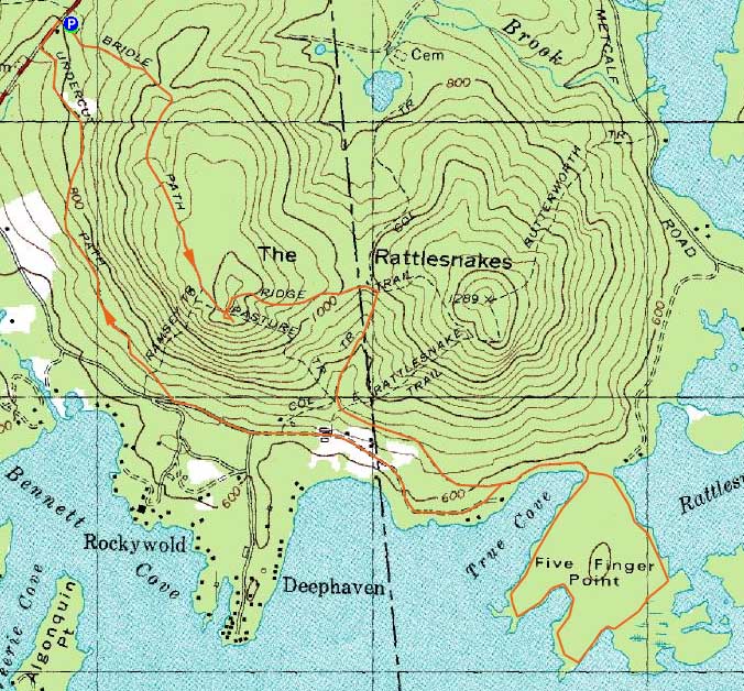
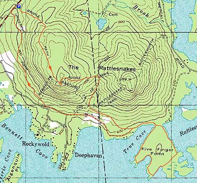
Route: Old Bridle Path, Ridge Trail, (West Rattlesnake), Ridge Trail, Col Trail, Five Finger Point Trail, roadwalk, Undercut Path
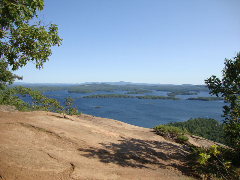
In between two days of lots of driving, I wanted a mellow day near the lake. After jogging up the crowded Old Bridle Path, I stopped at the summit of West Rattlesnake briefly. While that was originaly my only objective, wanted to check out some new-to-me trails. Thus, I continued on to the col, then down the Col Trail.
From there, I followed the Five Finger Point Trail southeast - generally mellow, though a bit rocky in a few places with some ups and downs.
Reaching the loop, I went clockwise. While it wasn't scenic at first, things changed after passing a swamp near the midpoint. From there, the western portion of the loop bumped up to the lake shore multiple times - perfect for wading in the relatively warm water.
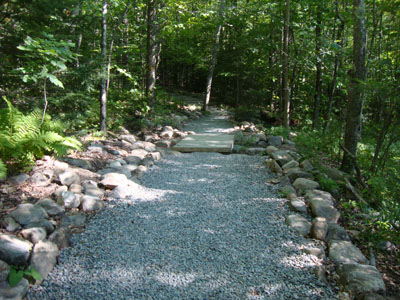
After finishing the loop, I took an unmarked trail to the paved road, then continued up to the Undercut Path. Fairly tame, it brought me back out to Route 113, a minute or two below the parking area.
| Hike Ratings |
|
Getting To Trailhead: |
Easy |
| Destination: |
West Rattlesnake |
|
Length: |
Easy |
|
Steepness: |
Easy |
|
Navigation: |
Easy |
|
Views: |
Excellent |
|
Crowds: |
Heavy |
|
| Hike Stats |
|
Date Hiked: |
Friday, August 20, 2010 |
| Hike Commenced: |
3:57 PM |
| Parking Elevation: |
815' |
| Destination: |
West Rattlesnake |
| Ascent Commenced: |
3:57 PM |
| Summit Reached: |
4:09 PM |
| Time Elapsed: |
00:12 |
| Trailhead Elevation: |
815' |
| Summit Elevation: |
1,240' |
| Distance: |
.9 miles |
| Vertical Gain: |
440' |
|
|
| Hike Ended: |
6:05 PM |
| Hike Time Elapsed: |
02:08 |
| Hike Vertical Gain: |
740' |
|
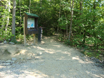
The Old Bridle Path trailhead

The Belknaps as seen over Squam Lake from the West Rattlesnake ledges
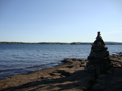
The Five Finger Point area of Squam Lake

Directions to trailhead: Take Route 113 West from Center Sandwich. The West Rattlesnake parking lot is on the left at a height of land, across from the Mt. Morgan parking area. The Old Bridle Path trailhead is located at the back of the new parking lot.
Back to West Rattlesnake Profile
|