Home
States
Colorado
Connecticut
Maine
Massachusetts
New Hampshire
New York
Rhode Island
Utah
Vermont
View All
Lists
NE 4,000 Footers
NE 100 Highest
NH 4,000 Footers
NH 100 Highest
NH 52 With A View
NH Belknap Range
NH Ossipee 10
Links
Trail Conditions
Trip Log
Sunrises
Sunsets
About
|
West Rattlesnake
Holderness, NH
Trailheads, measurements, times, distances, and maps are all approximate and relative to the hike(s) as shown below.

Looking up the Old Bridle Path
Route: Old Bridle Path
With cloudy skies and somewhat cold temperatures, I headed over to West Rattlesnake for a quick jog. While the Old Bridle Path had quite a few patches of blue ice, I was able to jog up without traction.
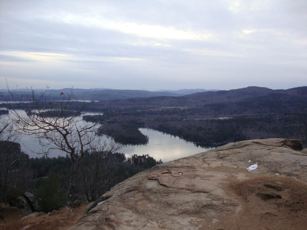
From the near-summit ledges, the views were decent. The lakes looked to be freezing over.
| Hike Ratings |
|
Getting To Trailhead: |
Easy |
| Destination: |
West Rattlesnake |
|
Length: |
Easy |
|
Steepness: |
Easy |
|
Navigation: |
Easy |
|
Views: |
Excellent |
|
Crowds: |
Minimal |
|
| Hike Stats |
|
Date Hiked: |
Friday, December 10, 2010 |
| Hike Commenced: |
3:21 PM |
| Parking Elevation: |
815' |
| Destination: |
West Rattlesnake |
| Ascent Commenced: |
3:21 PM |
| Summit Reached: |
3:32 PM |
| Time Elapsed: |
00:11 |
| Trailhead Elevation: |
815' |
| Summit Elevation: |
1,240' |
| Distance: |
.9 miles |
| Vertical Gain: |
440' |
|
|
| Hike Ended: |
3:45 PM |
| Hike Time Elapsed: |
00:24 |
| Hike Distance: |
1.8 miles |
| Hike Vertical Gain: |
455' |
|

The Old Bridle Path trailhead at the back of the parking area

Looking west from West Rattlesnake


Directions to trailhead: Take Route 113 West from Center Sandwich. The West Rattlesnake parking lot is on the left at a height of land, across from the Mt. Morgan parking area. The Old Bridle Path trailhead is located at the back of the parking lot.
Back to West Rattlesnake Profile
|