Home
States
Colorado
Connecticut
Maine
Massachusetts
New Hampshire
New York
Rhode Island
Utah
Vermont
View All
Lists
NE 4,000 Footers
NE 100 Highest
NH 4,000 Footers
NH 100 Highest
NH 52 With A View
NH Belknap Range
NH Ossipee 10
Links
Trail Conditions
Trip Log
Sunrises
Sunsets
About
|
West Rattlesnake
Holderness, NH
Trailheads, measurements, times, distances, and maps are all approximate and relative to the hike(s) as shown below.
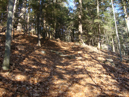
Looking up the Col Trail
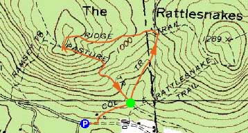
Route: Col Trail, Ridge Trail, (West Rattlesnake), Pasture Trail
While the forecast had called for an almost completely cloudy day, the skies had cleared. Thus, I decided to go for a quick lunchtime jog.
Starting on Pinehurst Road, I rolled the dice and left light traction behind. Jogging up the Col Trail, I encountered very little ice. After the somewhat steep climb to the col between the Rattlesnakes, I continued up the Ridge Trail to the West Rattlesnake summit, then over to the view ledges.
With blue skies the views were quite nice. In the distance, I could see the Ossipees were covered in either ice or snow in the higher elevations.
For the descent, I jogged down the Pasture Trail.
| Hike Ratings |
|
Getting To Trailhead: |
Easy |
| Destination: |
West Rattlesnake |
|
Length: |
Easy |
|
Steepness: |
Moderate |
|
Navigation: |
Easy |
|
Views: |
Excellent |
|
Crowds: |
Minimal |
|
| Hike Stats |
|
Date Hiked: |
Tuesday, December 14, 2010 |
| Hike Commenced: |
12:39 PM |
| Parking Elevation: |
623' |
| Destination: |
West Rattlesnake |
| Ascent Commenced: |
12:42 PM |
| Summit Reached: |
12:53 PM |
| Time Elapsed: |
00:11 |
| Trailhead Elevation: |
720' |
| Summit Elevation: |
1,240' |
| Vertical Gain: |
530' |
|
|
| Hike Ended: |
1:06 PM |
| Hike Time Elapsed: |
00:27 |
| Hike Vertical Gain: |
657' |
|

The Col Trail trailhead

Looking at Red Hill and, behind it, the white Ossipee Range, from the West Rattlesnake ledges

Directions to trailhead: Take Route 113 West from Center Sandwich. Shortly after the Mt. Morgan parking lot, take a left onto Pinehurst Road. Park outside the private property entranceway (don't block the road!), then follow the road up shortly, taking a left, then a right between two cabins. The Col Trail sign will be a minute or two up the path.
Back to West Rattlesnake Profile
|

