Home
States
Colorado
Connecticut
Maine
Massachusetts
New Hampshire
New York
Rhode Island
Utah
Vermont
View All
Lists
NE 4,000 Footers
NE 100 Highest
NH 4,000 Footers
NH 100 Highest
NH 52 With A View
NH Belknap Range
NH Ossipee 10
Links
Trail Conditions
Trip Log
Sunrises
Sunsets
About
|
Whiteface Mountain
Wolfeboro, NH
Trailheads, measurements, times, distances, and maps are all approximate and relative to the hike(s) as shown below.
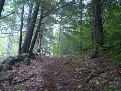
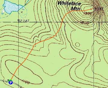
The trail to Whiteface Mountain
Route: Unknown trail
With a great forecast (clear and sunny), I decided to do a quick, new-to-me, local hike. Arriving at the trailhead, the skies were mostly cloudy.
The first part of the trail was basically a descent down an old road which passed numerous stonewalls and cellar holes in the woods. I proceeded straight through the first intersection, then took a right at the second junction onto a blazed trail (various old blazes, ranging from red to white).
The trail lollygagged around for a bit, before reaching a lowpoint while paralleling stonewall. Thereafter, the trail ascended somewhat steeply, passing a recent logging cut and then eventually reaching the grassy summit area of Whiteface Mountain.
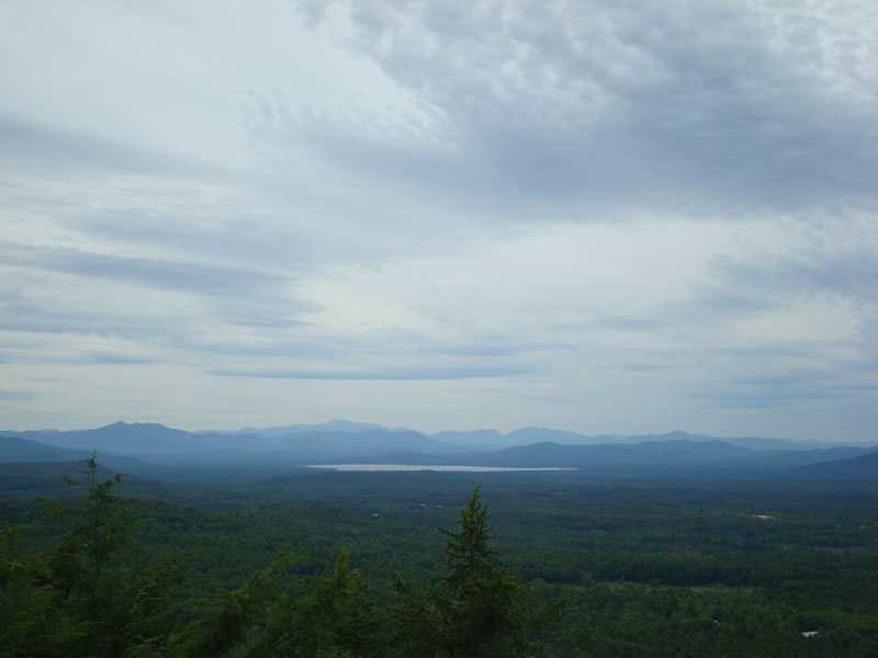
Just beyond the grassy area was the view ledge, which featured 180 degree vistas. While points to the north and east were under clouds, I could see some blue sky to the south.
The trail itself could certainly use some work - there are a lot of blowdowns (none too hard to get by) and the blazes are faded and vary in color. Nonetheless, it's a nice quick local hike.
| Hike Ratings |
|
Getting To Trailhead: |
Easy |
| Destination: |
Whiteface Mountain |
|
Length: |
Easy |
|
Steepness: |
Moderate |
|
Navigation: |
Moderate |
|
Views: |
Excellent |
|
Crowds: |
Minimal |
|
| Hike Stats |
|
Date Hiked: |
Tuesday, September 2, 2008 |
| Hike Commenced: |
4:21 PM |
| Parking Elevation: |
1,090' |
| Destination: |
Whiteface Mountain |
| Ascent Commenced: |
4:21 PM |
| Summit Reached: |
4:42 PM |
| Time Elapsed: |
00:21 |
| Trailhead Elevation: |
1,090' |
| Summit Elevation: |
1,339' |
| Vertical Gain: |
369' |
|
|
| Hike Ended: |
5:15 PM |
| Hike Time Elapsed: |
00:54 |
| Hike Vertical Gain: |
499' |
|
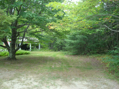
The trailhead on Cawper Road
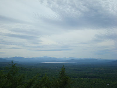
Looking north from the ledge near the Whiteface Mountain summit

Directions to trailhead: From Route 16 in Ossipee, take Route 28 south, then take a left onto North Wolfeboro Road. Go straight through an intersection onto Stoddard Road, then take a left onto Cawper Road immediately after passing a cemetary. The trailhead is to the right of a red garage near the height of land. Park on the side of Cawper Road.
Back to Whiteface Mountain Profile
|