Home
States
Colorado
Connecticut
Maine
Massachusetts
New Hampshire
New York
Rhode Island
Utah
Vermont
View All
Lists
NE 4,000 Footers
NE 100 Highest
NH 4,000 Footers
NH 100 Highest
NH 52 With A View
NH Belknap Range
NH Ossipee 10
Links
Trail Conditions
Trip Log
Sunrises
Sunsets
About
|
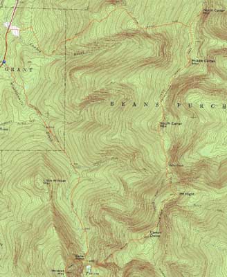
Wildcat A, Carter Dome, Mt. Hight, South Carter Mountain, Middle Carter Mountain, North Carter Mountain
Green's Grant, NH, Bean's Purchase, NH
Trailheads, measurements, times, distances, and maps are all approximate and relative to the hike(s) as shown below.
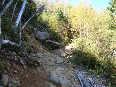
Crossing the slide on the Wildcat Ridge Trail
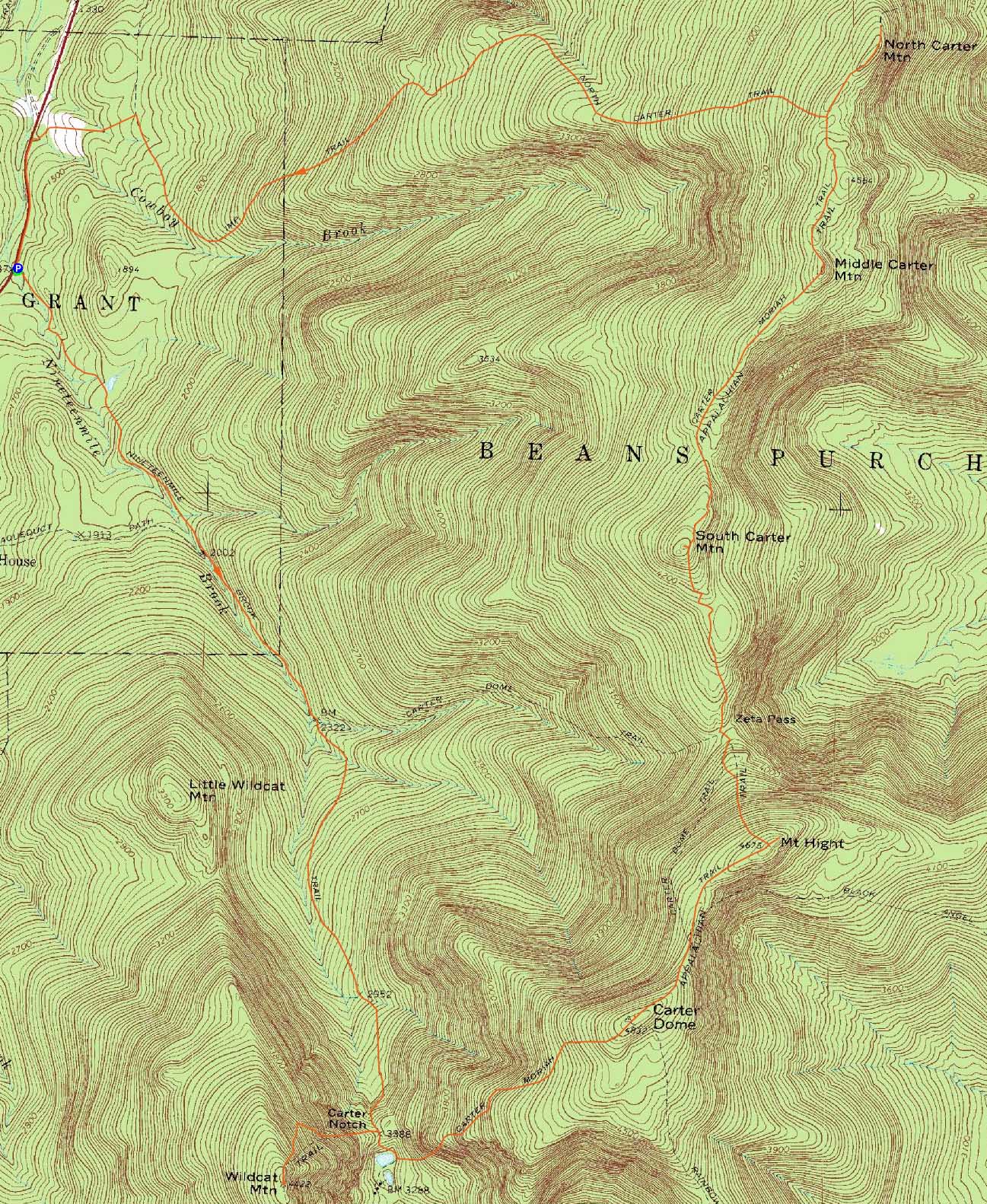
Route: Nineteen Mile Brook Trail, Wildcat Ridge Trail, (Wildcat A), Wildcat Ridge Trail, Nineteen Mile Brook Trail, Carter Moriah Trail, (Carter Dome), Carter Moriah Trail, (Mt. Hight), Carter Moriah Trail, (South Carter Mountain), Carter Moriah Trail, (Middle Carter Mountain), Carter Moriah Trail, (North Carter Mountain), Carter Moriah Trail, North Carter Trail, Imp Trail, logging road, Camp Dodge road, Route 16
Another nice, quasi-fall day - perfect for an adventageous hike plan.
Our first stop was Wildcat A. Making good time to Carter Notch, we worked our way up the steeps on the Wildcat Ridge Trail, noting the brush encroaching upon the trail. Reaching the near-summit viewpoint, we had tremendous views.
Our next stop was Carter Dome, via the very steep ascent up the Carter Moriah Trail. Reaching the summit, we had great views once again. Working our way to Mt. Hight, I backtracked to a near-summit viewpoint on the Dome - pushing about 10 feet through some scrub, I arrived in a neat talus slope with much better views than the nearby summit vista.
Back on the trail, we soon worked our way to the crowded Mt. Hight, where we had lunch whilst taking in the panoramic views. While there, I followed a herd path east to a nice ledge view.
After a break in Zeta Pass, we soon arrived on South Carter, doing the short bushwhack to the near-summit-view-ledge. After that, we worked our way along the scenic ridge to Middle Carter. Even with the afternoon light and temperatures, the views were still stunning. Reaching the North Carter Trail junction, we decided to push ahead to North Carter - a new-to-me peak. While the summit area was viewless, there was an amazing view from a ledge adjacent to it.
For the descent, we took the North Carter Trail to the Imp Trail, then cut across the logging road to Camp Dodge, finishing the day with the short roadwalk up Route 16.
| Hike Ratings |
|
Getting To Trailhead: |
Easy |
| Destination: |
Wildcat A |
|
Length: |
Moderate |
|
Steepness: |
Difficult |
|
Navigation: |
Easy |
|
Views: |
Excellent |
|
Crowds: |
Moderate |
| Destination: |
Carter Dome |
|
Length: |
Difficult |
|
Steepness: |
Difficult |
|
Navigation: |
Easy |
|
Views: |
Excellent |
|
Crowds: |
Minimal |
| Destination: |
Mt. Hight |
|
Length: |
Difficult |
|
Steepness: |
Moderate |
|
Navigation: |
Easy |
|
Views: |
Excellent |
|
Crowds: |
Heavy |
| Destination: |
South Carter Mountain |
|
Length: |
Difficult |
|
Steepness: |
Difficult |
|
Navigation: |
Easy |
|
Views: |
Excellent |
|
Crowds: |
Moderate |
| Destination: |
Middle Carter Mountain |
|
Length: |
Very Difficult |
|
Steepness: |
Difficult |
|
Navigation: |
Easy |
|
Views: |
Excellent |
|
Crowds: |
Minimal |
| Destination: |
North Carter Mountain |
|
Length: |
Very Difficult |
|
Steepness: |
Difficult |
|
Navigation: |
Easy |
|
Views: |
Excellent |
|
Crowds: |
Minimal |
|
| Hike Stats |
|
Date Hiked: |
Sunday, September 20, 2009 |
| Hike Commenced: |
8:31 AM |
| Parking Elevation: |
1,485' |
| Destination: |
Wildcat A |
| Ascent Commenced: |
8:31 AM |
| Summit Reached: |
10:39 AM |
| Time Elapsed: |
02:08 |
| Trailhead Elevation: |
1,485' |
| Summit Elevation: |
4,422' |
| Distance: |
4.3 miles |
| Vertical Gain: |
3,007' |
| Destination: |
Carter Dome |
| Ascent Commenced: |
10:43 AM |
| Summit Reached: |
12:32 PM |
| Time Elapsed: |
01:49 |
| Trailhead Elevation: |
4,422' |
| Summit Elevation: |
4,832' |
| Vertical Gain: |
1,574' |
| Destination: |
Mt. Hight |
| Ascent Commenced: |
12:40 PM |
| Summit Reached: |
1:06 PM |
| Time Elapsed: |
00:26 |
| Trailhead Elevation: |
4,832' |
| Summit Elevation: |
4,675' |
| Vertical Gain: |
165' |
| Destination: |
South Carter Mountain |
| Ascent Commenced: |
1:34 PM |
| Summit Reached: |
2:31 PM |
| Time Elapsed: |
00:57 |
| Trailhead Elevation: |
4,675' |
| Summit Elevation: |
4,430' |
| Vertical Gain: |
580' |
| Destination: |
Middle Carter Mountain |
| Ascent Commenced: |
2:34 PM |
| Summit Reached: |
3:22 PM |
| Time Elapsed: |
00:48 |
| Trailhead Elevation: |
4,430' |
| Summit Elevation: |
4,610' |
| Vertical Gain: |
595' |
| Destination: |
North Carter Mountain |
| Ascent Commenced: |
3:27 PM |
| Summit Reached: |
3:57 PM |
| Time Elapsed: |
00:30 |
| Trailhead Elevation: |
4,610 |
| Summit Elevation: |
4,530 |
| Vertical Gain: |
130' |
|
|
| Hike Ended: |
6:45 PM |
| Hike Time Elapsed: |
10:14 |
| Hike Vertical Gain: |
6,246' |
|
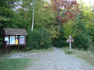
The Nineteen Mile Brook Trail trailhead off Route 16
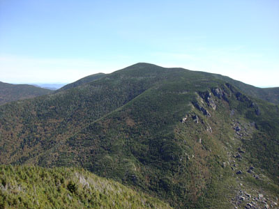
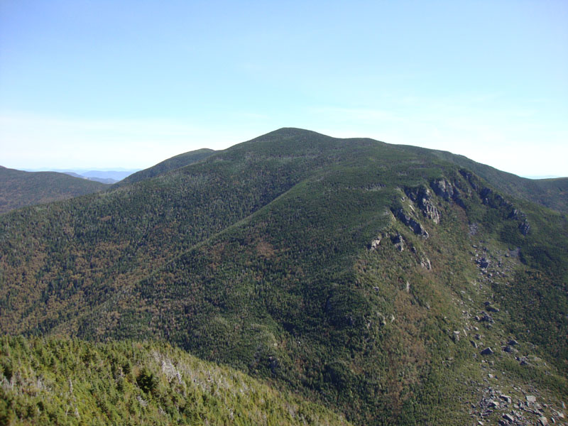
Looking Carter Dome from near the Wildcat A summit
The Carter-Moriah Trail on the way to Carter Dome
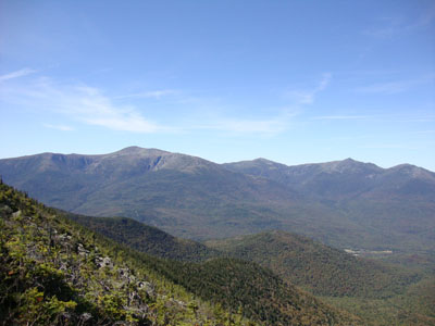
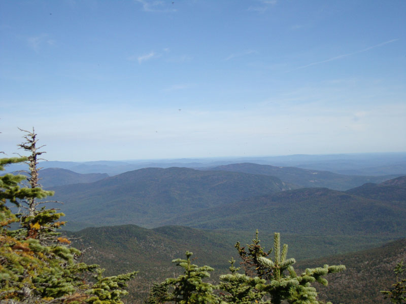
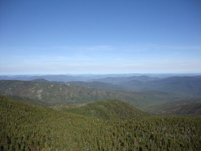
Looking at the Presidentials from near the Carter Dome summit
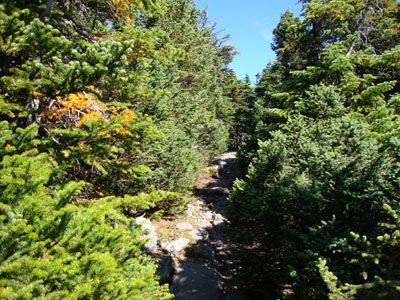
The Carter-Moriah Trail on the way to Mt. Hight
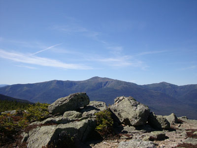
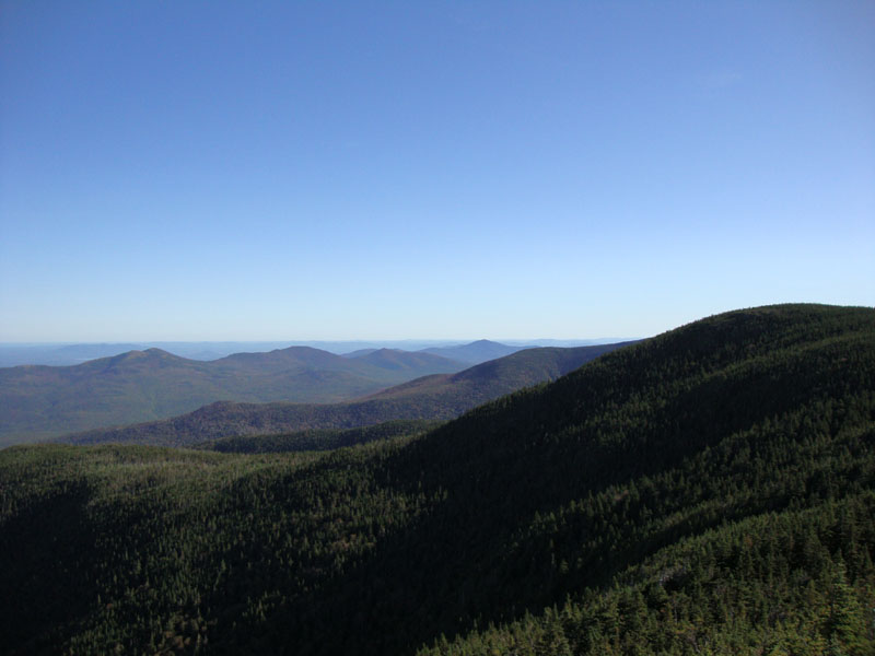
Looking at the Presidentials from Mt. Hight
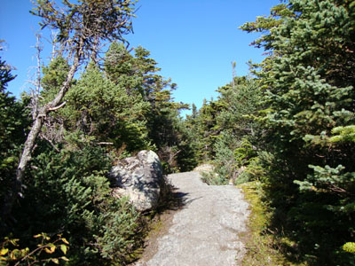
The Carter-Moriah Trail on the way to South Carter

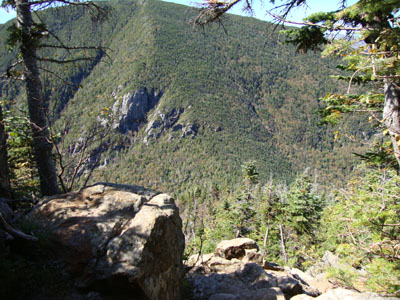
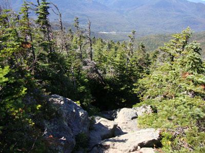
Looking at the Royces and Speckled Mountain from near the summit of South Carter
The Carter-Moriah Trail on the way to Middle Carter
Looking northeast from Middle Carter
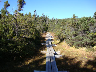
The Carter-Moriah Trail on the way to North Carter

Looking south at the Baldfaces and Kearsarge North from near the summit of North Carter

Directions to trailhead: Take Route 16 North past the Mt. Washington Auto Road entrance. Shortly thereafter, the Nineteen Mile Brook Trail WMNF fee parking area and trailhead are on the right side of the road, immediately after the brook.
Back to Wildcat A Profile
Back to Carter Dome Profile
Back to Mt. Hight Profile
Back to South Carter Profile
Back to Middle Carter Profile
Back to North Carter Profile
|