Home
States
Colorado
Connecticut
Maine
Massachusetts
New Hampshire
New York
Rhode Island
Utah
Vermont
View All
Lists
NE 4,000 Footers
NE 100 Highest
NH 4,000 Footers
NH 100 Highest
NH 52 With A View
NH Belknap Range
NH Ossipee 10
Links
Trail Conditions
Trip Log
Sunrises
Sunsets
About
|
Wildcat A, Carter Dome, Mt. Hight, South Carter Mountain, Middle Carter Mountain, North Carter Mountain
Green's Grant, NH, Bean's Purchase, NH
Trailheads, measurements, times, distances, and maps are all approximate and relative to the hike(s) as shown below.
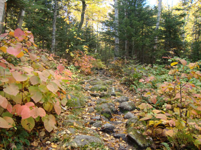
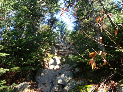
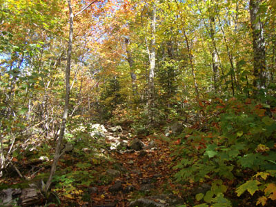
Looking up the Nineteen Mile Brook Trail on the way to Wildcat A
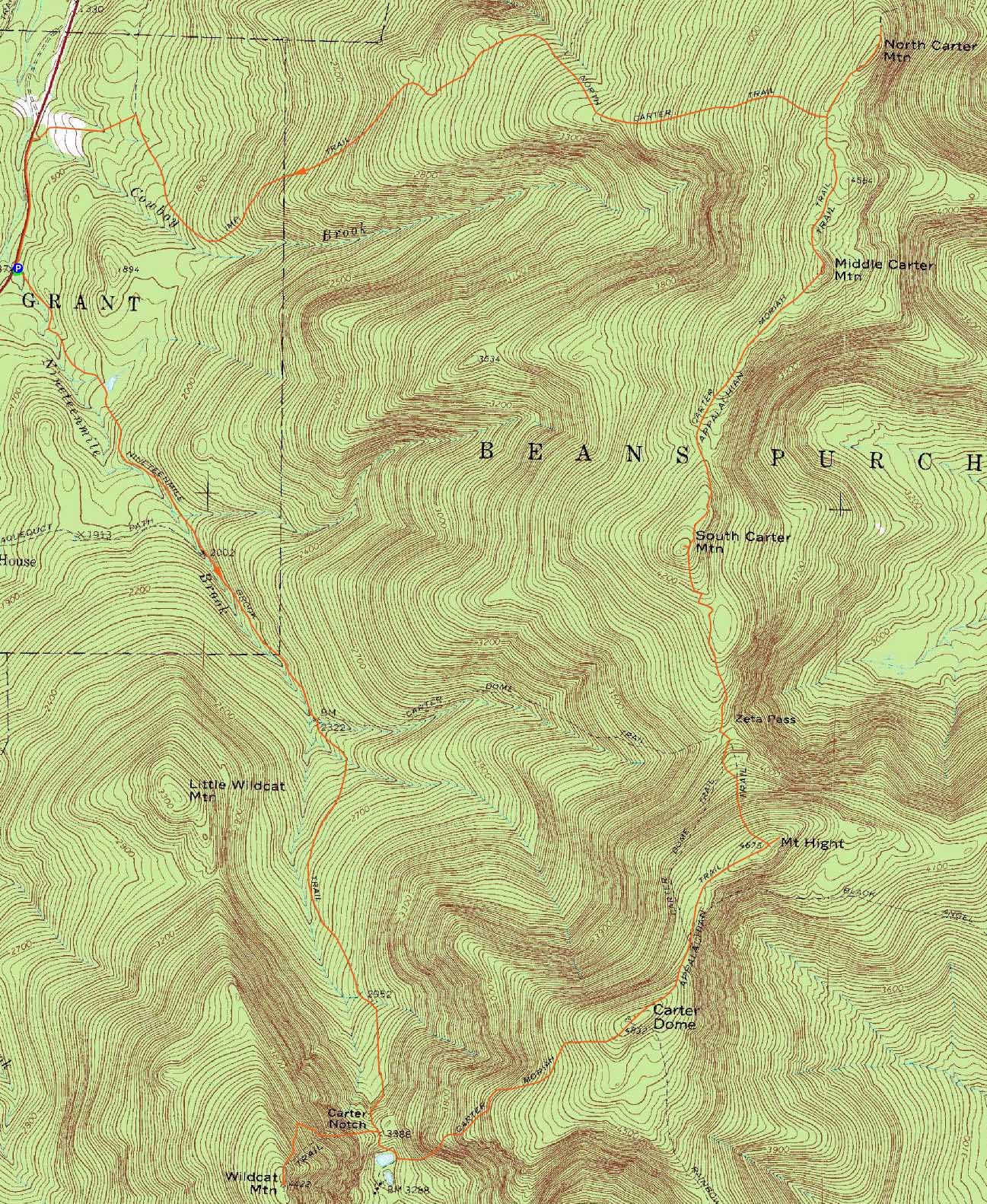
Route: Nineteen Mile Brook Trail, Wildcat Ridge Trail, (Wildcat A), Wildcat Ridge Trail, Nineteen Mile Brook Trail, Carter Moriah Trail, (Carter Dome), Carter Moriah Trail, (Mt. Hight), Carter Moriah Trail, (South Carter Mountain), Carter Moriah Trail, (Middle Carter Mountain), Carter Moriah Trail, (North Carter Mountain), Carter Moriah Trail, North Carter Trail, Imp Trail, logging road, Camp Dodge road, Route 16
While the Wildcats looked to be in the clear whilst driving up, the fog dropped down as I neared the trailhead. Nonetheless, it looked to be a nice fall day.
The walk up the Nineteen Mile Brook Trail was loud due to roaring waters from the inches of rain a day earlier. All water crossings of any significance were bridged, allowing for passage up the very wet trail. Though there wasn't much sunlight breaking through, the colors around the trail were quite nice, courtesy the fall foliage.
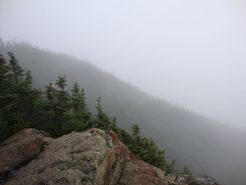
After climbing up the steep Wildcat Ridge Trail, I reached the summit of Wildcat A in the fog. A brisk wind kept things rather cool and thusly kept me moving.
Back in Carter Notch, I could see the fog was moving on. After climbing up the steeps on the Carter-Moriah, I reached essentially a brook bed - the less steep portion of the trail was not well drained with water bars and thus was rushing with water.
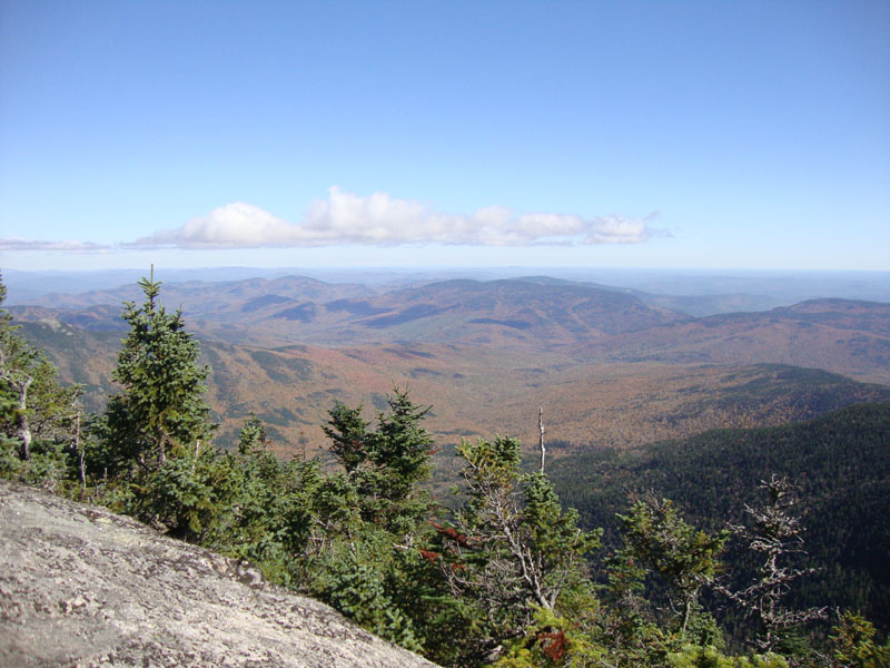
The views from Carter Dome were strong - there was still fog and clouds to the west and north, however more and more peaks were becoming visible as the day cleared.
The next stop was Mt. Hight. It took a bit of time to get around some puddles large enough to swallow a 1967 Oldsmobile Delmont, but nonetheless I was able to make it to the open summit of Mt. Hight, from which I could see excellent foliage-colored views in all directions.
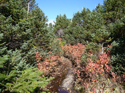
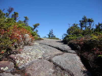
After a break on the cold summit, I dropped down to Zeta Pass and then climbed up to South Carter, briefly bushwhacking to the near-summit view ledge. Soon after, I continued along the very scenic portion of the Carter Moriah Trail to Middle Carter and then to North Carter, both summits featuring nice near-summit views of the Wild River foliage and North Carter featuring some rime ice on its trees.
Backtracking to the North Carter Trail, I worked my way down the very wet trail (another brook bed), then down the busy Imp Trail to the logging road to Camp Dodge. Near the end of Camp Dodge Road, I was treated to a fox sunning itself on a large boulder. Thereafter, it was a short walk up Route 16 back to the parking lot.
| Hike Ratings |
|
Getting To Trailhead: |
Easy |
| Destination: |
Wildcat A |
|
Length: |
Moderate |
|
Steepness: |
Difficult |
|
Navigation: |
Easy |
|
Views: |
Excellent |
|
Crowds: |
Minimal |
| Destination: |
Carter Dome |
|
Length: |
Difficult |
|
Steepness: |
Difficult |
|
Navigation: |
Easy |
|
Views: |
Excellent |
|
Crowds: |
Minimal |
| Destination: |
Mt. Hight |
|
Length: |
Difficult |
|
Steepness: |
Moderate |
|
Navigation: |
Easy |
|
Views: |
Excellent |
|
Crowds: |
Minimal |
| Destination: |
South Carter Mountain |
|
Length: |
Difficult |
|
Steepness: |
Difficult |
|
Navigation: |
Easy |
|
Views: |
Excellent |
|
Crowds: |
Heavy |
| Destination: |
Middle Carter Mountain |
|
Length: |
Very Difficult |
|
Steepness: |
Difficult |
|
Navigation: |
Easy |
|
Views: |
Excellent |
|
Crowds: |
Minimal |
| Destination: |
North Carter Mountain |
|
Length: |
Very Difficult |
|
Steepness: |
Difficult |
|
Navigation: |
Easy |
|
Views: |
Excellent |
|
Crowds: |
Minimal |
|
| Hike Stats |
|
Date Hiked: |
Saturday, October 2, 2010 |
| Hike Commenced: |
7:34 AM |
| Parking Elevation: |
1,485' |
| Destination: |
Wildcat A |
| Ascent Commenced: |
7:34 AM |
| Summit Reached: |
9:29 AM |
| Time Elapsed: |
01:55 |
| Trailhead Elevation: |
1,485' |
| Summit Elevation: |
4,422' |
| Distance: |
4.3 miles |
| Vertical Gain: |
3,007' |
| Destination: |
Carter Dome |
| Ascent Commenced: |
9:32 AM |
| Summit Reached: |
10:41 AM |
| Time Elapsed: |
01:09 |
| Trailhead Elevation: |
4,422' |
| Summit Elevation: |
4,832' |
| Vertical Gain: |
1,574' |
| Destination: |
Mt. Hight |
| Ascent Commenced: |
10:44 AM |
| Summit Reached: |
11:06 AM |
| Time Elapsed: |
00:22 |
| Trailhead Elevation: |
4,832' |
| Summit Elevation: |
4,675' |
| Vertical Gain: |
165' |
| Destination: |
South Carter Mountain |
| Ascent Commenced: |
11:31 AM |
| Summit Reached: |
12:21 PM |
| Time Elapsed: |
00:50 |
| Trailhead Elevation: |
4,675' |
| Summit Elevation: |
4,430' |
| Vertical Gain: |
580' |
| Destination: |
Middle Carter Mountain |
| Ascent Commenced: |
12:32 PM |
| Summit Reached: |
1:03 PM |
| Time Elapsed: |
00:31 |
| Trailhead Elevation: |
4,430' |
| Summit Elevation: |
4,610' |
| Vertical Gain: |
595' |
| Destination: |
North Carter Mountain |
| Ascent Commenced: |
1:05 PM |
| Summit Reached: |
1:32 PM |
| Time Elapsed: |
00:27 |
| Trailhead Elevation: |
4,610 |
| Summit Elevation: |
4,530 |
| Vertical Gain: |
130' |
|
|
| Hike Ended: |
3:28 PM |
| Hike Time Elapsed: |
7:54 |
| Hike Vertical Gain: |
6,246' |
|
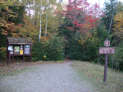
The Nineteen Mile Brook Trail trailhead off Route 16

Fog as seen from the Wildcat A vista
The Carter-Moriah Trail on the way to Carter Dome

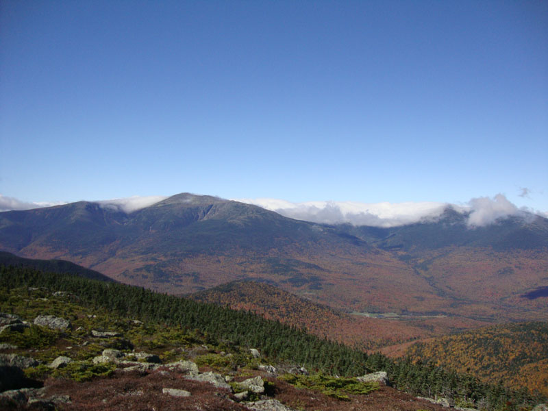
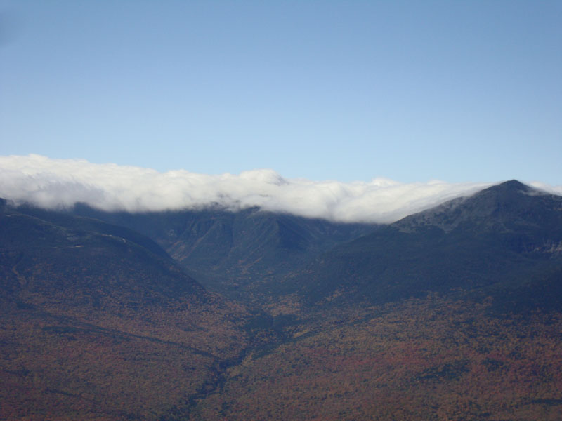
Looking at the Presidentials from near the Carter Dome summit
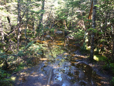
The Carter-Moriah Trail on the way to Mt. Hight

Looking at the Presidentials from Mt. Hight

Leaving Mt. Hight on the Carter-Moriah Trail en route to South Carter

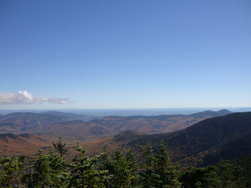
Looking into the Wild River Valley from near the summit of South Carter
The Carter-Moriah Trail on the way to Middle Carter

Looking into the Great Gulf from near the summit of Middle Carter
The Carter-Moriah Trail on the way to North Carter

Looking into the Wild River Valley from near the summit of North Carter
The Imp Trail on the way down from North Carter
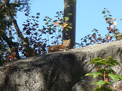
A fox hanging out near Camp Dodge


Directions to trailhead: Take Route 16 North past the Mt. Washington Auto Road entrance. Shortly thereafter, the Nineteen Mile Brook Trail WMNF fee parking area and trailhead are on the right side of the road, immediately after the brook.
Back to Wildcat A Profile
Back to Carter Dome Profile
Back to Mt. Hight Profile
Back to South Carter Profile
Back to Middle Carter Profile
Back to North Carter Profile
|