Home
States
Colorado
Connecticut
Maine
Massachusetts
New Hampshire
New York
Rhode Island
Utah
Vermont
View All
Lists
NE 4,000 Footers
NE 100 Highest
NH 4,000 Footers
NH 100 Highest
NH 52 With A View
NH Belknap Range
NH Ossipee 10
Links
Trail Conditions
Trip Log
Sunrises
Sunsets
About
|
Wildcat C, Wildcat B, Wildcat A, Wildcat D
Pinkham's Grant, NH, Bean's Grant, NH
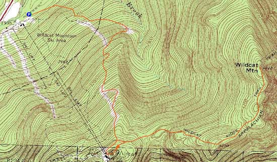
Trailheads, measurements, times, distances, and maps are all approximate and relative to the hike(s) as shown below.
Wildcat Ridge Trail to Wildcat C
Route: Stray Cat, Middle Polecat, Upper Polecat, bushwhack, Wildcat Ridge Trail, (Wildcat C), Wildcat Ridge Trail, (Wildcat B), Wildcat Ridge Trail, (Wildcat A), Wildcat Ridge Trail, (Wildcat B), Wildcat Ridge Trail, (Wildcat C), Wildcat Ridge Trail, (Wildcat D), Wildcat Ridge Trail, Upper Polecat, Middle Polecat, Stray Cat
Unlike Lincoln/Franconia Notch/Twin Mountain this morning, there was snowpack starting at the base. Maybe 3" of granular with a breakable crust in the lower elevations.
Stray Cat, Middle Polecat, and most of Upper Polecat were closed to skiers. There was a fresh snowmobile track up much of the route, making for easy snowshoeing. Upper Polecat has intense snowmaking in progress - loud and snowy.
From the top turn on Polecat, we followed the bootleg ski trail into the woods (ski area boundary sign on tree at top of steep on Polecat), then hooked around to the Wildcat Ridge Trail, bypassing D peak.
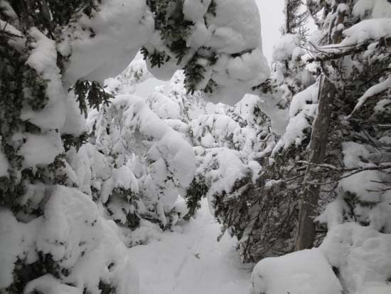
Wildcat Ridge Trail was broken out for snowshoe use, but firm from previous day's rain (breakable crust off trail). 1.5 feet to 2 feet of snowpack on the ridge. Not firm enough for booting - snowshoes were ideal. Virtually all ice was well covered by snowpack.
Day or so old tracks coming up from Carter Notch (crust on top).
| Hike Ratings |
|
Getting To Trailhead: |
Easy |
| Destination: |
Wildcat C |
|
Length: |
Moderate |
|
Steepness: |
Difficult |
|
Navigation: |
Difficult |
|
Views: |
Minimal (due to weather) |
|
Crowds: |
Minimal |
| Destination: |
Wildcat B |
|
Length: |
Difficult |
|
Steepness: |
Difficult |
|
Navigation: |
Easy |
|
Views: |
Minimal (due to weather) |
|
Crowds: |
Minimal |
| Destination: |
Wildcat A |
|
Length: |
Difficult |
|
Steepness: |
Difficult |
|
Navigation: |
Easy |
|
Views: |
Excellent |
|
Crowds: |
Minimal |
| Destination: |
Wildcat D |
|
Length: |
Moderate |
|
Steepness: |
Difficult |
|
Navigation: |
Easy |
|
Views: |
Excellent |
|
Crowds: |
Minimal |
|
| Hike Stats |
|
Date Hiked: |
Saturday, December 22, 2012 |
| Parking Elevation: |
1,960' |
| Destination: |
Wildcat C |
| Time Elapsed: |
02:16 |
| Trailhead Elevation: |
1,950' |
| Summit Elevation: |
4,285' |
| Vertical Gain: |
2,515' |
| Destination: |
Wildcat B |
| Time Elapsed: |
00:21 |
| Trailhead Elevation: |
4,285' |
| Summit Elevation: |
4,305' |
| Vertical Gain: |
195' |
| Destination: |
Wildcat A |
| Time Elapsed: |
00:12 |
| Trailhead Elevation: |
4,305' |
| Summit Elevation: |
4,422' |
| Vertical Gain: |
182' |
| Destination: |
Wildcat D |
| Time Elapsed: |
01:17 |
| Trailhead Elevation: |
4,422' |
| Summit Elevation: |
4,062' |
| Vertical Gain: |
609' |
|
|
| Hike Time Elapsed: |
05:38 |
| Hike Vertical Gain: |
3,511' |
|
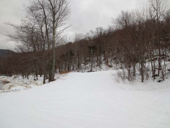
The end (beginning) of Stray Cat next to the Tomcat Triple Chairlift
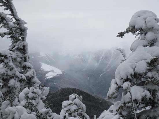
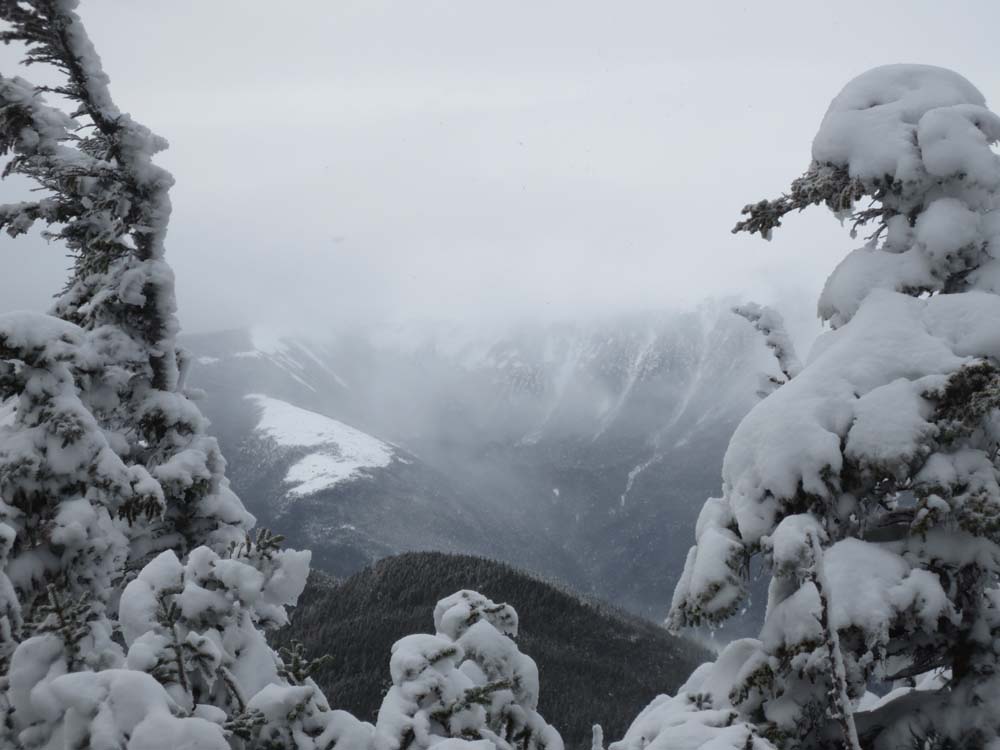
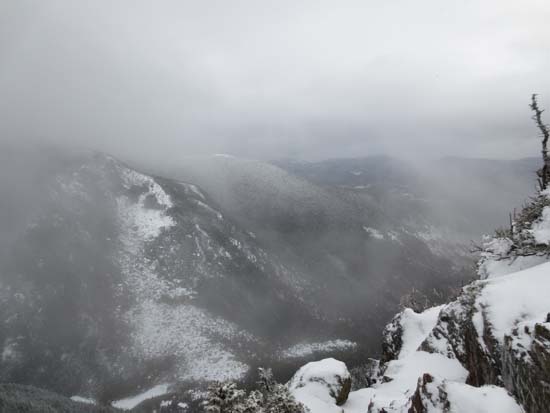
Slight views of the Presidentials as seen from near the summit of Wildcat C
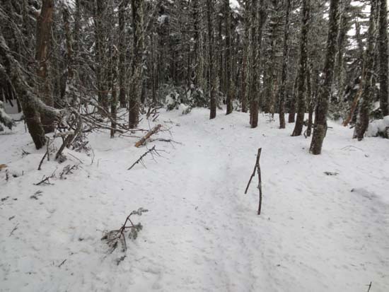
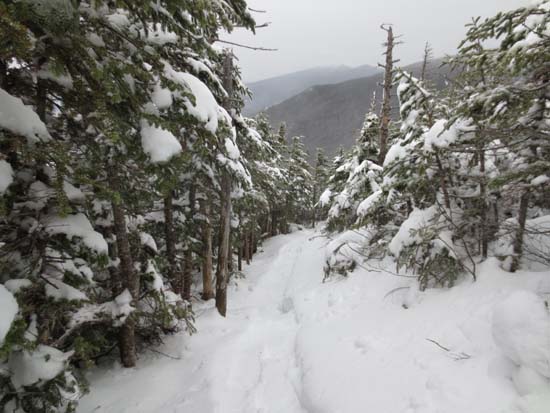
Wildcat Ridge Trail to Wildcat B
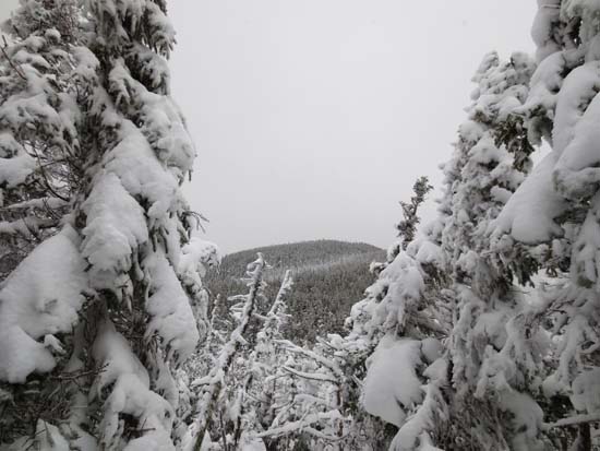
Slight views of Wildcat A as seen from near the summit of Wildcat B
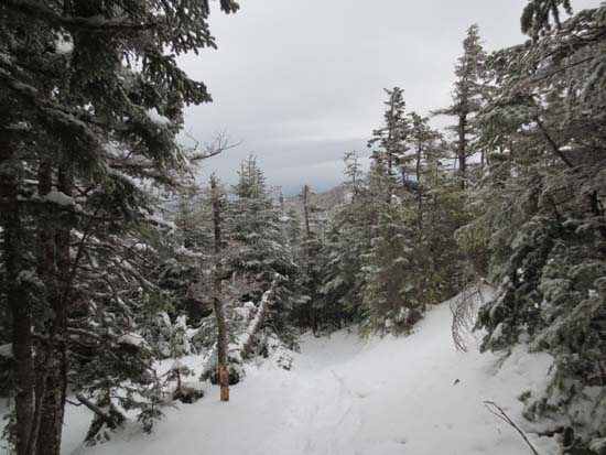
Wildcat Ridge Trail to Wildcat A
Carter Notch from Wildcat A
Wildcat Ridge Trail to Wildcat D
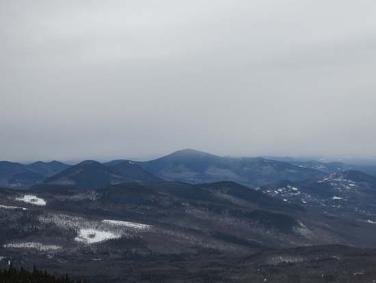
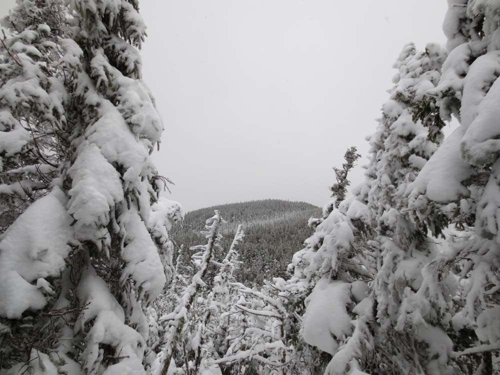
Kearsarge North Mountain as seen from near the summit of Wildcat D

Directions to trailhead: Take Route 16 North from Jackson to Wildcat Ski Area. In winter 2012-2013, a $10 per person uphill fee applied to hikers. In winter 2012-2013, access to the ski trails outside of ski area hours of operation was prohibited.
Back to Wildcat C Profile
Back to Wildcat B Profile
Back to Wildcat A Profile
Back to Wildcat D Profile
|