Home
States
Colorado
Connecticut
Maine
Massachusetts
New Hampshire
New York
Rhode Island
Utah
Vermont
View All
Lists
NE 4,000 Footers
NE 100 Highest
NH 4,000 Footers
NH 100 Highest
NH 52 With A View
NH Belknap Range
NH Ossipee 10
Links
Trail Conditions
Trip Log
Sunrises
Sunsets
About
|
Burke Mountain
Burke, VT
Trailheads, measurements, times, distances, and maps are all approximate and relative to the hike(s) as shown below.

Looking up the Red Trail
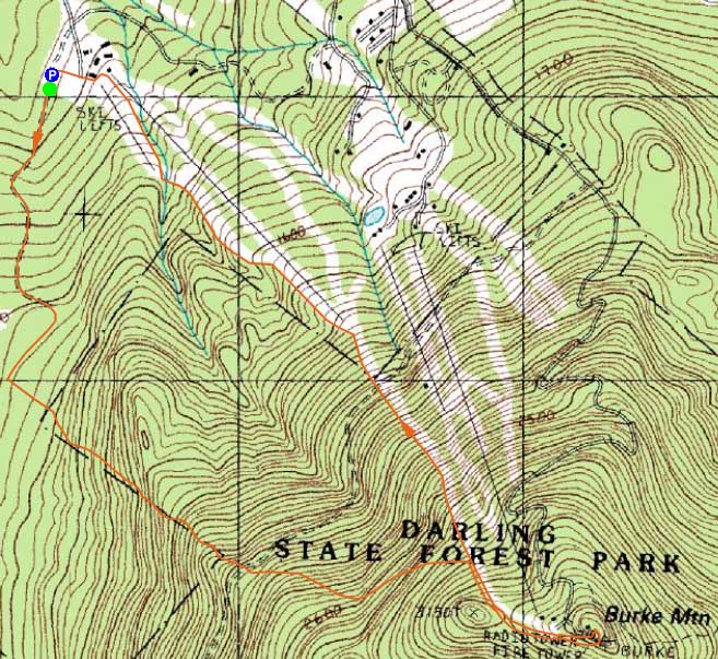
Route: Red Trail, Summit Trail, (Burke Mountain), unknown trail, ski trails
After a cold morning hike on Mt. Jackson, I decided to head west into Vermont and hike a peak I had been looking at for years.
Starting at the lowest ski area parking lot, I set foot on the snowmobile portion of the Red Trail. Eventually reaching a height of land after about 15 minutes, I spotted a small sign on my left for the Red Trail and followed it into the open hardwoods.
After crossing over a Kibby Connector Trail, I continued on the Red Trail, eventually reaching a sign in kiosk of sorts. While it had been smooth sailing up to this point (aside from perhaps sparse trail signage/marking up to this point) on my snowshoes, the trail ahead had been badly postholed a day or two earlier.
The postholes eventually came to an end after about 20 minutes (I suspect the person must have grown tired of sinking 1-2 feet with every step), resulting in untouched trail from that point up to the fire road crossing.
Above the fire road was a shelter. A blue blazed trail went directly uphill to West Peak. Fortunately, I looked around a bit and found the continuation of the Red Trail hiding behind the shelter. From there up to the side of the ski area had been fairly well packed down by skier traffic. Until nearing the ski area, one would have never known they were next to an open alpine ski area, due to the distance between it and the lower Red Trail.
After climbing up some switchbacks in ski glades, I eventually reached the col between West Peak and the main peak. From there, I followed the Summit Trail off and on, as it meandered toward the true summit, passing a few viewpoints.
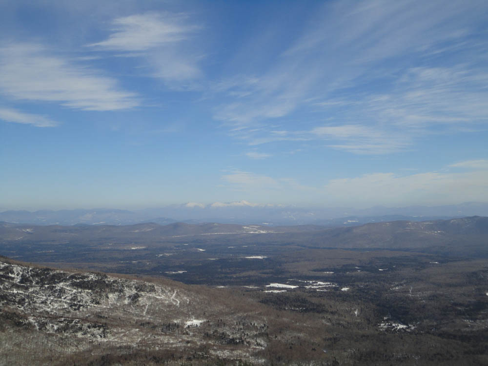
Reaching the summit, I took off my snowshoes and climbed up the stairs of the very tall fire tower. From the cab, I had superb views in all directions, including the Presidentials and Willoughby Gap.
Once back on the ground, I decided in the interest of time (and in the interest of avoiding the postholes) to head down the side of the ski trails back to the base.
| Hike Ratings |
|
Getting To Trailhead: |
Easy |
| Destination: |
Burke Mountain |
|
Length: |
Moderate |
|
Steepness: |
Moderate |
|
Navigation: |
Moderate |
|
Views: |
Excellent |
|
Crowds: |
Minimal |
|
| Hike Stats |
|
Date Hiked: |
Sunday, February 20, 2011 |
| Hike Commenced: |
1:09 PM |
| Parking Elevation: |
1,800' |
| Destination: |
Burke Mountain |
| Ascent Commenced: |
1:10 PM |
| Summit Reached: |
2:54 PM |
| Time Elapsed: |
01:44 |
| Trailhead Elevation: |
1,170' |
| Summit Elevation: |
3,267' |
| Vertical Gain: |
2,147' |
|
|
| Hike Ended: |
3:55 PM |
| Hike Time Elapsed: |
02:46 |
| Hike Vertical Gain: |
2,147' |
|

The Red Trail trailhead at the lowest ski area parking lot

Looking southeast at the Presidentials from the Burke Mountain firetower


Directions to trailhead: Take Interstate 91 North to Exit 23. Take a right onto US 5 through Lyndonville for 2 miles. Bear right onto Route 114 for 4 miles through East Burke Village and take a right onto Mountain Road. The Sherburne Base Lodge entrance road will be on the right shortly thereafter. The Red Trail starts at the back of the lowest parking lot.
Back to Burke Mountain Profile
|