Home
States
Colorado
Connecticut
Maine
Massachusetts
New Hampshire
New York
Rhode Island
Utah
Vermont
View All
Lists
NE 4,000 Footers
NE 100 Highest
NH 4,000 Footers
NH 100 Highest
NH 52 With A View
NH Belknap Range
NH Ossipee 10
Links
Trail Conditions
Trip Log
Sunrises
Sunsets
About
|
Burke Mountain
Burke, VT
Trailheads, measurements, times, distances, and maps are all approximate and relative to the hike(s) as shown below.

Looking up the Red Trail
Route: Red Trail, ski trails, (Burke Mountain), ski trails, West Peak Trail, ski trails
Shoulder season conditions with a biting wind.
The first portion of the Red Trail (ie the multi use section) was rather icy - Microspikes recommended. Upon leaving this roadbed and entering the open hardwoods, the trail was mostly dry with a few small patches of ice. Easily barebooted.
The Red Trail above the shelter was increasingly icy as one approaches the ski area. I was able to bareboot while ascending, but would have needed my Microspikes if descending.
The ski area is not yet open, so I hopped out onto the ski trails and beelined toward the summit. Very icy starting at around 3,000 feet...Microspikes were necessary. The fire tower steps above the first flight were also very icy. With the winds and the ice the way they were, I opted not to go all the way to the top of the tower.
Hoping to catch post sunset colors, I made a side trip to the West Peak. There was about 3-4" of crunchy snow in the small col, followed by blue and black ice on the footbed. A western snow flurry blocked any color, but it looks like the viewpoint below the shelter would be good for sunsets, especially when the angle from the fire tower is blocked by the communications tower.
Since they haven't yet pumped on the upper mountain, I descended the ski trails, which were generally good going, as the grass has repelled the ice for the most part.
| Hike Ratings |
|
Getting To Trailhead: |
Easy |
| Destination: |
Burke Mountain |
|
Length: |
Moderate |
|
Steepness: |
Moderate |
|
Navigation: |
Moderate |
|
Views: |
Excellent |
|
Crowds: |
Minimal |
|
| Hike Stats |
|
Date Hiked: |
Saturday, December 7, 2013 |
| Parking Elevation: |
1,800' |
| Destination: |
Burke Mountain |
| Time Elapsed: |
01:26 |
| Trailhead Elevation: |
1,170' |
| Summit Elevation: |
3,267' |
| Vertical Gain: |
2,147' |
|
|
| Hike Time Elapsed: |
02:48 |
| Hike Vertical Gain: |
2,247' |
|

The Red Trail trailhead at the lowest ski area parking lot

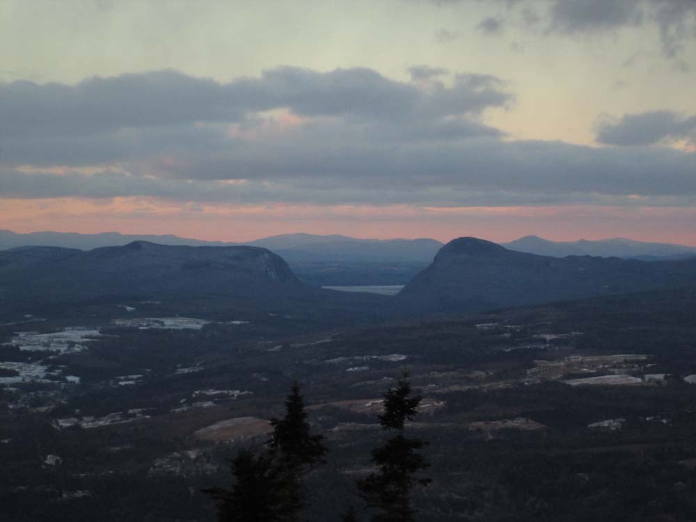
Looking at Willougby Gap from the Burke Mountain firetower

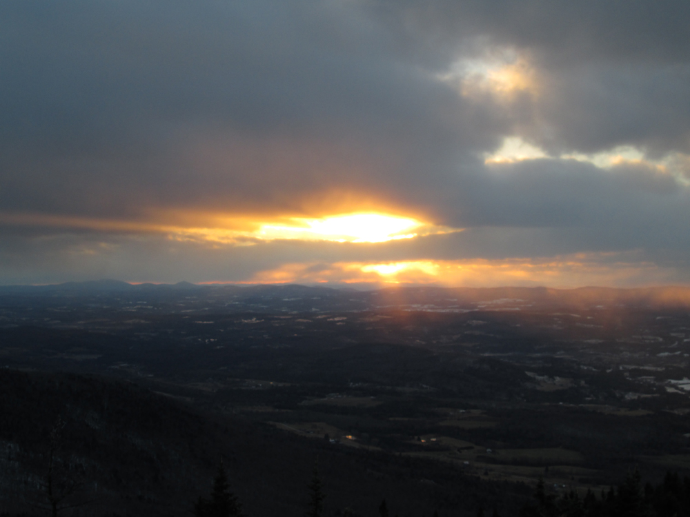
The sunset from the Burke Mountain firetower
Directions to trailhead: Take Interstate 91 North to Exit 23. Take a right onto US 5 through Lyndonville for 2 miles. Bear right onto Route 114 for 4 miles through East Burke Village and take a right onto Mountain Road. The Sherburne Base Lodge entrance road will be on the right shortly thereafter. The Red Trail starts at the back of the lowest parking lot.
Back to Burke Mountain Profile
|