Home
States
Colorado
Connecticut
Maine
Massachusetts
New Hampshire
New York
Rhode Island
Utah
Vermont
View All
Lists
NE 4,000 Footers
NE 100 Highest
NH 4,000 Footers
NH 100 Highest
NH 52 With A View
NH Belknap Range
NH Ossipee 10
Links
Trail Conditions
Trip Log
Sunrises
Sunsets
About
|
Jay Peak, Big Jay
Westfield, VT, Montgomery, VT
Trailheads, measurements, times, distances, and maps are all approximate and relative to the hike(s) as shown below.

Looking down the Vermonter ski trail
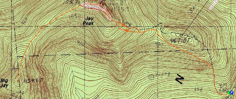
Route: Long Trail, Vermonter, (Jay Peak), Northway, Long Trail, herd path, (Big Jay), herd path, Long Trail, Northway, Vermonter, Long Trail
With a mediocre forecast, we headed up to northern Vermont for a quick hike of Jay and Big Jay. We followed the Long Trail until the branches and blowdowns clogged the corridor a bit too much. At that point, we bushwhacked a few dozen yards over to the ski trail, then followed it up to the abandoned (closed due to winds) summit area. After a quick hike up to the windy highpoint (cloudy views ranging from the Adirondacks, Mansfield, and Presidentials), we returned to the tramway terminal and headed toward Big Jay.
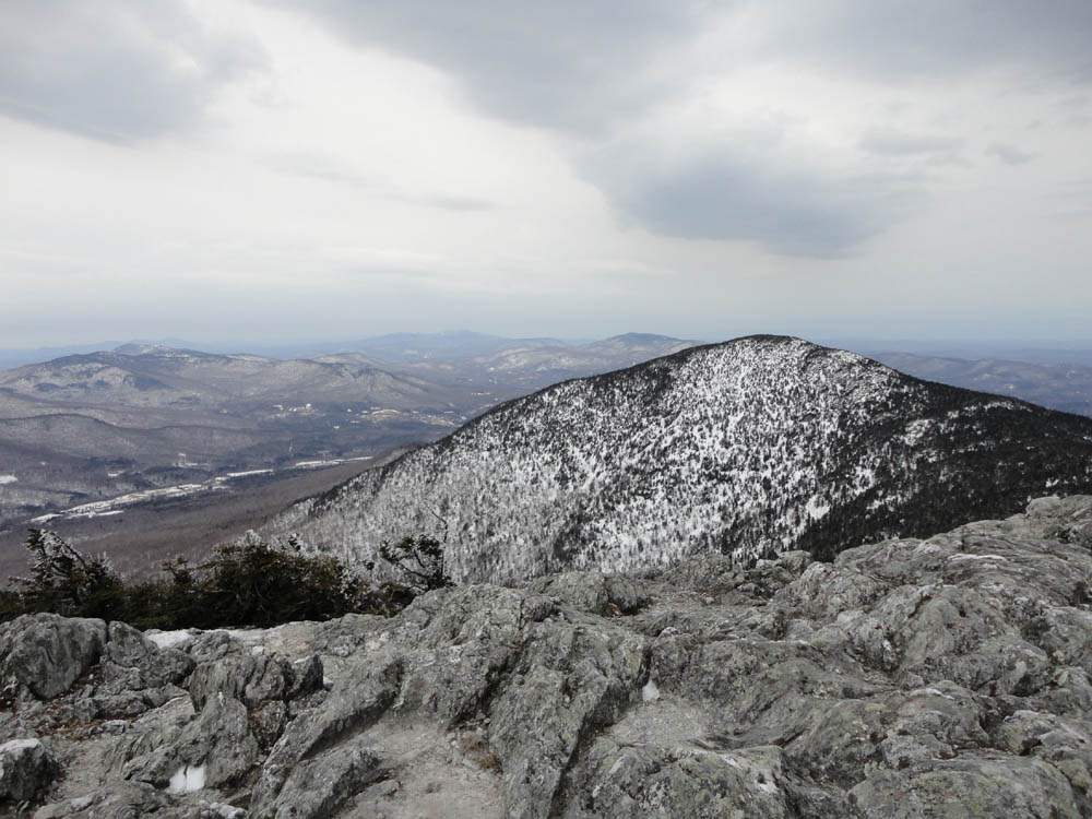
The herd path to Big Jay was fairly well packed by ski and snowshoe use. With up to 6 feet of snow in places, there were excellent views (including the Presidentials) to be had along the way, as well as near the highpoint. After signing the summit register, we headed back down the herd path, then took a lower ski trail to cut off the full climb back to the Jay Peak summit.
| Hike Ratings |
|
Getting To Trailhead: |
Easy |
| Destination: |
Jay Peak |
|
Length: |
Moderate |
|
Steepness: |
Moderate |
|
Navigation: |
Moderate |
|
Views: |
Excellent |
|
Crowds: |
Minimal |
| Destination: |
Big Jay |
|
Length: |
Moderate |
|
Steepness: |
Difficult |
|
Navigation: |
Difficult |
|
Views: |
Excellent |
|
Crowds: |
Minimal |
|
| Hike Stats |
|
Date Hiked: |
Saturday, April 16, 2011 |
| Parking Elevation: |
2,205' |
| Destination: |
Jay Peak |
| Time Elapsed: |
01:29 |
| Distance: |
1.6 miles |
| Trailhead Elevation: |
2,205' |
| Summit Elevation: |
3,858' |
| Vertical Gain: |
1,668' |
| Destination: |
Big Jay |
| Time Elapsed: |
01:00 |
| Trailhead Elevation: |
3,858' |
| Summit Elevation: |
3,786' |
| Vertical Gain: |
466' |
|
|
| Hike Time Elapsed: |
4:42 |
| Hike Vertical Gain: |
2,622' |
|

The Long Trail trailhead on Route 242

Looking at Big Jay from Jay Peak

The herd path on the way to Big Jay

Looking northwest from near the Big Jay summit


Directions to trailhead: From the town of Jay, take 242 south to the top of the pass. There is a parking lot on the left. The trailhead is just slightly downhill from this, on the right.
Back to Jay Peak Profile
Back to Big Jay Profile
|