Home
States
Colorado
Connecticut
Maine
Massachusetts
New Hampshire
New York
Rhode Island
Utah
Vermont
View All
Lists
NE 4,000 Footers
NE 100 Highest
NH 4,000 Footers
NH 100 Highest
NH 52 With A View
NH Belknap Range
NH Ossipee 10
Links
Trail Conditions
Trip Log
Sunrises
Sunsets
About
|
Killington Peak
Rutland, VT, Killington, VT
Trailheads, measurements, times, distances, and maps are all approximate and relative to the hike(s) as shown below.
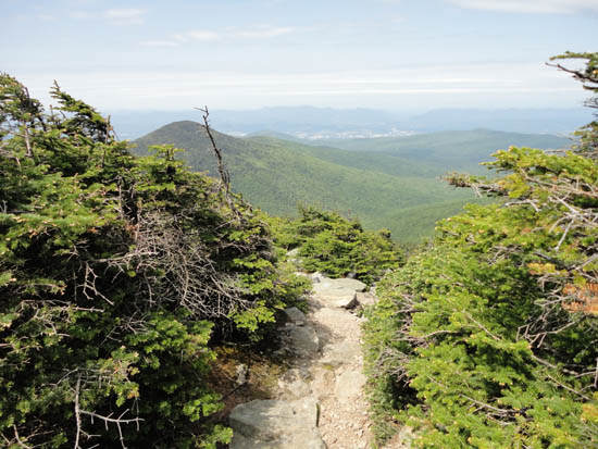
Looking down the Killington Spur
Route: Bucklin Trail, Long Trail, Killington Spur, (Killington Peak), Killington Spur, Long Trail, Bucklin Trail
Bucklin Trail was muddy in the flats between bridges (generally some rocks or herd paths to avoid), otherwise mostly dry to summit. Very few people on trails today.
| Hike Ratings |
|
Getting To Trailhead: |
Easy |
| Destination: |
Killington Peak |
|
Length: |
Moderate |
|
Steepness: |
Difficult |
|
Navigation: |
Easy |
|
Views: |
Excellent |
|
Crowds: |
Minimal |
|
| Hike Stats |
|
Date Hiked: |
Sunday, June 5, 2011 |
| Parking Elevation: |
1,786' |
| Destination: |
Killington Peak |
| Time Elapsed: |
01:37 |
| Trailhead Elevation: |
1,786' |
| Summit Elevation: |
4,235' |
| Vertical Gain: |
2,479' |
|
|
| Hike Time Elapsed: |
03:27 |
| Hike Vertical Gain: |
2,509' |
|
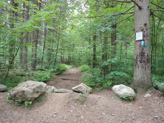
The Bucklin Trail trailhead

Looking southeast from near the summit of Killington Peak


Directions to trailhead: To get to the Bucklin Trail trailhead, take US 4 West from Pico Ski Area. A few minutes downhill, on a right curve, take a left onto Wheelerville Road. The Bucklin Trail parking area will be on the left after few miles on this road at a sharp right turn. The Bucklin Trail starts at the back of this parking lot.
Back to Killington Peak Profile
|


