Home
States
Colorado
Connecticut
Maine
Massachusetts
New Hampshire
New York
Rhode Island
Utah
Vermont
View All
Lists
NE 4,000 Footers
NE 100 Highest
NH 4,000 Footers
NH 100 Highest
NH 52 With A View
NH Belknap Range
NH Ossipee 10
Links
Trail Conditions
Trip Log
Sunrises
Sunsets
About
|
Killington Peak
Rutland, VT, Killington, VT
Trailheads, measurements, times, distances, and maps are all approximate and relative to the hike(s) as shown below.
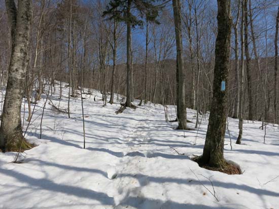
Looking up the Bucklin Trail
Route: Bucklin Trail, Long Trail, Killington Spur, (Killington Peak), spur trail, (Killington ski area summit), ski trails, herd path, Long Trail, Bucklin Trail
Spring is approaching with vigor. I was able to snowshoe roundtrip, but things were starting to get sloppy down low on the way out.
The flats had maybe 6" of snowpack with some monorail in places. The Irene reroute, with its southern exposure, had extended melted areas and had some areas that looked like the were going to get mud/standing/running water on them soon.
After the last (bridged) crossing (and start of ascent), snowpack quickly picked up to 1-2 feet. Stepping off the monorail resulted in sinking.
Cooper Lodge had some friendly skiers having a late afternoon cookout. One can walk up on the roof right now with the snowpack at its current level. Probably 3-4 feet of natural up high.
Killington Spur is hard to follow if you're unfamiliar with it, and the upper portion was tricky due to set up snow/steeps. Opted to drop down to the summit lodge, then double back along the stairway to the bootleg ski trail to Cooper Lodge.
I believe this trail could be considered closed for mud season starting April 15.
| Hike Ratings |
|
Getting To Trailhead: |
Easy |
| Destination: |
Killington Peak |
|
Length: |
Moderate |
|
Steepness: |
Difficult |
|
Navigation: |
Moderate |
|
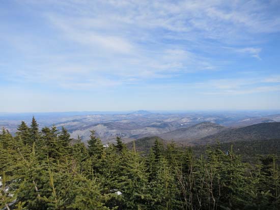
Views: |
Excellent |
|
Crowds: |
Moderate |
|
| Hike Stats |
|
Date Hiked: |
Thursday, April 10, 2014 |
| Parking Elevation: |
1,786' |
| Destination: |
Killington Peak |
| Time Elapsed: |
02:05 |
| Trailhead Elevation: |
1,786' |
| Summit Elevation: |
4,235' |
| Vertical Gain: |
2,529' |
|
|
| Hike Time Elapsed: |
04:07 |
| Hike Vertical Gain: |
2,609' |
|
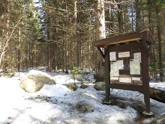
The Bucklin Trail trailhead
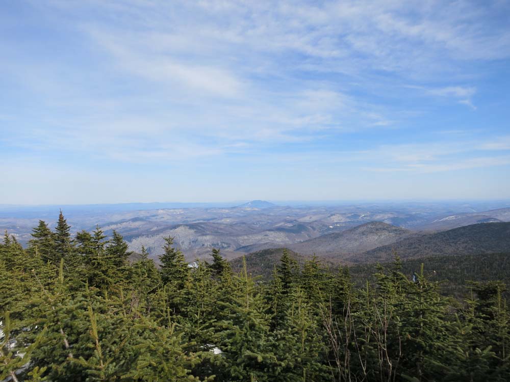
Looking toward Ascutney from a snowdrift on of Killington Peak
Directions to trailhead: To get to the Bucklin Trail trailhead, take US 4 West from Pico Ski Area. A few minutes downhill, on a right curve, take a left onto Wheelerville Road. The Bucklin Trail parking area will be on the left after few miles on this road at a sharp right turn. The Bucklin Trail starts at the back of this parking lot. Wheelerville Road and the Bucklin Trail are both subject to spring closures.
Back to Killington Peak Profile
|