Home
States
Colorado
Connecticut
Maine
Massachusetts
New Hampshire
New York
Rhode Island
Utah
Vermont
View All
Lists
NE 4,000 Footers
NE 100 Highest
NH 4,000 Footers
NH 100 Highest
NH 52 With A View
NH Belknap Range
NH Ossipee 10
Links
Trail Conditions
Trip Log
Sunrises
Sunsets
About
|
Mt. Abraham
Lincoln, VT, Warren, VT
Trailheads, measurements, times, distances, and maps are all approximate and relative to the hike(s) as shown below.

The Battell Trail
Route: Battell Trail, Long Trail
Second hike of the day. Battell Trail not too busy, but Long Trail busy.
| Hike Ratings |
|
Getting To Trailhead: |
Easy |
| Destination: |
Mt. Abraham |
|
Length: |
Moderate |
|
Steepness: |
Difficult |
|
Navigation: |
Easy |
|
Views: |
Excellent |
|
Crowds: |
Heavy |
|
| Hike Stats |
|
Date Hiked: |
Saturday, July 2, 2011 |
| Parking Elevation: |
1,495' |
| Destination: |
Mt. Abraham |
| Time Elapsed: |
01:18 |
| Trailhead Elevation: |
1,495' |
| Summit Elevation: |
4,006' |
| Distance: |
2.9 miles |
| Vertical Gain: |
2,551' |
|
|
| Hike Time Elapsed: |
02:49 |
| Hike Vertical Gain: |
2,701' |
|

The Battell Trail trailhead

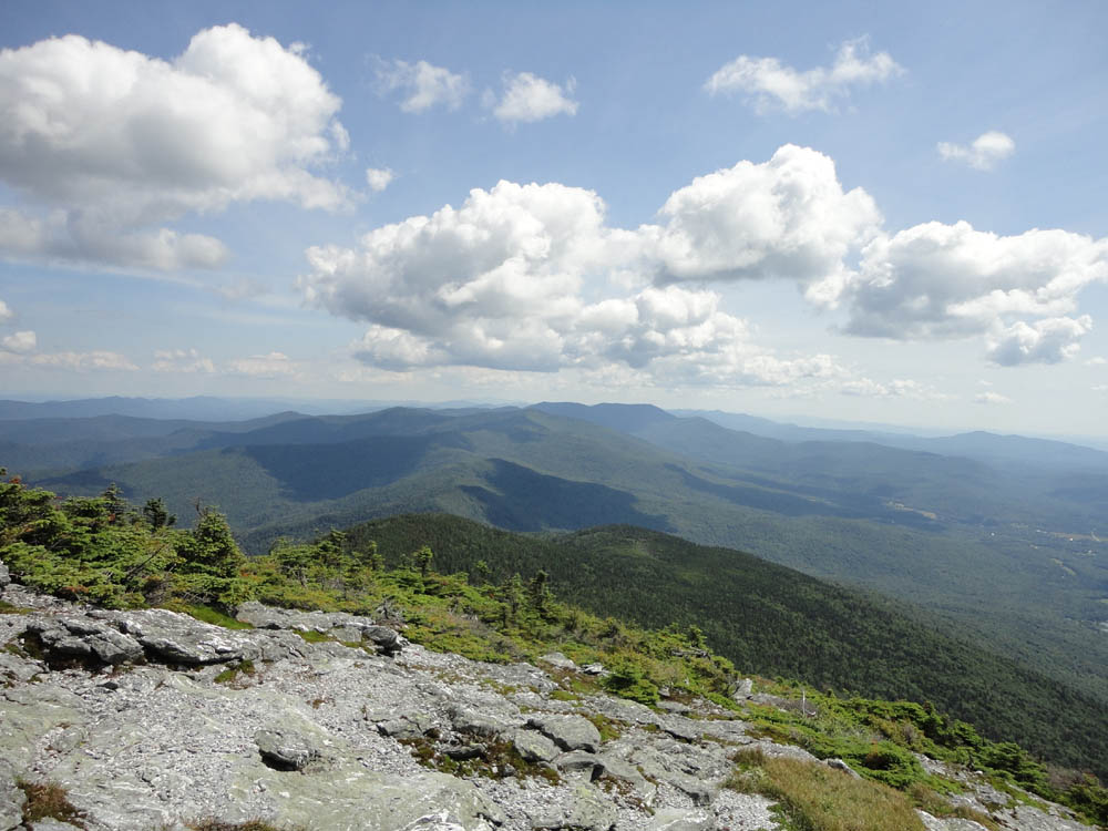
Looking south from Mt. Abraham

The 1973 Cessna plane wreck near the summit of Mt. Abraham


Directions to trailhead: From Route 100 in Warren, take Lincoln Gap Road (seasonal) west over Lincoln Gap. Lincoln Gap Road will become East River Road. Bear right onto Quaker Street, passing through Lincoln. Shortly thereafter, take a right onto Elder Hill Road. The Battell Trail trailhead and parking area will eventually be at the end of this road (multiple side roads leave it prior).
Back to Mt. Abraham Profile
|