Home
States
Colorado
Connecticut
Maine
Massachusetts
New Hampshire
New York
Rhode Island
Utah
Vermont
View All
Lists
NE 4,000 Footers
NE 100 Highest
NH 4,000 Footers
NH 100 Highest
NH 52 With A View
NH Belknap Range
NH Ossipee 10
Links
Trail Conditions
Trip Log
Sunrises
Sunsets
About
|
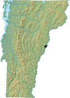
Mt. Tom
Woodstock, VT

Woodstock as seen from Mt. Tom's south peak
 Summary Summary
Standing over Woodstock, Mt. Tom features multiple viewpoints from its southern peak. Its highpoint is wooded. Part of the trail network is located in the Marsh-Billings-Rockefeller National Historical Park.
Summit Elevation
1,350 feet
Summit Facilities
None.
Trip Reports:
Click on the date for photos, timestamps, and maps.
More Information
Mt. Tom - NewEnglandSkiHistory.com
|
