Home
States
Colorado
Connecticut
Maine
Massachusetts
New Hampshire
New York
Rhode Island
Utah
Vermont
View All
Lists
NE 4,000 Footers
NE 100 Highest
NH 4,000 Footers
NH 100 Highest
NH 52 With A View
NH Belknap Range
NH Ossipee 10
Links
Trail Conditions
Trip Log
Sunrises
Sunsets
About
|
Wheeler Mountain
Sutton, VT
Trailheads, measurements, times, distances, and maps are all approximate and relative to the hike(s) as shown below.

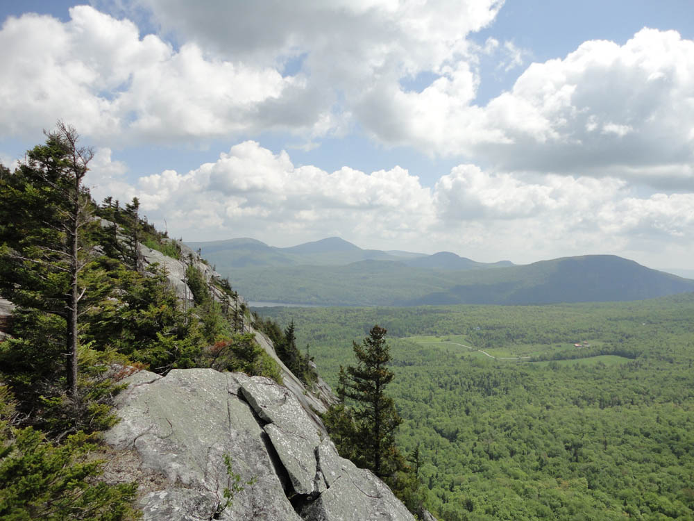
Looking down the Red Trail
Route: Red Trail, White Trail
For the first hike of the day, I decided to check out a peak I had seen from Mt. Pisgah during the winter. Branching onto the Red Trail, things quickly became steep and scrambly - certainly not a good trail to descend or attempt while wet. Eventually reaching the White Trail after multiple scramble ledges and no fall zones, I followed a slightly more mellow route to near the summit and over to Eagle Point, which excellent views for much of the way.
Backtracking, I bushwhacked just a few dozen feet off the trail to what appeared to be the highpoint of the mountain, then rejoined the trail and descended via the still-steep-but-easier-than-Red White Trail.
| Hike Ratings |
|
Getting To Trailhead: |
Easy |
| Destination: |
Wheeler Mountain |
|
Length: |
Moderate |
|
Steepness: |
Very Difficult |
|
Navigation: |
Moderate |
|
Views: |
Excellent |
|
Crowds: |
Moderate |
|
| Hike Stats |
|
Date Hiked: |
Monday, May 30, 2011 |
| Parking Elevation: |
1,655' |
| Destination: |
Wheeler Mountain |
| Time Elapsed: |
00:38 |
| Trailhead Elevation: |
1,650' |
| Summit Elevation: |
2,371' |
| Vertical Gain: |
791' |
|
|
| Hike Time Elapsed: |
01:39 |
| Hike Distance: |
2.3 miles |
| Hike Vertical Gain: |
961' |
|

The trailhead on Wheeler Mountain Road

Looking at Lake Willoughby and Bald Mountain from near the summit of Wheeler Mountain


Directions to trailhead: Take Interstate 91 North to Exit 23. Take US 5 North past Route 5A. Wheeler Mountain Road will eventually be on the right, across from Annis Brook Lane. Head up Wheeler Mountain Road. The trailhead will eventually be on the left with a small parking area on the left shortly thereafter.
Back to Wheeler Mountain Profile
|