Home
States
Colorado
Connecticut
Maine
Massachusetts
New Hampshire
New York
Rhode Island
Utah
Vermont
View All
Lists
NE 4,000 Footers
NE 100 Highest
NH 4,000 Footers
NH 100 Highest
NH 52 With A View
NH Belknap Range
NH Ossipee 10
Links
Trail Conditions
Trip Log
Sunrises
Sunsets
About
|
Bald Mountain, Speckled Mountain
Woodstock, ME, Peru, ME
Trailheads, measurements, times, distances, and maps are all approximate and relative to the hike(s) as shown below.
The trail to Little Concord Pond
Pretty tame walk from Shagg Pond Road to Little Concord Pond. Generally dry with minor mud.
Trail up Bald Mountain was rugged in places, but generally dry. The loop around the Bald Ledges is very scenic. The actual highpoint of Bald is on the opposite side of the main trail (open woods bushwhack, but I don't think the peak's on any lists, so does it matter?).
A little confusion climbing up the bump between Bald and Speckled, as there is a tree town boundary swath that meets in the trail. Stick with the blue blazes, as the yellow blazed corridor is the swath.
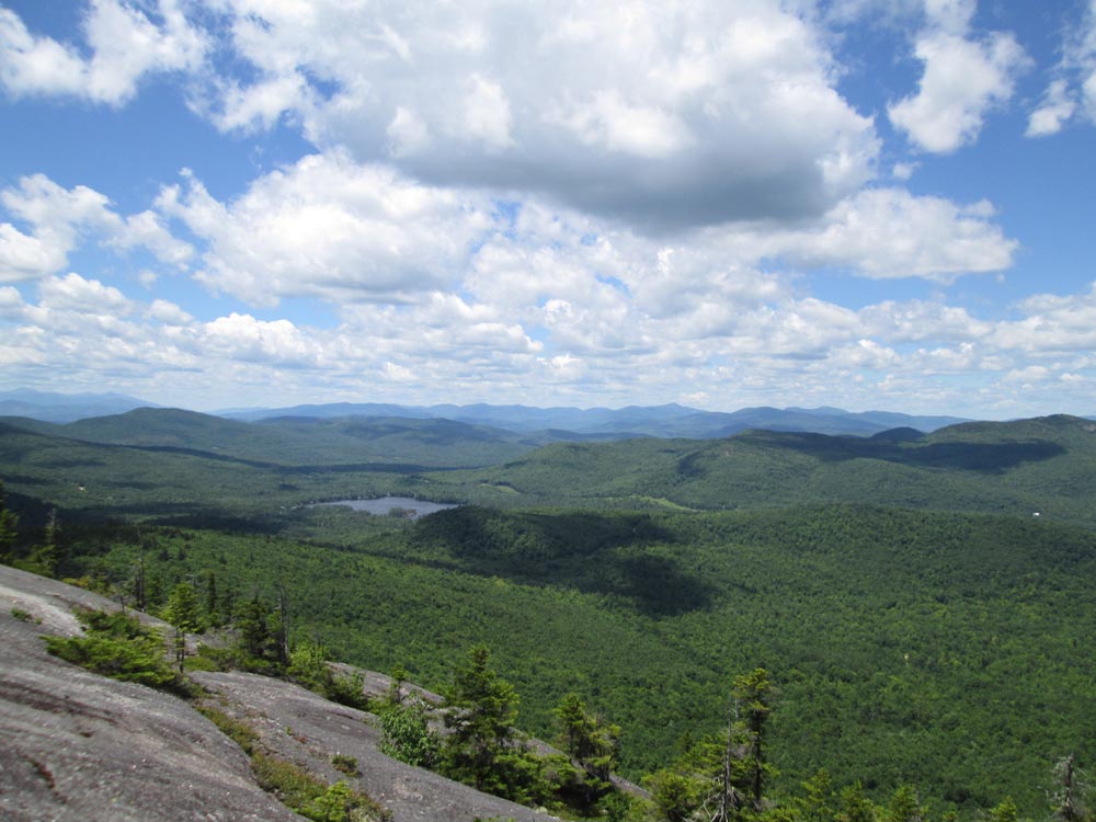
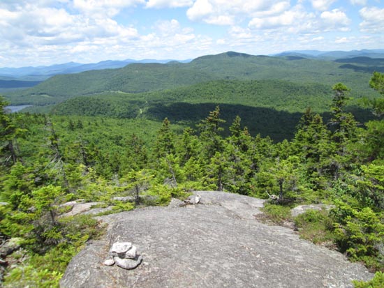
Some rugged terrain on the ascent up Speckled, as well as a few damp ledges. Lots of views from the on-trail ledges and the ledges around the summit. Had the summit to ourselves. Blueberries are still green, but should be plentiful up there.
On the way back, we looped around Little Concord Pond, which was rugged due to a lack of good, established footbed (lots of herd paths, etc.).
| Hike Ratings |
|
Getting To Trailhead: |
Easy |
| Destination: |
Bald Mountain |
|
Length: |
Moderate |
|
Steepness: |
Moderate |
|
Navigation: |
Moderate |
|
Views: |
Excellent |
|
Crowds: |
Moderate |
| Destination: |
Speckled Mountain |
|
Length: |
Moderate |
|
Steepness: |
Difficult |
|
Navigation: |
Moderate |
|
Views: |
Excellent |
|
Crowds: |
Minimal |
|
| Hike Stats |
|
Date Hiked: |
Sunday, July 3, 2016 |
| Parking Elevation: |
950' |
| Destination: |
Bald Mountain |
| Time Elapsed: |
00:40 |
| Trailhead Elevation: |
950' |
| Summit Elevation: |
1,692' |
| Vertical Gain: |
762' |
| Destination: |
Speckled Mountain |
| Time Elapsed: |
00:57 |
| Trailhead Elevation: |
1,692' |
| Summit Elevation: |
2,183' |
| Vertical Gain: |
783' |
|
|
| Hike Time Elapsed: |
04:24 |
| Hike Vertical Gain: |
1,795' |
|
The trailhead on Shagg Pond Road
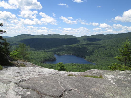
Looking south at Shagg Pond from the Bald Mountain ledges
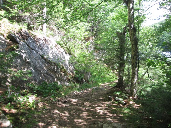
The Speckled Mountain Trail

Looking northwest at the Mahooscus from Speckled Mountain
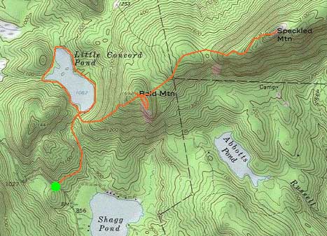

Directions to trailhead: From West Peru, take Dickvale Road south (becomes Concord Pond Road), then take a left onto Shagg Pond Road. There is limited room to park across from the trailhead.
Back to Bald Mountain Profile
Back to Speckled Mountain Profile
|