Home
States
Colorado
Connecticut
Maine
Massachusetts
New Hampshire
New York
Rhode Island
Utah
Vermont
View All
Lists
NE 4,000 Footers
NE 100 Highest
NH 4,000 Footers
NH 100 Highest
NH 52 With A View
NH Belknap Range
NH Ossipee 10
Links
Trail Conditions
Trip Log
Sunrises
Sunsets
About
|
Baldpate Mountain - West Peak, Baldpate Mountain - East Peak
Grafton, ME
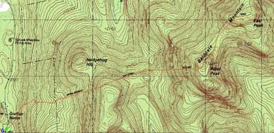
Trailheads, measurements, times, distances, and maps are all approximate and relative to the hike(s) as shown below.
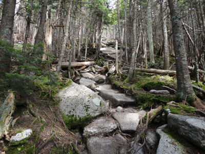
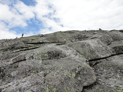
Looking up the Appalachian Trail on the way to West Baldpate
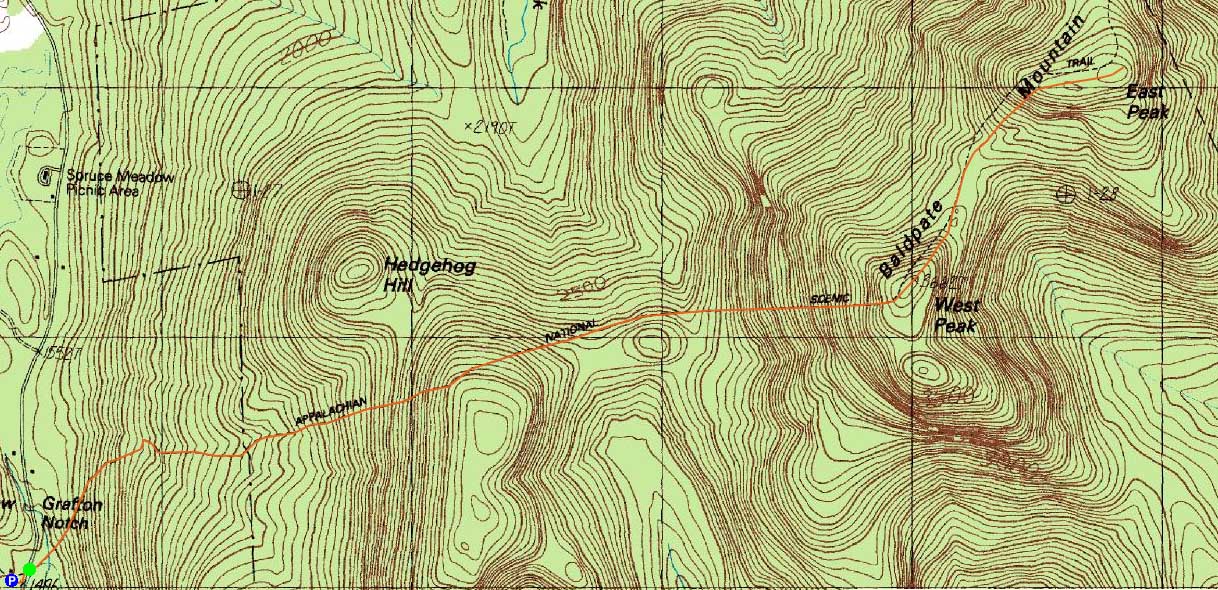
Route: Appalachian Trail
The final Maine peak of the weekend was Baldpate Mountain. Starting at the hiker parking area, I walked up Route 26 for a minute or so, then started on the Appalachian Trail on a series of bogwalks.
The climb to the first ridge was fairly gradual with decent footing. From there to the campsite, however, things dragged as the trail worked its way around a subpeak, gradually losing elevation.
Shortly after passing the campsite, the trail picked up in steepness, eventually becoming very steep and rough prior to reaching the top of West Baldpate. Just to the north, volunteers were working on building a sizable reroute of the trail, expected to be open in the next year or two.
While there were no views from the highpoint, there were superb directional views from the ledges just past it. After perhaps having some bad food at a gas station on the way to Grafton Notch, I wasn't feeling that well and was thus toying with calling it a day. Nonetheless, I continued on for the scenic ledge-dominated walk to East Baldpate, complete with two ladders and a few scrambles.
The views from around the flat East Baldpate summit were superb. While it was tempting to spend some time here, I was ready to head home.
The trail seemed to drag on forever on the return trip, especially the long, slight uphill portion of the trail from the campsite to the height of land.
| Hike Ratings |
|
Getting To Trailhead: |
Easy |
| Destination: |
Baldpate Mountain - West Peak |
|
Length: |
Moderate |
|
Steepness: |
Difficult |
|
Navigation: |
Easy |
|
Views: |
Excellent |
|
Crowds: |
Moderate |
| Destination: |
Baldpate Mountain - East Peak |
|
Length: |
Moderate |
|
Steepness: |
Very Difficult |
|
Navigation: |
Easy |
|
Views: |
Excellent |
|
Crowds: |
Minimal |
|
| Hike Stats |
|
Date Hiked: |
Sunday, July 18, 2010 |
| Parking Elevation: |
1,496' |
| Destination: |
Baldpate Mountain - West Peak |
| Time Elapsed: |
01:41 |
| Trailhead Elevation: |
1,500' |
| Summit Elevation: |
3,662' |
| Distance: |
2.9 miles |
| Vertical Gain: |
2,482' |
| Destination: |
Baldpate Mountain - East Peak |
| Time Elapsed: |
00:33 |
| Trailhead Elevation: |
3,662' |
| Summit Elevation: |
3,780' |
| Distance: |
0.9 mile |
| Vertical Gain: |
380' |
|
|
| Hike Time Elapsed: |
04:47 |
| Hike Distance: |
7.6 miles |
| Hike Vertical Gain: |
3,448' |
|
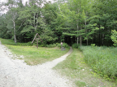
The Appalachian Trail trailhead
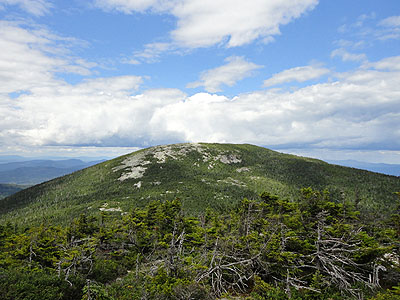
Looking at East Baldpate from the West Baldpate ledges
The Appalachian Trail between the peaks
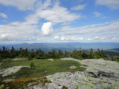
Looking northeast from East Baldpate

Directions to trailhead: Take US 2 East to Route 26 North into Grafton Notch. The hiker parking area is just below The Eyebrow. The Appalachian Trail departs northbound across Route 26. There may be a parking fee.
Back to Baldpate Mountain - West Peak Profile
Back to Baldpate Mountain - East Peak Profile
|