Home
States
Colorado
Connecticut
Maine
Massachusetts
New Hampshire
New York
Rhode Island
Utah
Vermont
View All
Lists
NE 4,000 Footers
NE 100 Highest
NH 4,000 Footers
NH 100 Highest
NH 52 With A View
NH Belknap Range
NH Ossipee 10
Links
Trail Conditions
Trip Log
Sunrises
Sunsets
About
|
Big Bald Peak
Denmark, ME, Bridgton, ME
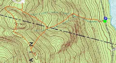
Trailheads, measurements, times, distances, and maps are all approximate and relative to the hike(s) as shown below.
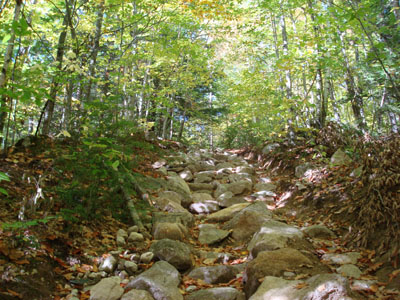
Looking up the Bald Peak Trail
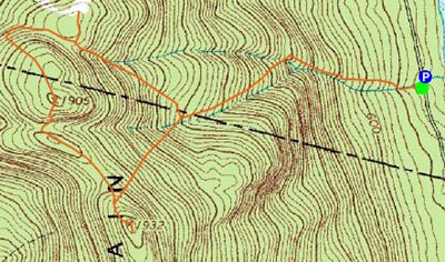
Route: Bald Peak Trail, (Big Bald Peak), Bald Peak Trail, North Ridge Trail, (Shawnee Peak Ski Area summit), Sue's Way, Bald Peak Trail
After staying up very late (only to see the Sox get pounded in extra innings), I decided that I would take it easy the next day. Destination: Pleasant Mountain.
Parking on the side of Mountain Road, I climbed up the embankment and started ascending the Bald Peak Trail. The trail is mostly moderate in pitch, with a few short steep sections, until Sue's Way splits off. Thereafter, there is a sustained steep pitch, before hitting the ridge. From here, the trail ascends through sparsely-tree covered ledges up to the Big Bald Peak summit.
Though there isn't a wide view ledge on Big Bald Peak like on Pleasant Mountain, I found the views to be better - through the trees there were decent looks in nearly all directions.
With threatening clouds in the distance, I decided to forget about doing the extra mile and change to Pleasant Mountain. Still on my agenda, though, was the Shawnee Peak ski area summit.
I followed the North Ridge trail to a few small peaks, before descending a big. The trail continued to descend down the mountainside - to the northwest. Worried that I was going the wrong way (I wasn't carrying a map and hadn't look at this section), I bushwacked back up the ridge to get a look at the ski area summit. Seeing there was a big gully between me and there, I decided to go back and follow the trail a bit further. Sure enough, it started to traverse back toward the ski area (through some neat rock formations).
The views from the ski area were great. I was surprised to see that none of the buildings on the summit had any glass in the window frames.
Sue's Way on the descent wasn't as steep as the Bald Peak Trail, but still had moderate pitches.
I made it back just in time, as it started the sprinkle shortly after I started to drive back.
| Hike Ratings |
|
Getting To Trailhead: |
Easy |
| Destination: |
Big Bald Peak |
|
Length: |
Moderate |
|
Steepness: |
Difficult |
|
Navigation: |
Easy |
|
Views: |
Excellent |
|
Crowds: |
Minimal |
|
| Hike Stats |
|
Date Hiked: |
Sunday, October 14, 2007 |
| Hike Commenced: |
11:00 AM |
| Parking Elevation: |
450' |
| Destination: |
Big Bald Peak |
| Ascent Commenced: |
11:01 AM |
| Summit Reached: |
11:41 AM |
| Time Elapsed: |
00:40 |
| Trailhead Elevation: |
455' |
| Summit Elevation: |
1,932' |
| Vertical Gain: |
1,492' |
|
|
| Hike Ended: |
1:11 PM |
| Hike Time Elapsed: |
02:11 |
| Hike Vertical Gain: |
1,817' |
|
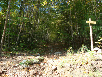
Bald Peak Trail trailhead
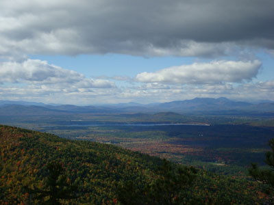
Looking out towards Mt. Chocorua from Big Bald Peak

Directions to trailhead: From 302, take Mountain Road south past both base areas of Shawnee Peak Ski Area. The Bald Peak Trail is shortly after the second base area, up the embankment to the right. There is limited room for parking along the road.
Back to Big Bald Peak Profile
|