Home
States
Colorado
Connecticut
Maine
Massachusetts
New Hampshire
New York
Rhode Island
Utah
Vermont
View All
Lists
NE 4,000 Footers
NE 100 Highest
NH 4,000 Footers
NH 100 Highest
NH 52 With A View
NH Belknap Range
NH Ossipee 10
Links
Trail Conditions
Trip Log
Sunrises
Sunsets
About
|
Bigelow Mountain (Avery Peak), Bigelow Mountain (West Peak)
Wyman, ME, Dead River, ME
Trailheads, measurements, times, distances, and maps are all approximate and relative to the hike(s) as shown below.
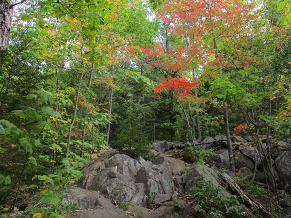
Looking up the Fire Warden's Trail on the way to Avery Peak
Route: Fire Warden's Trail, Appalchian Trail, (Bigelow Mountain - Avery Peak), Appalchian Trail, (Bigelow Mountain - West Peak), Appalachian Trail, Fire Warden's Trail
Trails were generally dry, with the exception of some of the steeps on Firewardens Trail, and on the range. Some of the Firewardens Trail steeps had water running down them, making for mud and wet slabs. Some wet rock on the Bigelow Range Trail as well, below treeline.
Weather forecast was botched, as NOAA's mostly sunny forecast never panned out. Fortunately the summits cleared, so we had good views.
Apart from a bunch of folks descending from the camp sites, the trails were pretty quiet; we even had West Peak to ourselves (find an NH 4K above treeline peak like that on a weekend).
Some really strong foliage colors, especially just below the range, as well as on the slopes of a few nearby mountains. Not yet peak, but very nice.
| Hike Ratings |
|
Getting To Trailhead: |
Moderate |
| Destination: |
Bigelow Mountain (Avery Peak) |
|
Length: |
Moderate |
|
Steepness: |
Difficult |
|
Navigation: |
Easy |
|
Views: |
Excellent |
|
Crowds: |
Heavy |
| Destination: |
Bigelow Mountain (West Peak) |
|
Length: |
Moderate |
|
Steepness: |
Difficult |
|
Navigation: |
Easy |
|
Views: |
Excellent |
|
Crowds: |
Moderate |
|
| Hike Stats |
|
Date Hiked: |
Sunday, September 30, 2018 |
| Parking Elevation: |
1,235' |
| Destination: |
Bigelow Mountain (Avery Peak) |
| Time Elapsed: |
02:54 |
| Trailhead Elevation: |
1,235' |
| Summit Elevation: |
4,088' |
| Vertical Gain: |
2,983' |
| Destination: |
Bigelow Mountain (West Peak) |
| Time Elapsed: |
00:30 |
| Trailhead Elevation: |
4,088' |
| Summit Elevation: |
4,145' |
| Distance: |
0.7 mile |
| Vertical Gain: |
370' |
|
|
| Hike Time Elapsed: |
06:37 |
| Hike Vertical Gain: |
3,523' |
|
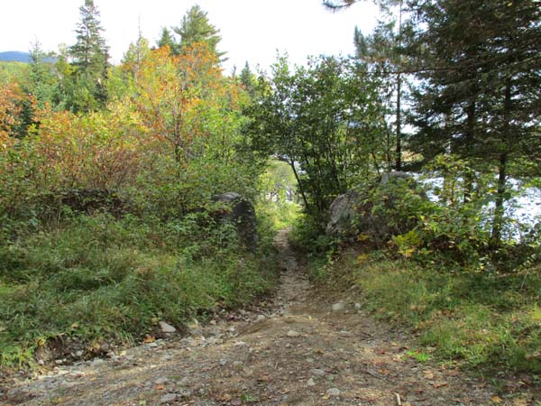
The second Fire Warden's Trail trailhead
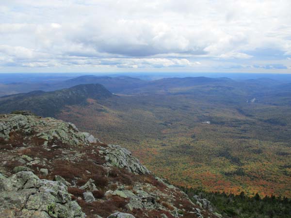
Looking at Little Bigelow from Avery Peak
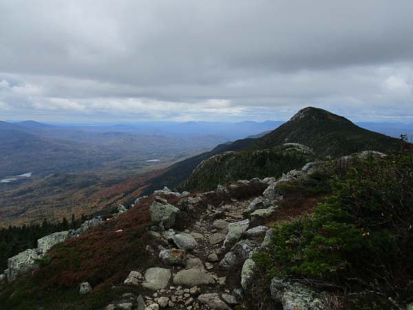
Heading to West Peak
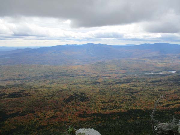
Looking at Sugarloaf from Bigelow Mountain's West Peak
Directions to trailhead: Take Route 27 northwest from the entrance to Sugarloaf USA ski area. Shortly after passing the Appalachian Trail crossing, take a right onto Stratton Brook Pond Road. There are two small Fire Warden's Trail parking areas along this road - the second of which, at the end of the road, should only be attempted by four wheel drive vehicles. The Fire Warden's Trail continues alongside Stratton Brook Pond at the end of this second parking area.
Back to Bigelow Mountain - Avery Peak Profile
Back to Bigelow Mountain - West Peak Profile
|


