Home
States
Colorado
Connecticut
Maine
Massachusetts
New Hampshire
New York
Rhode Island
Utah
Vermont
View All
Lists
NE 4,000 Footers
NE 100 Highest
NH 4,000 Footers
NH 100 Highest
NH 52 With A View
NH Belknap Range
NH Ossipee 10
Links
Trail Conditions
Trip Log
Sunrises
Sunsets
About
|
Big Spencer Mountain
T2 R3 Wels, ME
Trailheads, measurements, times, distances, and maps are all approximate and relative to the hike(s) as shown below.
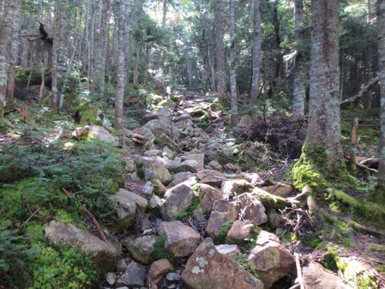
The upper Big Spencer Mountain Trail
Route: Big Spencer Mountain Trail, bushwhack
Trail was a bit wet and slippery due to previous afternoon's rain. Somewhat moderate ATV road walk up to the site of the old fire warden's cabin, then relentlessly steep up to the ridge, with a few short wooden ladders.
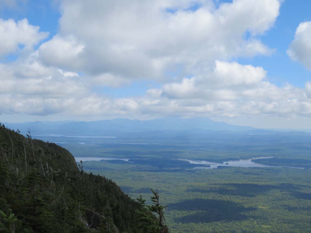
Nice views from the ridge at the top of the trail, though lots of communications equipment and solar panels take away from the feel a bit. A new installation southwest of the old fire tower was particularly interesting, as a large plot was literally burned (looks like a swath was cut first), then a new set of panels and towers constructed.
From there, we bushwhacked southwest in less than savory spruce, eventually reaching the recognized highpoint. A quick read of the register, as well as a look from a nearby ledge, revealed that this is not the highpoint. Rather, it was perhaps another 2/10ths further southwest through more unsavory woods (some nice short mossy stretches, but lots of spruce and random little cliffbands...not the worst ever, but certainly not open woods). Stopped at what seemed to be the highest point (which after the fact looks like it corresponds with the highpoint on the USGS map), then bushwhacked over to a small, but nice view ledge.
| Hike Ratings |
|
Getting To Trailhead: |
Moderate |
| Destination: |
Big Spencer Mountain |
|
Length: |
Moderate |
|
Steepness: |
Very Difficult |
|
Navigation: |
Difficult |
|
Views: |
Excellent |
|
Crowds: |
Minimal |
|
| Hike Stats |
|
Date Hiked: |
Saturday, August 17, 2013 |
| Parking Elevation: |
1,360' |
| Destination: |
Big Spencer Mountain |
| Time Elapsed: |
01:59 |
| Trailhead Elevation: |
1,360' |
| Summit Elevation: |
3,206' |
| Vertical Gain: |
1,996' |
|
|
| Hike Time Elapsed: |
04:07 |
| Hike Vertical Gain: |
2,146' |
|
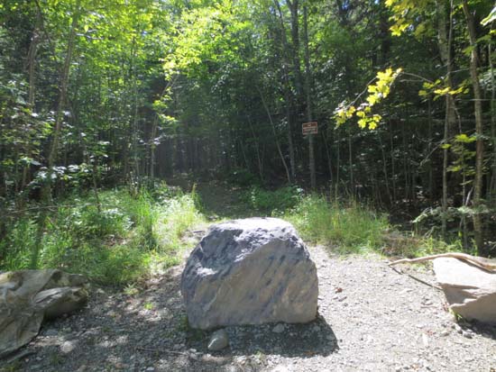
The Big Spencer Mountain Trail trailhead

Mt. Katahdin as seen from near the summit of Big Spencer Mountain
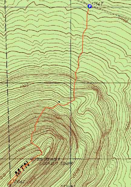

Directions to trailhead: From Greenville, take Lily Bay Road northeast (eventually becoming Baxter State Park Road). Take a left onto Spencer Mountain Road. The Big Spencer Mountain Trail trailhead and parking area will eventually be on the left. The road may be somewhat rough in places with possible beaver flooding.
Back to Big Spencer Mountain Profile
|